


Photo adjustments
Proportionally resized and converted to WebP without cropping, retouching or changing the photographed subject.
Explore the region
About Wudalianchi scenic area
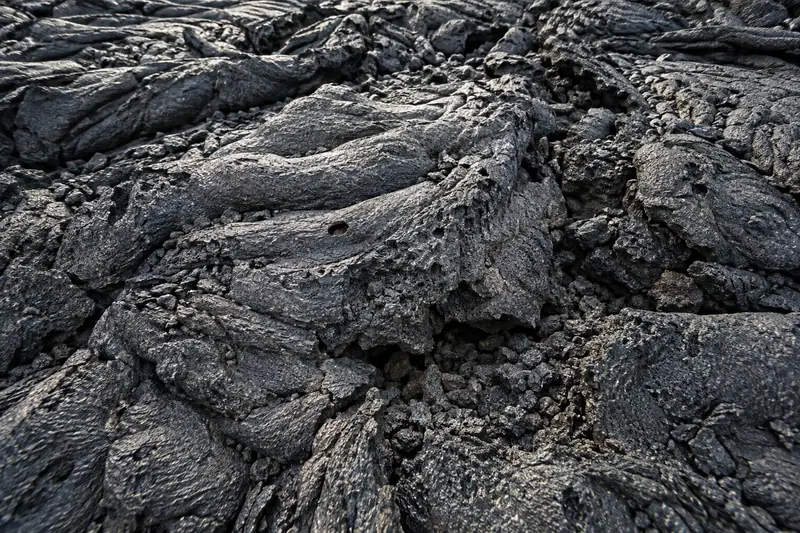
Eruptions blocked an earlier river channel, producing the chain of five lakes that gives the area its name. Dark basalt surfaces preserve different lava textures, while springs and water-filled depressions show how water now moves through the volcanic ground. The geopark covers a wide area with separately managed stops, so a useful first visit pairs one volcanic landscape with a spring or lake rather than attempting every cone.
The two most recent volcanoes last erupted in 1719-1721, during the Kangxi era (康熙) of the Qing dynasty, making them China's youngest volcanoes. Waterfalls are common where the five lakes meet, and marshes have formed between them; from south to north they are named Tou Chi, Er Chi, San Chi, Si Chi and Wu Chi (头池, 二池, 三池, 四池, 五池).
The park's basalt has solidified into a stone sea (石海) whose surface resembles a heaving ocean of frozen waves, and includes numerous volcanic cones, the largest being Heilongshan (黑龙山). A southern spring (南泉) yields bicarbonate mineral water containing more than ten trace elements. According to local tradition, the Daur people who lived nearby drank from the spring, believing it could treat stomach ailments and benefit health; the spring is grouped with France's Vichy mineral springs and Russia's North Caucasus springs as one of the 'world's three great cold springs' (世界三大冷泉).
Because of its large exposed area and typical geological structure, the volcanic field is described as 'an open volcanic textbook' (一本打开的火山教科书). Wudalianchi was included in the first group of China National Geoparks (中国国家地质公园) in 1989, and on 13 February 2004 UNESCO approved it as part of the first batch of World Geoparks (世界地质公园).
What to look for
- Basalt lava fields and volcanic cones, including the Laoheishan landscape.
- The linked lakes and mineral-spring areas that reveal the interaction of lava and water.
The surrounding area
Northern border-city base with markets and Russian-influenced dining; not a Harbin day-walk district.
Location & getting there
Getting to Wudalianchi scenic area
Use the visitor-service centre at Shengshui Square in the scenic-area town to establish the day's permitted route and transport.
- The geopark operates visitor transport between separate sites; check the current service and ticket coverage before setting out.
Combine your visit
Suggested order within this visit:
-
Volcanic landscape at Laoheishan
Begin with the cone and lava that explain the area's formation.
-
Spring or lake area
Choose an operating water-landscape stop to see the consequences of the volcanic terrain.
These are separate geopark visits requiring the appropriate road or visitor-transport connection. This is a thematic sequence, not a walking circuit or a promise of combined admission.
Find Wudalianchi scenic area
五大连池风景区 · 黑河市
The pin marks the area, not the entrance.
More places nearby
Approximate straight-line distances between map pins, not travel distances.
Laoheishan Volcano Scenic Entrance 老黑山景区入口
10 km awayThis arrival point serves the Laoheishan volcanic landscape at Wudalianchi. The visit moves between two scales of volcanic evidence: the large crater above and the broken lava surfaces below. The authorised ascent and crater-rim…
View guide →Aihui History Museum 瑷珲历史陈列馆
168 km awayAihui History Museum uses the former fortified town's site to tell the history of the eastern China–Russia border. Its exhibition combines archaeological and ethnic material with documents, treaty-signing reconstructions and…
View guide →China Lindu Wood Carving park 中国林都木雕园
225 km awayYichun's Lindu Wood Carving Park turns the timber of the Lesser Khingan forests into an outdoor art collection. Carved Korean-pine columns form the entrance arches, and leaf-shaped sculptures line the main path. At the centre…
View guide →Sources & visit information
The sources below support the place-specific description and arrival information. Suggested combinations are editorial planning ideas; confirm current opening, entry arrangements and transport services for your date.
Visitor information adapted and edited from Wikipedia contributors · CC BY-SA 4.0. Source revision 90834855.
Background paragraphs translated and condensed from Wikipedia contributors, "五大连池世界地质公园", Chinese Wikipedia · CC BY-SA 4.0. Source revision 90834855.