


Photo adjustments
The exact downloaded source bytes are separately retained and hashed. Prepared JPEG is proportionally reduced to a maximum 720-pixel long edge; full frame retained, no subject alteration. Final website rendition: full frame retained, proportionally resized to at most 720 pixels and converted to WebP. No additional retouching or subject alteration. Card displays may crop the view.
Explore the region
About Tai Mo Shan
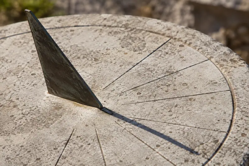
The lower park has a sundial, Chinese-style pavilion and woodland viewpoint; farther uphill, the country-park visitor centre introduces local wildlife and weather. The higher lookout opens a broader panorama but is windier and more exposed. Choose the lower circuit or a longer ascent according to fitness and conditions, and treat clouds, sunrise colours and clear distant views as possibilities rather than promises.
According to the Qing-dynasty gazetteer Xin'an County Gazetteer (新安县志), Tai Mo Shan was named for its profile, said to resemble an old official's cap; it is also popularly called Tai Mo Shan (大雾山, 'big foggy mountain') and was written Da Mo Shan (大磨山) in the late-Qing Miscellany of Hong Kong (香港杂记). At 957 metres it is Hong Kong's highest peak, 23 metres above the second-highest, Lantau Peak (凤凰山), though its slope is comparatively gentle.
Subtropical forest on the mountain's southeast side reaches to about 550 metres, above which cold- and wind-tolerant shrub and grassland dominate; rare native plants recorded there include Camellia granthamiana (葛量洪茶) and the Hong Kong Open-lipped Orchid (香港金线兰). The mountain once produced a variety of green tea, and abandoned terraced fields, already recorded as disused in an 1859 account in the Illustrated London News, remain visible on some slopes.
The mountain lies near the geographic centre of the New Territories, administratively divided among Tsuen Wan, Yuen Long and Tai Po Districts, and falls within Tai Mo Shan Country Park and Shing Mun Country Park. Its many named ridges average 600 to 700 metres or more in elevation, and on clear days from late October to December over 85 percent of Hong Kong's land area is visible from the summit.
What to look for
- Rotary Park combines a sundial garden, pavilion and woodland-framed viewpoint.
- The higher Tai Mo Shan Lookout provides an exposed panorama of the surrounding hills and city.
Location & getting there
Getting to Tai Mo Shan
Approach from the Tai Mo Shan Country Park bus stop on Route Twisk, served from the Tsuen Wan area. Follow signs towards Rotary Park and Tai Mo Shan Road for the visitor centre. The higher lookout requires an onward hill walk on the signed route.
Combine your visit
Suggested order for the visit:
-
Rotary Park
Begin with the garden and woodland viewpoints.
-
Country Park Visitor Centre
Read the weather and wildlife interpretation when open.
-
Tai Mo Shan Lookout
Add the exposed ascent only in suitable conditions.
This is an editorial sequence of named spaces or places. It does not imply a verified walking connection or promise opening, ticket availability or a journey time.
Find Tai Mo Shan
大帽山 · 荃湾区
The pin marks the area, not the entrance.
More places nearby
Approximate straight-line distances between map pins, not travel distances.
Sam Tung Uk Museum 三栋屋博物馆
4 km awaySam Tung Uk Museum preserves the layout of a Hakka walled village within present-day Tsuen Wan. The entrance, assembly and ancestral halls form the communal core, with original houses arranged around them. Moving through this…
View guide →Lam Tsuen wishing trees 林村许愿树
5 km awayThe Lam Tsuen Wishing Trees are part of a village shrine setting beside the Tin Hau Temple in Fong Ma Po. The custom of attaching written wishes to oranges became associated with the banyan trees, especially around Lunar New…
View guide →Hong Kong Railway Museum 香港铁路博物馆
6 km awayThe Hong Kong Railway Museum occupies the old Tai Po Market station. Its pitched roof, decorated ridges and small ornamental figures give the station a distinctly southern Chinese architectural character. Preserved locomotives…
View guide →Sources & visit information
The sources below support the place-specific description and arrival information. Suggested combinations are editorial planning ideas; confirm current opening, entry arrangements and transport services for your date.
- Hong Kong Tourism Board: Tai Mo Shan route ↗
- Chinese Wikipedia: 大帽山 (revision 94029466, 2026-08-24) ↗
- English Wikipedia: Tai Mo Shan (revision 1369721305, 2026-08-16) ↗
Background paragraphs translated and condensed from Wikipedia contributors, "大帽山", Chinese Wikipedia · CC BY-SA 4.0. Source revision 94029466.
Background paragraphs condensed from Wikipedia contributors, "Tai Mo Shan", English Wikipedia · CC BY-SA 4.0. Source revision 1369721305.