


Photo adjustments
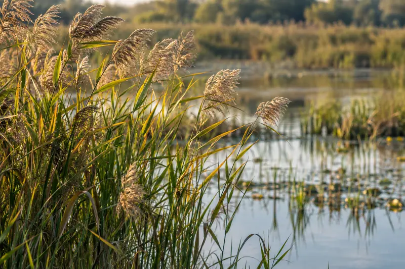
Full frame retained; proportionally resized and converted to WebP. No retouching or changes to the photographed subject. Card displays may crop the view.
City & district guides
About Xianghai National Nature Reserve
Red-crowned cranes are the best-known birds, but the landscape is more varied than a single crane enclosure suggests. Xianhe Island is the established visitor focus, while Lanhaige offers a wider view of the wetland setting. Distinguish managed birds around visitor facilities from wild birds using the reserve: migration, water levels and access arrangements all affect what can be observed on a particular day.
In the early 2000s, successive years of drought caused severe shrinkage of the Xianghai wetland. Restoration measures were later introduced under a project diverting water from the Chaersen Reservoir (察尔森水库) into the wetland, and the wetland has since partially recovered. Xianghai lies in Tongyu County in western Jilin, bounded by the Huolin River (霍林河) to the south and the Emutai River (额木太河) to the north; seepage and evaporation leave no clear watercourse within the reserve except seasonal terminal wetlands and marshes formed in the rainy season.
The Daxianghai and Erchang lakes were dammed in 1971 and incorporated into an irrigation system fed by the Tao'er River, becoming known as the Xianghai Reservoir, which connects to the Huangyu, Dadu, Xiao and Hama lakes; water depth generally ranges from 0.5 to 1.5 meters, reaching more than 10 meters at its deepest point.
The reserve covers a total area of 105,467 hectares and provides habitat for 52 species of nationally protected wildlife. It was established with the approval of the Jilin provincial government in March 1981, became a national-level nature reserve in 1983, and was placed on the List of Wetlands of International Importance in 1992; it was rated a 4A tourist attraction in 2005.
What to look for
- Xianhe Island's reed-fringed water and crane interpretation; some cranes associated with the visitor area are managed birds.
- Lanhaige, the named lookout over the reserve's water-and-grassland landscape.
- Mongolian elm woodland, one of the distinctive habitats protected alongside the wetlands.
Location & getting there
Getting to Xianghai National Nature Reserve
Travel to Xianghai Township and Xianghai Village in Tongyu County, the local base for the reserve's established visitor sites.
- Use the open visitor circuit around Xianhe Island and Lanhaige; the reserve's conservation areas are not unrestricted walking country.
Combine your visit
Suggested order within this visit:
-
Xianhe Island
Begin with the wetland and crane-focused visitor area.
-
Lanhaige lookout
Continue to a wider landscape view using the locally available visitor route.
This sequence is an editorial suggestion based on the features described in the sources. Access to individual buildings or areas should be checked locally; no travel time or shared admission is implied.
Find Xianghai National Nature Reserve
向海 · 白城市
The pin marks the area, not the entrance.
More places nearby
Approximate straight-line distances between map pins, not travel distances.
Chengsijiazi Castles城四家子城址
63 km awayChengsijiazi is a large archaeological city site beside the Tao'er River, with origins in the Liao period and later Jin and Yuan occupation. Its earthworks define a roughly four-sided plan: river channels protected the west and…
View guide →Hua Yan Temple白城华严寺
76 km awayBaicheng's Huayan Temple is a rebuilt Buddhist complex on the southern side of the city, beside the forest park. Its halls follow a symmetrical north–south arrangement. The Mahavira Hall has yellow tiles, grey walls and a…
View guide →Momoge National Nature Reserve莫莫格
117 km awayMomoge protects a mosaic of shallow lakes, reed marshes and saline meadows near the meeting of the Nen and Tao'er river systems. It is an important migration stop for Siberian cranes, with Oriental storks and other waterbirds…
View guide →Sources & visit information
The sources below support the place-specific description and arrival information. Suggested combinations are editorial planning ideas; confirm current opening, entry arrangements and transport services for your date.
- Wikipedia: 向海 ↗
- Jilin Department of Culture and Tourism: Baicheng visitor routes ↗
- People's Daily local reporting: Xianghai Village ↗
- Xianghai reserve administration: managed birds at Xianhe Island ↗
Visitor information adapted and edited from Wikipedia contributors · CC BY-SA 4.0. Source revision 92058920.
Background paragraphs translated and condensed from Wikipedia contributors, "向海", Chinese Wikipedia · CC BY-SA 4.0. Source revision 92058920.