

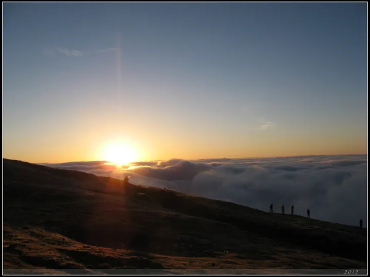
Photo adjustments
Full frame retained; proportionally resized and converted to WebP. No retouching or changes to the photographed subject. Card displays may crop the view.
Explore the region
About Niubei Mountain
Ya'an's municipal tourism commission records the summit at 3,660 metres, with Yeniu Shan, the mountain's other name and Yingjing County's highest peak, given as 3,666 metres; other named peaks in the same range include Da Yeniu Shan (3,409 m), Guangtou Shan (3,478 m), Machangliang (3,499 m), Niangniang Shan and Dakuang Shan, running north-south and forming the source of the Ying River. In late 2009 a National Geographic photographer came upon an unnamed slope in Luding County from which many snow mountains could be seen, and it subsequently became known as Niubei Shan, drawing photographers from all directions; the source states that Niubei Shan earned, together with Dawagengzha, the reputation of a 360-degree 'China's largest viewing platform'. The source also states that Gongga Shan stands due west of the mountain at its highest point, visible in full from the summit, and describes Niubei Shan as the best place to view it.
Yingjing County's own tourism page lists seven famous sights at Niubei Shan: sea of cloud, sunrise, sunset glow, snow mountains, Buddha's light, star trails and alpine rhododendron, with Gongga, Emei and other named mountains visible from the summit along with a seasonal ice waterfall. A hiking route on the mountain runs about 5.4 kilometres, typically taking three to four hours, starting from Yueshan Corridor at about 2,800 metres, passing Xianxialing, Qiankunling and Jinniu Xiangyun, and ending at Guangmingding at 3,666 metres.
What to look for
- The summit and its named peaks, including Yeniu Shan, Da Yeniu Shan, Guangtou Shan and Machangliang.
- The view west to Gongga Shan, visible in full from the summit according to the Ya'an tourism commission.
- Niangniang Ding, on the mountain's Niejiaogou side, which looks down over the Dadu River valley.
- The 5.4-kilometre hiking route from Yueshan Corridor via Xianxialing, Qiankunling and Jinniu Xiangyun to the 3,666-metre summit at Guangmingding.
Location & getting there
Getting to Niubei Mountain
Check weather, trail access and the last return service. A mountain or forest area is not one entrance, and a map’s central pin may be far from the trailhead.
- Search for 牛背山 with 雅安市 and 荥经县.

Find Niubei Mountain
牛背山 · 荥经县
No reliable map pin yet: search by the Chinese name.
Sources & visit information
The linked sources support the identity and background described in this introduction. Opening hours, admission, activity availability and exact arrival arrangements have not been comprehensively checked. Confirm current visitor information with the venue; the original catalogue locality and editorial review flag are retained.