

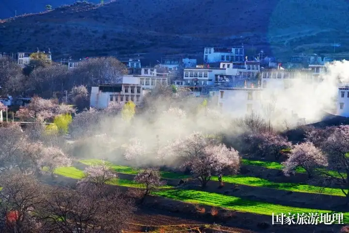
Photo adjustments
EXIF orientation normalized; resized without changing aspect ratio; converted to WebP. No subject edits.
Explore the region
About Sun Valley
Derong County lies at the south-western corner of Sichuan where Sichuan, Yunnan and Tibet meet, on the southern flank of the Hengduan ranges; the county government calls it an important route from Garze prefecture south out of Sichuan into Yunnan and Tibet, and an important ferry crossing on the Yunnan-Tibet tea-horse road. It is a multi-ethnic county with a Tibetan majority and also Han, Naxi, Qiang and Yi people. Its highest peak reaches 5,599 metres and its lowest point 1,990 metres, and the vertical zoning of its vegetation is marked enough for the county to sum it up in the saying that one mountain holds four seasons and the weather differs every ten li. The county overview divides Derong into one town, eleven townships, 122 village committees and 250 natural villages, with a total population of 27,500, and it is from this account that the name Sun Valley of western China comes.
The climate is what the label points at. Derong belongs to the subtropical dry valley climate zone and the county calls it the centre of the south-western dry valleys: sunshine is plentiful, the air dry and rain scarce, mean annual precipitation is 363.3 mm and evaporation is 6.5 times that figure. The annual temperature range is small and the daily range large, the mean annual temperature is 14.6 degrees Celsius, the extremes recorded are 36 and minus 8.9 degrees, and the mean frost-free period is 243 days. Taiyanggu town, whose seat stands at 2,500 metres, has the same typical dry valley climate, with wide temperature differences and rainfall concentrated in the rainy season.
Taiyanggu town covers 289 square kilometres and holds 14 administrative villages, two communities and one monastery, bordering Ciwu and Gongbo townships to the north, Baisong town and Bari township to the east, Bendu township to the south, and Riyu town and Xulong township to the west. Within it stand Wengjia monastery and the sacred mountain of Wengjia, which the township profile counts among the famous hundred and eight keys of the Tibetan areas; the county overview describes the same mountain as the golden key that opens the gates of the 108 sacred mountains of Tibetan Buddhism and, in legend, the pig mountain, to which circumambulators gather in each pig year. The prefecture's register of A-grade tourist areas, current to 11 April 2022, lists the Wengjia Scenic Area at grade 3A with its address in Taiyanggu town. The county's other named sights are the Xiayong provincial scenic area, the Gajin snow mountain, the Baisong-Ciwu ecotourism area, the Momu great gorge and the first bend of the Jinsha river.
What to look for
- The Momu great gorge, one of the five sights the county overview names alongside the sacred mountain.
- The first bend of the Jinsha river, on the same county list.
- Wengjia monastery and the sacred mountain of Wengjia in Taiyanggu town, counted among the hundred and eight keys of the Tibetan areas and reached by circumambulators in each pig year.
- The Gajin snow mountain, which both the county overview and the township profile name.
- The dry valley vegetation itself, in a county whose evaporation runs at six and a half times its 363.3 mm of annual rain.
Location & getting there
Getting to Sun Valley
Confirm the visitor entrance and which boat or walking routes operate on your date. Rainfall, water levels and weather can change access.
- Search for 太阳谷 with 甘孜藏族自治州 and 得荣县.
Find Sun Valley
太阳谷 · 得荣县
No reliable map pin yet: search by the Chinese name.
Sources & visit information
The linked sources support the identity and background described in this introduction. Opening hours, admission, activity availability and exact arrival arrangements have not been comprehensively checked. Confirm current visitor information with the venue; the original catalogue locality and editorial review flag are retained.