

Entry & permits for Tibet (Xizang)
Foreign tourists need Tibet entry approval, commonly called a Tibet Travel Permit, and an organised visit arranged through a specialist travel agency in China. Confirm your approved route before booking transport. Requirements differ for Taiwan residents and for travellers using mainland or Hong Kong/Macao Chinese resident documents; check the document guide before you book.
Check the travel-document requirements →Policy scope verified: 2026-09-06. UK FCDO: China regional travel advice ↗ State Council Taiwan Affairs Office: Tibet entry approval ↗ Xizang Department of Culture and Tourism: Medog border permit notice ↗

Photo adjustments
Full frame retained; proportionally resized and converted to WebP. No retouching or changes to the photographed subject. Card displays may crop the view.
Explore the region
About Bomi
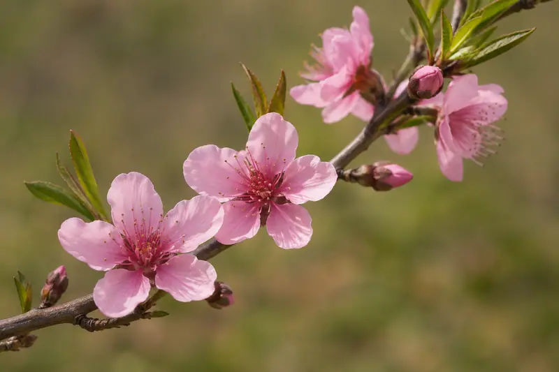
West of town, the Guxiang area brings together lake views and the Gangyun spruce forest; northwest, the Qingduo valley is associated with peach blossom landscapes. These are different excursions rather than one urban attraction. For a compact introduction, concentrate on the western forest-and-lake corridor and leave distant glacier visits for another day.
Bomi, meaning 'ancestor' in Tibetan, was largely a semi-independent area from the Tubo period onward and was ruled in the Qing dynasty by local hereditary kings (土王). In 1910 the last Qing resident commissioner in Tibet, Lianyu (联豫), sent troops that defeated the Bomi king, and in 1911 the area was organized as Dongjiu County (冬九县), also called Lower Bomi. The Tibetan Gaxia (噶厦) government expelled the king's son-in-law in 1928, bringing the region fully under its administration; in 1951 the PRC established the Second Chamdo Office, and in 1960 the Qingduo (倾多), Bo Qu (波曲) and Yigong (易贡) zongs merged to form present-day Bomi County.
Bomi County lies at the eastern end of the Nyenchen Tanglha range and the eastern Himalaya, with terrain higher in the north and lower in the south. Its central area comprises the valleys of the Parlung Tsangpo (帕龙藏布) and Yi'ong Tsangpo (易贡藏布) rivers, fed by dozens of tributaries across a drainage area of 4549.6 square kilometers. Elevation within the county ranges from 6648 meters at its highest point to 2001.4 meters at its lowest, while the county seat at Zhamu town sits at 2720 meters.
What to look for
- The Gangyun spruce forest, a defining part of Bomi’s wooded landscape.
- Guxiang Lake and its surrounding mountain-valley setting west of Zhamu.
The surrounding area
Eastern valleys, lakes and canyon scenery around Basum Tso and the Yarlung Zangbo.
Location & getting there
Getting to Bomi
Use Zhamu/札木镇, the Bomi county seat on the G318 corridor, as the accommodation and transport base.
- Arrange the western Guxiang and forest stops together; Qingduo and the eastern glacier areas branch in other directions.
Combine your visit
Suggested order for this visit:
-
Gangyun spruce forest
Begin with Bomi’s characteristic conifer landscape.
-
Guxiang Lake
Continue west for the lake and valley views.
This is an editorial sequence based on the features described in the sources. Confirm access locally; no walking time, shared admission or guaranteed interior access is implied.
Find Bomi
波密 · 林芝
The pin marks the area, not the entrance.
More places nearby
Approximate straight-line distances between map pins, not travel distances.
Namcha Barwa 南迦巴瓦峰
74 km awayNamcha Barwa rises inside the great bend of the Yarlung Tsangpo, opposite Gyala Peri across the gorge. The contrast between its snow-covered summit and the much lower forested valley gives the mountain its exceptional visual…
View guide →Midui Glacier 米堆冰川
82 km awayMidui’s icefalls descend into a landscape of mixed forest, fields and village life in Bomi’s Yupu area. The contrast is its defining feature: high ice and steep rock sit above a green valley rather than an empty polar-looking…
View guide →Yarlung Tsangpo Grand Canyon 雅鲁藏布大峡谷
85 km awayThe Yarlung Tsangpo cuts around Namcha Barwa at the eastern end of the Himalayas, creating a landscape of deep relief, forested slopes and a powerful river far below the snow peaks. The visitor area near Pai introduces this…
View guide →Sources & visit information
The sources below support the place-specific description and arrival information. Suggested combinations are editorial planning ideas; confirm current opening, entry arrangements and transport services for your date.
- Wikipedia: 波密县 ↗
- Bomi county: Zhamu, Guxiang and Qingduo geography and attractions ↗
- English Wikipedia: Bomê County (revision 1372397806, 2026-08-31) ↗
Visitor information adapted and edited from Wikipedia contributors · CC BY-SA 4.0. Source revision 91955958.
Background paragraphs translated and condensed from Wikipedia contributors, "波密县", Chinese Wikipedia · CC BY-SA 4.0. Source revision 91955958.
Background paragraphs condensed from Wikipedia contributors, "Bomê County", English Wikipedia · CC BY-SA 4.0. Source revision 1372397806.