

Entry & permits for Tibet (Xizang)
Foreign tourists need Tibet entry approval, commonly called a Tibet Travel Permit, and an organised visit arranged through a specialist travel agency in China. Confirm your approved route before booking transport. Requirements differ for Taiwan residents and for travellers using mainland or Hong Kong/Macao Chinese resident documents; check the document guide before you book.
Check the travel-document requirements →Policy scope verified: 2026-09-06. UK FCDO: China regional travel advice ↗ State Council Taiwan Affairs Office: Tibet entry approval ↗ Xizang Department of Culture and Tourism: Medog border permit notice ↗
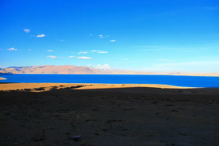
Photo adjustments
Full frame retained; proportionally resized and converted to WebP. No retouching or changes to the photographed subject. Card displays may crop the view.
Explore the region
About Pelkhu Tso
Its two broad lobes create a distinctive dumbbell outline, and ancient shorelines record earlier water levels. The lake is visually linked with Shishapangma: the documented Xifeng viewpoint and Lapu village bring water, grassland and the snow-covered mountain into the same scene. A shore visit can concentrate on this small group of viewpoints without attempting to drive around the entire lake.
The lake lies 60 kilometres north of Shishapangma (希夏邦马峰) and 40 kilometres south of the Yarlung Tsangpo (雅鲁藏布江), at an elevation of 4,580 metres. Its basin receives moisture from the Indian Ocean, with annual precipitation of 300 to 400 millimetres and a mean temperature of two degrees Celsius. The lake covers 284.4 square kilometres.
Rain falling directly on the lake and runoff from melting snow and ice provide its principal water supply. Bari Xiong Qu (巴日雄曲) enters from the southeast. The basin has no outlet, and many glacier-fed streams disappear into alluvial deposits before reaching the lake, whose water is brackish.
What to look for
- The lake-and-Shishapangma composition from the Peiku Tso Xifeng viewpoint.
- Lapu village’s lakeside boardwalk and the contrast between the water, grassland and mountain backdrop.
The surrounding area
A separate western urban centre anchored by Tashilhunpo, suitable for a considered extension from Lhasa.
Location & getting there
Getting to Pelkhu Tso
Use the Peiku Tso Xifeng viewpoint (佩枯错希峰观景台) and nearby Lapu village (拉普村) as named arrival anchors.
- Confirm current road conditions with your local driver before visiting this remote Gyirong–Nyalam lake area.
Combine your visit
Suggested order for this visit:
-
Peiku Tso Xifeng viewpoint
Begin with the broad lake and mountain panorama.
-
Lapu village lakeside
Move to the documented village approach and boardwalk for a lower view.
This is an editorial sequence based on the features described in the sources. Confirm access locally; no walking time, shared admission or guaranteed interior access is implied.
Find Pelkhu Tso
佩枯错 · 日喀则
The pin marks the area, not the entrance.
Sources & visit information
The sources below support the place-specific description and arrival information. Suggested combinations are editorial planning ideas; confirm current opening, entry arrangements and transport services for your date.
- Chinese Academy of Sciences field account: Peiku Tso basin and ancient shorelines ↗
- Firsthand Shigatse visit: Peiku Tso Xifeng viewpoint and Lapu village ↗
- Chinese Wikipedia: 佩枯错 (revision 91956650, 2026-03-19) ↗
- English Wikipedia: Lake Pelku (revision 1366266191, 2026-07-27) ↗
Background paragraphs translated and condensed from Wikipedia contributors, "佩枯错", Chinese Wikipedia · CC BY-SA 4.0. Source revision 91956650.
Background paragraphs condensed from Wikipedia contributors, "Lake Pelku", English Wikipedia · CC BY-SA 4.0. Source revision 1366266191.