


Get to know Xigazê

Photo adjustments
Full frame retained; proportionally resized and converted to WebP. No retouching or changes to the photographed subject. Card displays may crop the view.
- Administrative area
- Prefecture-level city · 地级市
- Part of
- Tibet (Xizang)
- Chinese name
- 日喀则市
- Local areas
- 18 local areas
Area & population
- Area in the source
- 182,000.00 km²
- Population · 2020
- 798,153
- Administrative seat
- Samzhubzê District
Source: cited geographic source, as of the dates shown.
Entry & permits for Tibet (Xizang)
Foreign tourists need Tibet entry approval, commonly called a Tibet Travel Permit, and an organised visit arranged through a specialist travel agency in China. Confirm your approved route before booking transport. Requirements differ for Taiwan residents and for travellers using mainland or Hong Kong/Macao Chinese resident documents; check the document guide before you book.
Check the travel-document requirements →Policy scope verified: 2026-09-06. UK FCDO: China regional travel advice ↗ State Council Taiwan Affairs Office: Tibet entry approval ↗ Xizang Department of Culture and Tourism: Medog border permit notice ↗
Explore Xigazê
Core places to explore, with English and Chinese names.
Tashilhunpo Monastery 扎什伦布寺
Gyantse Dzong 江孜宗山
Palcho Monastery 白居寺
Sakya Monastery 萨迦寺
Rongbuk Monastery 绒布寺
Mount Everest 珠穆朗玛峰
Tingri 定日
Pelkhu Tso 佩枯错
Shigatse 日喀则
Gyantse 江孜
Naining Monastery 乃宁寺
Shalu Monastery 夏鲁寺
Duoqing Lake and Chomolhari Viewing Area 多庆错与卓木拉日观景区
Dungkar Monastery 东嘎寺
Gyirong Valley Official Route 吉隆沟正规开放线路
Phagpa Monastery 帕巴寺
Mount Everest Base Camp Visitor Area 珠穆朗玛峰大本营开放游览区
Qilin Gorge 奇林峡
Lhatse Chode Monastery 曲德寺
Shigatse Dzong 日喀则宗山
Gyantse Dzong Anti-British Resistance Site 江孜宗山抗英遗址
Pelkor Chode Monastery and Kumbum Stupa 白居寺与十万佛塔
Samzhubzê District 桑珠孜区
Namling County 南木林县
Gyangzê County 江孜县
Tingri County 定日县
Sa'gya County 萨迦县
Lhazê County 拉孜县
Ngamring County 昂仁县
Xaitongmoin County 谢通门县
Bainang County 白朗县
Rinbung County 仁布县
Kangmar County 康马县
Dinggyê County 定结县
Zhongba County 仲巴县
Yadong County 亚东县
Gyirong County 吉隆县
Nyalam County 聂拉木县
Saga County 萨嘎县
Kamba County 岗巴县
Places to explore around Xigazê
 Tashilhunpo
Tashilhunpo Monastery扎什伦布寺
Tashilhunpo rises against a hill in central Shigatse. Founded in 1447, it became the traditional seat of the Panchen Lamas, whose memorial stupas form an important part of the complex. The huge gilded Maitreya image gives the…
Read the place guide →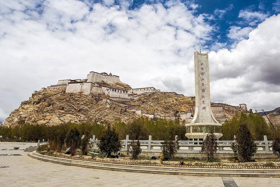 Gyantse Dzong above the town, with the memorial in the foreground, May 2014.
Gyantse Dzong江孜宗山
Gyantse Dzong crowns the rocky spur above Gyantse, with defensive walls following the shape of the hill. The fortress controlled an important approach towards the Tsangpo Valley and Lhasa and became a major site of the 1904…
Read the place guide → The Kumbum and adjoining monastery buildings at Palcho Monastery, Gyantse, Tibet; 25 May 2014.
Palcho Monastery白居寺
Palcho, also called Pelkor Chode or Baiju Monastery, brings together several Tibetan Buddhist traditions at the foot of Gyantse’s hills. Its outstanding feature is the Kumbum: a stepped stupa filled with small chapels, sculpture…
Read the place guide →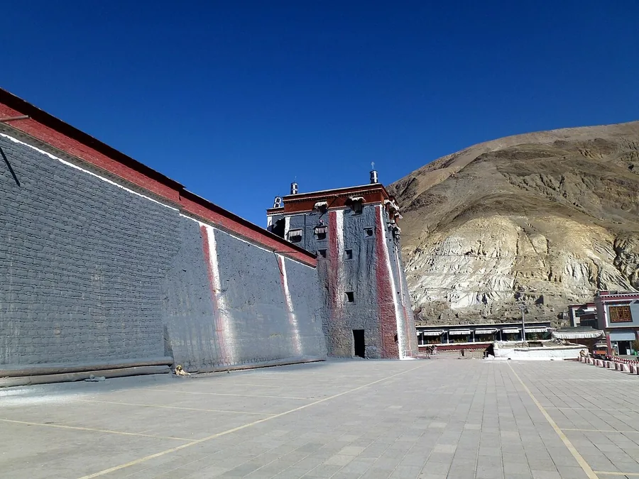 The exterior wall and tower of Sakya's southern monastery complex in Tibet; photograph date unknown.
Sakya Monastery萨迦寺
Sakya Monastery has a fortress-like southern complex in Sakya town, across the river from the site of the earlier northern monastery. Founded in the eleventh century, it gave its name to the Sakya school of Tibetan Buddhism. The…
Read the place guide →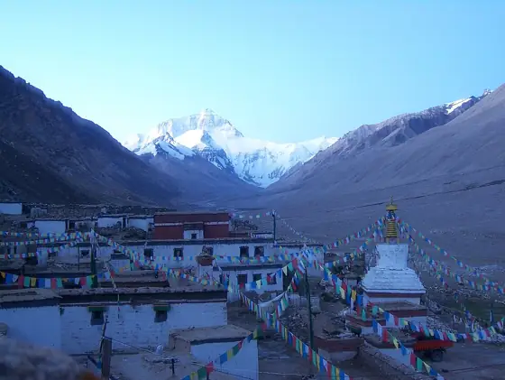 A picture of Rongphu monastery. Taken by Ethan Lutske, and uploaded with his permission.
Rongbuk Monastery绒布寺
Rongbuk occupies the upper Dzakar Chu valley on the northern side of Everest. Its compact monastic buildings and terraced chorten stand against a much larger mountain landscape, with the north face visible when the weather…
Read the place guide → Everest's north face from the path toward base camp in Tibet's Rongbuk Valley, August 2006.
Mount Everest珠穆朗玛峰
Everest’s summit marks the China–Nepal border and reaches 8,848.86 metres according to the joint 2020 survey. For a sightseeing visit from Tibet, the northern Rongbuk valley provides the relevant orientation: the north face…
Read the place guide →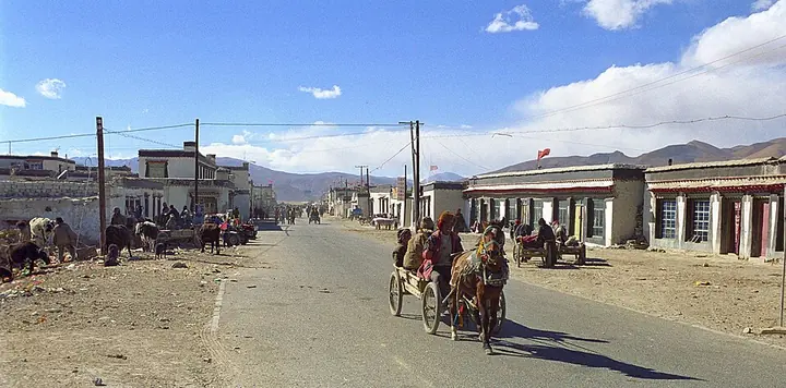 A street in Tingri, photographed in 2004 · 定日岗嘎 Photograph date recorded by the source: October 2004.
Tingri定日
Old Tingri, also called Gangga, sits on the broad Tingri Plain and has long served travellers crossing the high country south of the Tsangpo basin. Its earlier role as a trading post connected Tibetan wool, livestock and salt…
Read the place guide →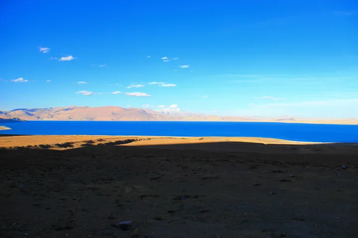 Pelkhu Tso (Lake Paiku) near Gyirong County, Xigazê · 日喀则市吉隆县附近的佩枯错 Source-recorded photograph date: 2012-06-07.
Pelkhu Tso佩枯错
Pelkhu Tso, also written Peiku or Paiku, fills a high basin near the boundary of Gyirong and Nyalam. Its two broad lobes create a distinctive dumbbell outline, and ancient shorelines record earlier water levels. The lake is…
Read the place guide →Shigatse Dzong overlooking the city of Shigatse · 西藏日喀则市日喀则宗俯瞰全城 Source-recorded photograph date: 2019-10-09.Shigatse日喀则
Shigatse's urban centre is shaped by Tashilhunpo Monastery, the streets serving its pilgrims and the old town below the fortress hill. Tashilhunpo gives the strongest introduction to the city's religious history, while the…
Read the place guide →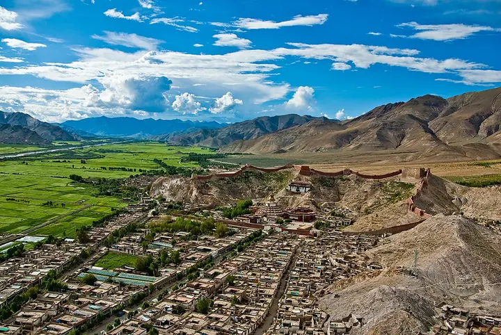 Gyantse viewed from the dzong, photographed in 2009 · 江孜
Gyantse江孜
Gyantse occupies the Nyang Chu valley at the meeting of old trade routes between central Tibet and the southern Himalayan passes. Two neighbouring landmarks make its history tangible: the Dzong crowns a rocky hill, while Palcho…
Read the place guide → AI illustration · AI 示意图(仅供参考,非该地点实拍)
Naining Monastery乃宁寺
Naining Chode stands in the upper Nyang Chu valley at Nanni village, south of Gyantse. Its religious buildings and the memorial outside the gate reflect different parts of its history, including the fighting here during the…
Read the place guide →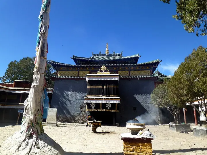 Facade and courtyard of Shalu Monastery, Shigatse · 日喀则夏鲁寺 Photograph date recorded by the source: 14 November 2014 (original upload date).
Shalu Monastery夏鲁寺
Shalu brings Tibetan wall construction together with green glazed roofs, projecting eaves and timber brackets associated with Chinese architecture. The combination is especially clear at the main Shalu Lhakhang. Inside, the…
Read the place guide →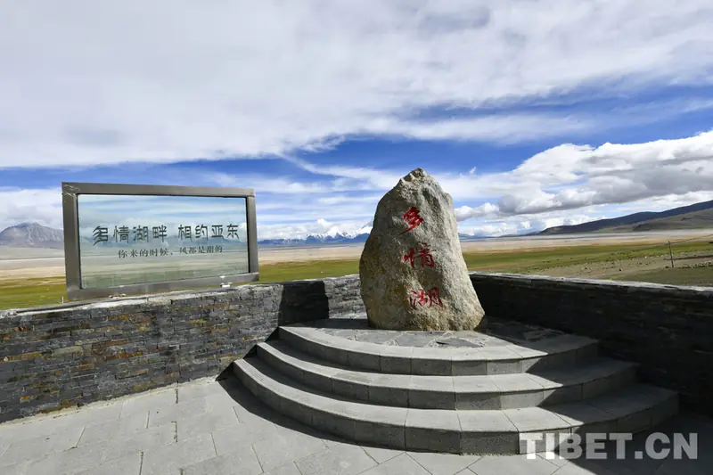 Duoqing Lake and Chomolhari Viewing Area · 多庆错与卓木拉日观景区
Duoqing Lake and Chomolhari Viewing Area多庆错与卓木拉日观景区
Duoqing Lake and Chomolhari Viewing Area is Duoqing Co (Dochen Tso) National Wetland Park, on the border of Yadong and Kangma counties, Tibet, from which Zhuomula (Chomolhari) Snow Mountain -- also called 'Goddess Peak' -- is viewed across the wetland.
Read the place guide →AI illustration · AI 示意图(仅供参考,非该地点实拍)Dungkar Monastery东嘎寺
Gelug branch of Tashilhunpo near Yadong on the southern border, where Zhang Jingwu met the 14th Dalai Lama in July 1951.
Read the place guide →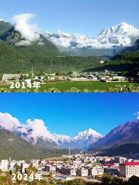 Gyirong Valley Official Route · 吉隆沟正规开放线路
Gyirong Valley Official Route吉隆沟正规开放线路
Gyirong Valley Official Route names the officially designated route through the Gyirong valley in Gyirong County, Tibet, a Himalayan trade corridor whose primeval forest, below Bangxing village, holds tree species found nowhere else in China.
Read the place guide →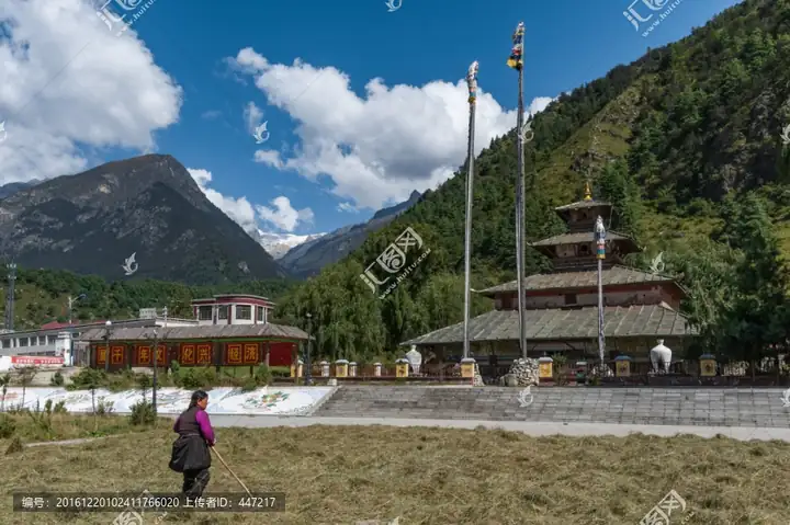 Phagpa Monastery · 帕巴寺
Phagpa Monastery帕巴寺
Four-storey Nepalese-style tower temple in Gyirong town, Shigatse, with copper and brass eaves and largely intact murals; a national key site since 2013.
Read the place guide → AI illustration · AI 示意图(仅供参考,非该地点实拍)
Mount Everest Base Camp Visitor Area珠穆朗玛峰大本营开放游览区
Mount Everest Base Camp Visitor Area is the designated public viewing area for Mount Everest in Tingri County, Tibet, centred on Rongbuk Monastery within the Qomolangma National Nature Reserve.
Read the place guide →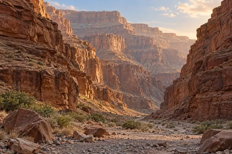 AI illustration · AI 示意图(仅供参考,非该地点实拍)
Qilin Gorge奇林峡
Qilin Gorge is an earth-forest canyon at Mucun village, Qiongzi township, Dinggyê County, Tibet, carved over millions of years by glacial meltwater beneath Kangchenjunga, the third-highest peak in the world.
Read the place guide → Lhatse Chode Monastery · 曲德寺
Lhatse Chode Monastery曲德寺
Gelug monastery founded by the Fifth Dalai Lama in old Lhatse, below the ruined Lhatse Dzong on the Yarlung Tsangpo, with a well-kept mural hall.
Read the place guide →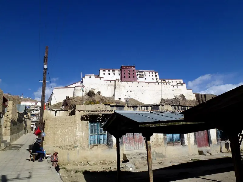 Shigatse Dzong · 日喀则宗山
Shigatse Dzong日喀则宗山
Shigatse Dzong is Samzhubzê Dzong, a fortress-palace completed in 1363 in Samzhubzê District, Shigatse, rebuilt between 2004 and 2007 on its original ruined foundations after Cultural Revolution-era destruction.
Read the place guide →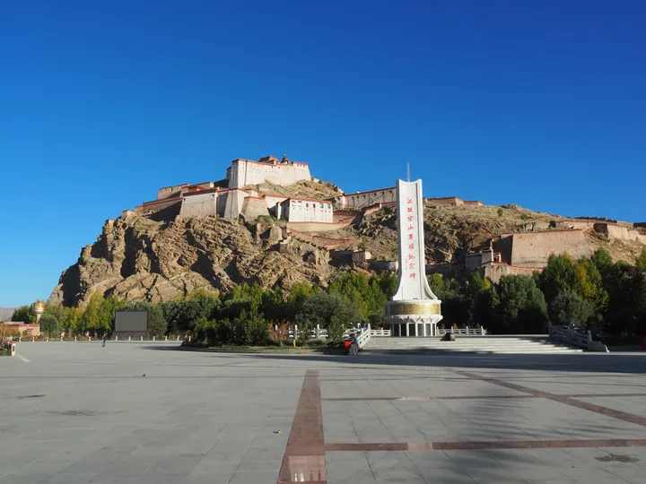 Gyantse Dzong fortress on its hill above the Heroes Memorial, Gyantse County · 江孜县江孜宗山城堡,山下为宗山英雄纪念碑 Source-recorded photograph date: 2015-09-30 06:00.
Gyantse Dzong Anti-British Resistance Site江孜宗山抗英遗址
Hilltop fortress of Gyantse, founded in 967 and ruined when British troops stormed it in July 1904; nationally protected since 1961.
Read the place guide →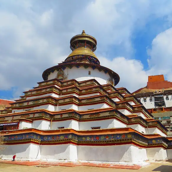 Pelkor Chode Monastery and Kumbum Stupa · 白居寺与十万佛塔
Pelkor Chode Monastery and Kumbum Stupa白居寺与十万佛塔
Pelkor Chode Monastery and Kumbum Stupa is Pelkor Chode Monastery and its Kumbum stupa (the 'Thousand Auspicious Gates Stupa') in Gyangzê County, Tibet -- the only monastery in Tibet shared by three Buddhist orders, built around a nine-storey stupa carrying more than 27,529 painted images.
Read the place guide →Local life & food
Xigazê local specialties
日喀则市特色美食 · 11 specialties to discover
 Gamba lamb soup 岗巴羊肉汤AI illustration · AI 示意图
The flavor centers on lamb itself, with soft meat and richer fatty sections depending on the cut. It is usually less heavily sauced than a braised platter.
Source ↗Read the dish guide → Shigatse pengbi pea jelly 朋必AI illustration · AI 示意图
The pale jelly is smooth and mild with a soft, defined bite. The dressing provides sharpness and heat, so even the same jelly can taste quite different between vendors.
Source ↗Read the dish guide → Highland Barley Wine 青稞酒
Highland Barley Wine (青稞酒), called chang in Tibetan, is a low-alcohol drink brewed mainly from highland barley (青稞) in Tibet, Nepal and parts of the eastern Himalayas.
Read the dish guide →
Photo adjustments
EXIF orientation normalized; resized without changing aspect ratio; converted to WebP. No subject edits.
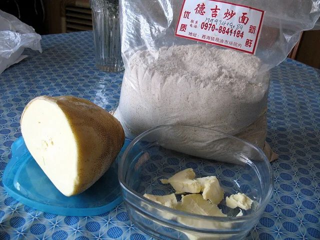 Tsampa 糌粑
The flavor is distinctly toasted and grainy, with richness from butter and a texture that changes with added liquid. It is substantial rather than a light powder garnish.
Source ↗Read the dish guide →
Photo adjustments
EXIF orientation applied where present; resized proportionally to at most 640 px on the long edge and encoded as WebP. No crop, retouching, recoloring or subject changes.
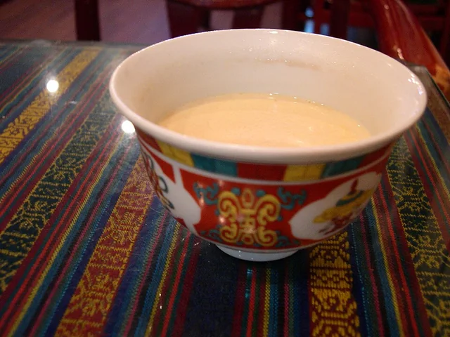 Butter tea 酥油茶
The flavor is savory, tea-bitter and rich, with a smooth fatty mouthfeel rather than the sweetness of commercial milk tea.
Source ↗Read the dish guide →
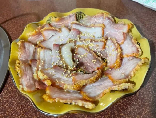 Tibetan-Style Yak Meat 藏式牦牛肉
Tibetan-Style Yak Meat (藏式牦牛肉) is listed among the local specialties of Xigazê, Tibet (Xizang). The name includes 牛肉 (beef).
Read the dish guide →Photo adjustments
EXIF orientation normalized; resized without changing aspect ratio; converted to WebP. No subject edits.
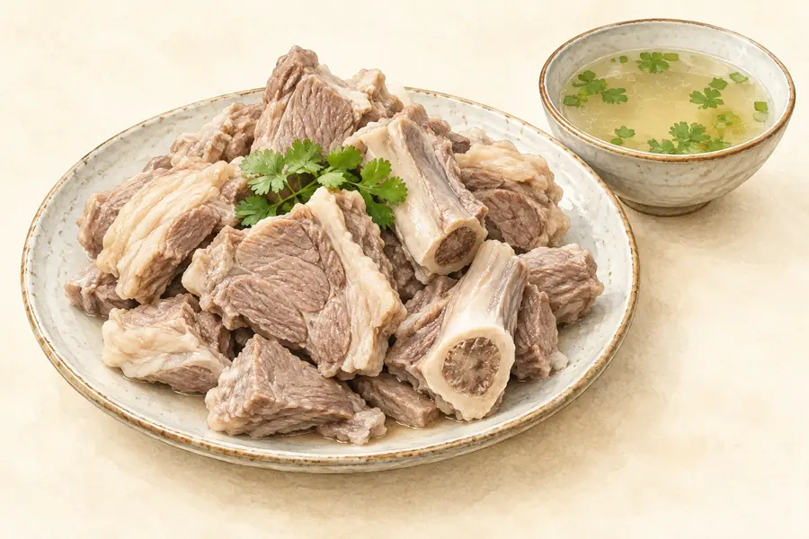 Gamba Mutton 岗巴羊肉AI illustration · AI 示意图(仅供参考,非实拍)
Gamba Mutton (岗巴羊肉) is the meat of the Gamba sheep (岗巴羊), a sheep breed raised in Gamba County (岗巴县) in Shigatse (日喀则), Tibet.
Read the dish guide → Yadong Wood Ear Chicken Stew 亚东木耳炖鸡AI illustration · AI 示意图(仅供参考,非实拍)
Yadong Wood Ear Chicken Stew (亚东木耳炖鸡) is listed among the local specialties of Xigazê, Tibet (Xizang). The name includes 鸡 (chicken). 炖 describes slow simmering.
Read the dish guide →More dishes from across Tibet (Xizang) are in the Tibet (Xizang) food guide.
Counties & districts in Xigazê
18 areas belong directly to Xigazê.
18 areas
Samzhubzê District 桑珠孜区
Samzhubzê District (also spelled Sangzhuzi District, Samdruptse District) is a district in the Tibet Autonomous Region of the China, and the administrative center of the prefecture-level city of Shigatse…
Explore the area →CountyNamling County 南木林县
Namling County (Tibetan: རྣམ་གླིང་རྫོང་།; Chinese: 南木林县) is a county of Shigatse in the Tibet Autonomous Region, China.
Explore the area →CountyGyangzê County 江孜县
Gyantse County officially Gyangzê County (Tibetan: རྒྱལ་རྩེ་རྫོང་།; Chinese: 江孜县) is a county of Xigazê in the Tibet Autonomous Region, China. Its main settlement is Gyantse Town known for its monasteries.
Explore the area →CountyTingri County 定日县
Tingri County (Tibetan: དིང་རི་རྫོང་།; simplified Chinese: 定日县; traditional Chinese: 定日縣; pinyin: Dìngrì Xiàn) is a county under the administration of the prefecture-level city of Shigatse in the Tibet…
Explore the area →Show fewer areas
Sa'gya County 萨迦县
Sa'gya County (Tibetan: ས་སྐྱ་རྫོང་།; Chinese: 萨迦县) is a county under the prefecture-level city of Shigatse in the Tibet Autonomous Region, China.
Explore the area →CountyLhazê County 拉孜县
Lhatse County is a county of Shigatse in the Tibet Autonomous Region, China. It was established in 1959, with Lhatse Town as the county seat. In 1968, Quxar Town became the county seat.
Explore the area →CountyNgamring County 昂仁县
Ngamring County (Tibetan: ངམ་རིང་རྫོང་།; Chinese: 昂仁县) is a county of Xigazê in the Tibet Autonomous Region, China. "Ngamring County, sometimes referred to as the gateway to Mount Kailash and Far West Tibet…
Explore the area →CountyXaitongmoin County 谢通门县
Xaitongmoin County or Zhetongmön (Tibetan: བཞད་མཐོང་སྨོན་རྫོང་།, Chinese: 谢通门县) is a county of Xigazê in the Tibet Autonomous Region, China.
Explore the area →CountyBainang County 白朗县
Bainang County (Tibetan: པ་སྣམ་རྫོང་།; Chinese: 白朗县) is a county of Xigazê in the Tibet Autonomous Region, China.
Explore the area →CountyRinbung County 仁布县
Rinbung County (Tibetan: རིན་སྤུངས་རྫོང་།; Chinese: 仁布县) is a county at the northeastern boundary of the prefecture-level city of Xigazê in the Tibet Autonomous Region, China.
Explore the area →CountyKangmar County 康马县
Kangmar County (Tibetan: ཁང་དམར་རྫོང་།; Chinese: 康马县) is a county of Xigazê in the Tibet Autonomous Region, China, bordering India's Sikkim state to the south. Gala Co lake is located in Kangmar County.
Explore the area →CountyDinggyê County 定结县
Dinggyê County (Tibetan: གཏིང་སྐྱེས་རྫོང་།, Chinese: 定结县) is a county of the Shigatse city in the Tibet Autonomous Region, China, bordering Nepal's Sankhuwasabha and Taplejung Districts to the south and…
Explore the area →CountyZhongba County 仲巴县
(Tibetan: འབྲོང་པ་རྫོང; Chinese: 仲巴县) is a county of Shigatse Prefecture in China's Tibet Autonomous Region. Located in the western part of Central Tibet (sometimes referred to as "western Tibet"), it is the…
Explore the area →CountyYadong County 亚东县
Yadong County,
Explore the area →CountyGyirong County 吉隆县
Gyirong County (Tibetan: སྐྱིད་གྲོང་རྫོང་།; also transliterated as Kyirong or Jilong) is a county of the Shigatse Prefecture, Tibet Autonomous Region, China.
Explore the area →CountyNyalam County 聂拉木县
Nyalam County is a county in Shigatse, Tibet, China. It borders on Nepal.
Explore the area →CountySaga County 萨嘎县
Saga County (Tibetan: ས་དགའ་རྫོང་།; Chinese: 萨嘎县) is a county of the prefecture-level city of Xigazê in the Tibet Autonomous Region, China, bordering Nepal to the west and southwest.
Explore the area →CountyKamba County 岗巴县
Kamba County (Tibetan: གམ་པ་རྫོང, Chinese: 岗巴县) is a county of Xigazê in the Tibet Autonomous Region, China, bordering India's Sikkim state to the south.
Explore the area →No areas match this name.
Plan your visit
Getting there
Search for 日喀则市 in a map app to find stations and your accommodation.
Where to stay →Build your route
Tashilhunpo Monastery and Gyantse Dzong are about 80 km apart in a straight line. The linked place guides have entrance and visit details.
Continue with Tibet (Xizang) →More in Tibet (Xizang)
Sources & geographic information
Administrative names and parent areas: Official geographic directory · Reference date 2026-09-06.
Background text adapted from Shigatse — Wikipedia contributors, under CC BY-SA 4.0. Text has been shortened and reorganized; source revision 1373381608.
Photo: Tashilhunpo Monastery · Antoine Taveneaux · CC BY-SA 3.0. Resized and WebP compressed; subject not altered.

Photo: Gyantse Dzong · Windmemories · CC BY-SA 4.0. Proportionally resized and converted to WebP without cropping, retouching or changing the photographed subject.

Photo: Palcho Monastery · Gerd Eichmann · CC BY-SA 4.0. Proportionally resized and converted to WebP without cropping, retouching or changing the photographed subject.

Photo: Sakya Monastery · Hiroki Ogawa · CC BY 3.0. Proportionally resized and converted to WebP without cropping, retouching or changing the photographed subject.

Photo: Rongbuk Monastery · Original uploader was DamnYankees at en.wikipedia · Public domain. Resized and WebP compressed; subject not altered.

Photo: Mount Everest · Luca Galuzzi (Lucag) · Luca Galuzzi · CC BY-SA 2.5. Proportionally resized and converted to WebP without cropping, retouching or changing the photographed subject.

Photo: Tingri · Reurinkjan · CC BY 2.0. Full frame retained; proportionally resized and converted to WebP. No retouching or changes to the photographed subject. Card displays may crop the view.

Photo: Pelkhu Tso · 李麓扬,上传者:Zhangmoon618 · CC BY-SA 3.0. Full frame retained; proportionally resized and converted to WebP. No retouching or changes to the photographed subject. Card displays may crop the view.

Photo: Shigatse · 钉钉 · CC BY-SA 4.0. Full frame retained; proportionally resized and converted to WebP. No retouching or changes to the photographed subject. Card displays may crop the view.

Photo: Gyantse · Antoine Taveneaux · CC BY-SA 3.0. Full frame retained; proportionally resized and converted to WebP. No retouching or changes to the photographed subject. Card displays may crop the view.

Photo: Shalu Monastery · Hiroki Ogawa · Hiroki Ogawa — Shalu_Monastery_Shigatse_Tibet_China_西藏_日喀则_夏鲁寺_-_panoramio.jpg — CC BY 3.0 · CC BY 3.0. Full frame retained; proportionally resized and converted to WebP. No retouching or changes to the photographed subject. Card displays may crop the view.

Photo: Duoqing Lake and Chomolhari Viewing Area · Source photographer · License not provided. EXIF orientation normalized; resized without changing aspect ratio; converted to WebP. No subject edits.
Photo: Gyirong Valley Official Route · Source photographer · License not provided. EXIF orientation normalized; resized without changing aspect ratio; converted to WebP. No subject edits.
Photo: Phagpa Monastery · Source photographer · License not provided. EXIF orientation normalized; resized without changing aspect ratio; converted to WebP. No subject edits.
Photo: Lhatse Chode Monastery · Source photographer · License not provided. EXIF orientation normalized; resized without changing aspect ratio; converted to WebP. No subject edits.
Photo: Shigatse Dzong · Hiroki Ogawa · CC BY 3.0. EXIF orientation normalized; resized without changing aspect ratio; converted to WebP. No subject edits.

Photo: Gyantse Dzong Anti-British Resistance Site · Laika ac from UK · CC BY-SA 2.0. Full frame retained; proportionally resized and converted to WebP. No retouching or changes to the photographed subject. Card displays may crop the view.
.jpg)
Photo: Pelkor Chode Monastery and Kumbum Stupa · Source photographer · License not provided. EXIF orientation normalized; resized without changing aspect ratio; converted to WebP. No subject edits.
Map data © OpenStreetMap contributors. Pins mark approximate centres, not entrances or boundaries.