

Photo adjustments
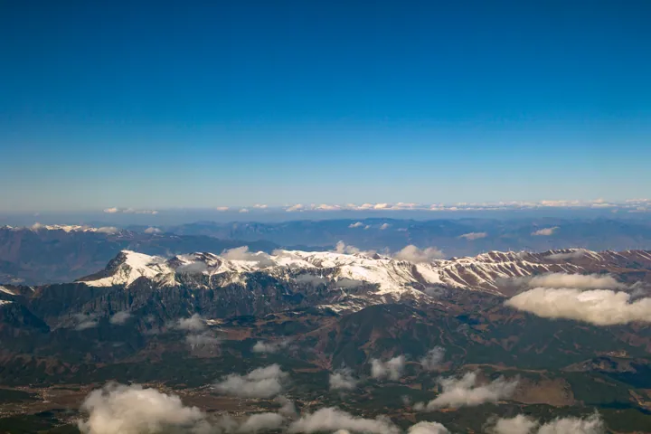
Full frame retained; proportionally resized and converted to WebP. No retouching or changes to the photographed subject. Card displays may crop the view.
Explore the region
About Dahai Grass Mountain
Rounded meadow hills, grazing animals and small streams give it a pastoral character, while the distant Guniuzhai peak marks the higher mountain skyline. Grass colour, flowers, cloud and winter snow change the appearance strongly through the year. Use the managed scenic-area route for a short visit; the open-looking terrain should not be mistaken for an invitation to drive across meadows or follow unmarked ridges.
Elevations within the scenic area range from 2,570 to 4,017 metres, and it is a national 4A tourist attraction (国家4A级旅游景区). A ski facility covers more than 20,000 square metres at an average elevation of 3,541 metres. In 2022, it opened three beginner runs and one intermediate run. The facility serves as a ski-training base and also accommodates general visitors. A wider development plan envisages 26 runs for beginner, intermediate and advanced skiers, together with four cableways, hotel accommodation and a resort town for winter sports.
What to look for
- Subalpine meadows form broad, rounded hills with small streams between them.
- Guniuzhai peak adds a higher mountain landmark above the grassland landscape.
Location & getting there
Getting to Dahai Grass Mountain
Travel from Huize towards Dahai Township, then take the Dahai–Caoshan road to the scenic area southeast of the township. The local government documents this road connection; confirm weather and road conditions before the ascent.
Combine your visit
Suggested order for the visit:
-
Managed meadow viewpoint
Take in the rounded grassland slopes.
-
Open section of the scenic-area route
Compare the stream valleys and higher mountain skyline.
This is an editorial sequence of named spaces or places. It does not imply a verified walking connection or promise opening, ticket availability or a journey time.
Find Dahai Grass Mountain
大海草山 · 曲靖
The pin marks the area, not the entrance.
More places nearby
Approximate straight-line distances between map pins, not travel distances.
Dongchuan Red Land 东川红土地
18 km awayDongchuan’s red-land scenery is a cultivated landscape around Huashitou, with fields creating patches of exposed soil and vegetation across rolling slopes. Iron in the soil contributes to the red colour, while planting, harvest…
View guide →Dashanbao 大山包
132 km awayDashanbao combines rolling highland grassland with the abrupt edge of Jigongshan Grand Canyon. Dahai Lake and other wetlands also form an important wintering environment for black-necked cranes, though birdwatching access is…
View guide →Yuantong Temple 圆通寺
141 km awayYuantong Temple in central Kunming is arranged around a pond and Yuantong Hall. A stone bridge carrying an octagonal pavilion connects the entrance side with the hall, making water an unusually strong organising feature in the…
View guide →Sources & visit information
The sources below support the place-specific description and arrival information. Suggested combinations are editorial planning ideas; confirm current opening, entry arrangements and transport services for your date.
- Yunnan Forestry: Dahai Grass Mountain ↗
- Qujing government: Dahai–Caoshan road ↗
- Chinese Wikipedia: 大海草山 (revision 92475005, 2026-04-30) ↗
Background paragraphs translated and condensed from Wikipedia contributors, "大海草山", Chinese Wikipedia · CC BY-SA 4.0. Source revision 92475005.