

Photo adjustments
EXIF orientation normalized; resized without changing aspect ratio; converted to WebP. No subject edits.
Explore the region
About Qarhan Salt Lake
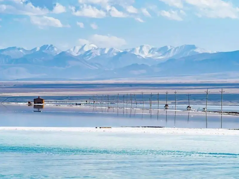
Dabusun is a major component, and the wider landscape supports large-scale mineral production. The visitor area presents a controlled view of this working industrial environment: coloured brine, salt surfaces and evaporation fields belong to the same story. Treat the tourism route as a defined part of the salt works, not permission to explore production areas independently.
The name Qarhan derives from a Mongolian word meaning white; the Chinese transcription is Cha'erhan (察尔汗), sometimes rendered Charhan in English. The playa is a sea-facies lake, formed from seawater of the ancient Tethys Sea left behind as the Qinghai-Tibet Plateau rose. It now consists of Dabusun Lake (达布逊湖) together with South Huobuxun Lake (南霍布逊湖), North Huobuxun Lake (北霍布逊湖) and the Senie salt pond (涩聂), among other basins.
Qarhan spans Golmud and Dulan counties in Haixi Prefecture and covers 5,856 square kilometres, stretching more than 160 kilometres east to west. It lies in the centre of the Qaidam Basin, between the Kunlun Mountains to the south and the Qilian Mountains to the north. Its lakes sit at elevations of about 2,675 to 2,680 metres, with Dabusun and North Hulsan the lowest and Xiezuo the highest.
Evaporation has formed a hard salt crust across the playa, on which the Qinghai-Tibet railway and highway are built directly. The lake holds rich deposits of sodium chloride, potassium chloride and magnesium chloride, with total reserves of about 60 billion tonnes, making it one of China's mineral production bases.
What to look for
- The landscape combines salt flats with several brine lakes.
- Evaporation fields reveal the connection between scenery and mineral production.
- The designated visitor route offers access within an active industrial setting.
Location & getting there
Getting to Qarhan Salt Lake
Arrange road transport from Golmud to the Qarhan Salt Lake visitor reception operated by the scenic area. Use its current entrance and transfer instructions rather than a pin in the middle of the wider salt-flat system.
Combine your visit
Choose from these complementary stops when planning your visit.
-
Scenic-area reception察尔汗盐湖游客接待处
Confirm the authorised visitor route.
-
Designated salt-lake viewpoint开放盐湖观景点
Observe the brine and salt surfaces.
-
Industrial landscape outlook盐田景观窗口
Understand the working salt fields from the permitted area.
Follow the scenic operator’s route through the industrial area. Brine pools, salt crust and production roads are not unrestricted walking or swimming areas.

Find Qarhan Salt Lake
察尔汗盐湖 · 海西州
The pin marks the area, not the entrance.
Sources & visit information
The sources below support the place-specific description and arrival information. Suggested combinations are editorial planning ideas; confirm current opening, entry arrangements and transport services for your date.
- Golmud Government, August 2026: salt-field tourism and production boundaries ↗
- Qarhan Playa — Wikipedia geographic and historical reference ↗
- Chinese Wikipedia: 察尔汗盐湖 (revision 92694861, 2026-05-17) ↗
- English Wikipedia: Qarhan Playa (revision 1366613480, 2026-07-29) ↗
Geographic and historical facts selectively adapted from Wikipedia contributors, Qarhan Playa · CC BY-SA 4.0. Source revision 1366613480.
Background paragraphs translated and condensed from Wikipedia contributors, "察尔汗盐湖", Chinese Wikipedia · CC BY-SA 4.0. Source revision 92694861.
Background paragraphs condensed from Wikipedia contributors, "Qarhan Playa", English Wikipedia · CC BY-SA 4.0. Source revision 1366613480.