


Photo adjustments
EXIF orientation normalized; resized without changing aspect ratio; converted to WebP. No subject edits.
Explore the region
About Qilian Mountains · Zhuoer Mountain
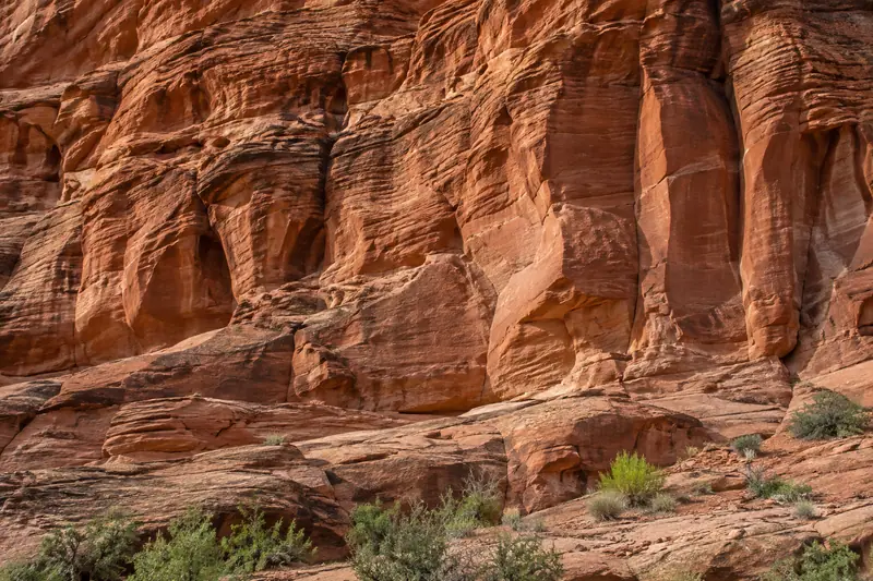
Its red rock and grassy slopes overlook the Babao River valley, with Ami Dongsuo, also called Niuxin Mountain, across the water. The changing relationship between town, farmland and higher peaks is the main attraction. Weather controls how much of the surrounding range is visible.
What to look for
- Red rock and grassland create the characteristic Zhuoer landscape.
- The valley view includes the Babao River and Ami Dongsuo across it.
Location & getting there
Getting to Qilian Mountains · Zhuoer Mountain
Use the Zhuoer Mountain scenic-area visitor entrance near Babao town in Qilian County. Confirm which entrance and sightseeing transport are operating; a Qilian Mountains regional map search will not reliably lead to this particular viewpoint.
Combine your visit
Choose from these complementary stops when planning your visit.
-
Zhuoer visitor entrance卓尔山游客入口
Confirm the operating path and transport.
-
Red-rock viewpoints丹霞观景处
Compare the red formations with the grassy slopes.
-
Babao valley view八宝河谷观景处
Look toward the town and Ami Dongsuo.
This is a suggested combination, not a timed route; confirm the opening and transport arrangements for your date.
Find Qilian Mountains · Zhuoer Mountain
祁连山·卓尔山 · 海北州
The pin marks the area, not the entrance.
More places nearby
Approximate straight-line distances between map pins, not travel distances.
Arou Monastery 阿柔大寺
20 km awayArou Monastery sits in grassland country east of Babao. The Gelug monastery’s assembly hall, row of stupas and prayer-wheel corridor form a compact cultural stop on a Qilian road journey. Its courtyards combine Tibetan religious…
View guide →Qilian County 祁连
45 km awayQilian County is a mountain and grassland region in northern Qinghai, with Babao as its main visitor base. Zhuoer Mountain gives an elevated view of the valley, while Arou Monastery adds a cultural stop along the eastern road…
View guide →Qinghai Lake · regional lake reference 青海湖·全湖区域示意点
132 km awayQinghai Lake is a large saline lake in a closed basin on the northeastern plateau. Its broad water surface, surrounding grasslands and mountain horizon create a landscape experienced differently from each shore. The regional map…
View guide →Sources & visit information
The sources below support the place-specific description and arrival information. Suggested combinations are editorial planning ideas; confirm current opening, entry arrangements and transport services for your date.