

Explore the region
About Qinghai Lake
Qinghai Lake (青海湖) is a salt lake on the northeastern Tibetan Plateau, lying between Haibei (海北) and Hainan (海南) Tibetan autonomous prefectures about 100 km west of Xining (西宁). It gave Qinghai Province its name and is the largest lake in China.
The Tibetan name Tso Ngönpo and the Mongolian Koko Nor both mean "blue lake"; older Chinese texts call it Xihai (西海), the "Western Sea", or Xianshui (鲜水). The surface lies at over 3,200 m, and its area has changed through time: shrinking for much of the 20th century and growing again since 2004. The average depth is about 21 m. Four ranges of 3,600 to 5,000 m surround the lake: the Datong Mountains (大通山) to the north, Riyue Mountain (日月山) to the east, Qinghai Nanshan (青海南山) to the south and Xiangpi Mountain (橡皮山) to the west.
Twenty-three rivers and streams feed the lake, most of them only seasonally; the largest is the Buha River (布哈河). With little inflow and strong evaporation the water has turned saline and alkaline, and other Yellow River fish died out as it did. Five native fish species live here, of which the edible naked carp (青海湖裸鲤) is the most numerous. The dry, cold winters often keep the lake frozen for three months at a stretch.
The lake lies where several Asian bird migration routes cross. Bird Island (鸟岛), near the Buha River mouth, covers about 0.5 km² and holds more than 100,000 migratory birds in spring and summer. Haixin Shan (海心山), also called Longju Island (龙驹岛), is an island of about 1 km² once famed for its "dragon colts". Tibetan Buddhist pilgrims still circle the shore, above all in the Horse Year of the twelve-year cycle.
What to look for
- Bird Island (鸟岛) on the west side, a spring and summer stop for over 100,000 migratory birds
- Haixin Shan (海心山), also called Longju Island, the roughly 1 km² island in the lake
- The four ranges that ring the basin, among them Riyue Mountain (日月山) on the east
- The winter ice, which often lasts three months
Location & getting there
Getting to Qinghai Lake
- Search for 青海湖 with 海南藏族自治州 and 共和县(跨海晏县、刚察县).
Find Qinghai Lake
青海湖 · 共和县(跨海晏县、刚察县)
No reliable map pin yet: search by the Chinese name.
Sources & visit information
Written from the linked sources and fact-checked against them on 2026-09-23. Opening hours, admission and access arrangements are not covered; confirm current visitor information with the site.
Some facts checked against Wikipedia contributors, "青海湖" · CC BY-SA 4.0.
Some facts checked against Wikipedia contributors, "Qinghai Lake" · CC BY-SA 4.0.
Image credits & notes (1)
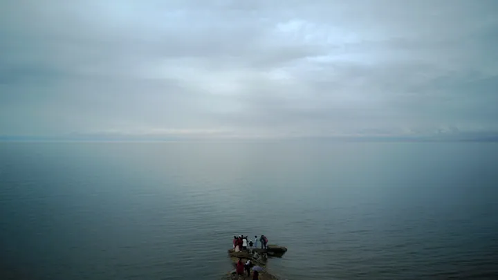
- Qinghai Lake, viewed from a rocky outcrop at the water's edge · 青海湖,摄于湖边一处岩石岬角Photo: 三猎 · CC BY-SA 4.0 · taken 2017-06-03Resized for the web; the photo itself has not been edited. Thumbnails may show a cropped view.
