

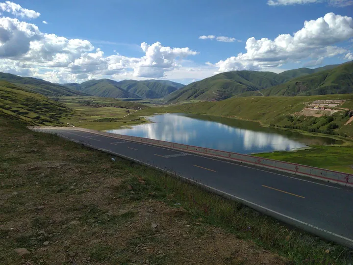
Photo adjustments
Full frame retained; proportionally resized and converted to WebP. No retouching or changes to the photographed subject. Card displays may crop the view.
Explore the region
About Kasa Lake
The lake's water surface covers 1.92 square kilometres and the village whose territory holds it covers 3.96 square kilometres in all. The provincial item that gives those figures describes Kasa as a waterbird habitat and as a holy lake well known locally. The Luhuo county gazetteer entry names Kasa lake among the county's principal sights, alongside the Danduka snow mountain, the Zongta seven-colour grassland, Yirigou, earthquake remains, the Kaniang Guanmen ridge, religious monasteries, stone-coffin tombs, Red Army cultural remains and the sacred mountain Gejin, and records that the county holds one provincial nature reserve and two county-level ones. The county itself lies in the central-northern part of Garze prefecture, covers 5,796.64 square kilometres at an average altitude of 3,860 metres, and is divided into four working committees, sixteen townships and 171 administrative villages, with a year-end resident population of 49,153.
The provincial item is also a record of the lake's condition. It says that with global climate change the lake, being on the plateau, has held less water year by year, and sets out what was done about it in 2023: Chonggu township put 400,000 yuan into water-ecology restoration and tree planting, Kasha village organised more than a hundred person-turns to dig channels, clear water courses and bring water in to top the lake up, and 31.8 tonnes of non-native fish were netted out of the lake by the village working with the environmental protection, forestry and grassland, agriculture and animal husbandry and water departments. About 6.8 tonnes of rubbish, floating debris and water weed were cleared from the shore, and the lake was patrolled more than sixty times.
What to look for
- The lake itself, 1.92 square kilometres of plateau freshwater at 3,700 metres, designated a provincial nature reserve in 1999.
- The waterbirds the provincial item records the lake as a habitat for.
- The shoreline that village work parties cleared of rubbish, floating debris and water weed, and the channels dug to bring water back into the lake.
- The other sights the county gazetteer names alongside it, among them the Danduka snow mountain, the Zongta seven-colour grassland and the stone-coffin tombs.
Location & getting there
Getting to Kasa Lake
Check the open visitor route and follow the site’s rules on distance, food and photography. Conservation areas may limit access beyond designated paths.
- Search for 卡萨湖 with 甘孜藏族自治州 and 炉霍县.
Find Kasa Lake
卡萨湖 · 炉霍县
No reliable map pin yet: search by the Chinese name.
Sources & visit information
The linked sources support the identity and background described in this introduction. Opening hours, admission, activity availability and exact arrival arrangements have not been comprehensively checked. Confirm current visitor information with the venue; the original catalogue locality and editorial review flag are retained.