

Photo adjustments
EXIF orientation normalized; resized without changing aspect ratio; converted to WebP. No subject edits.
Explore the region
About Lianbao Yeze Scenic Area
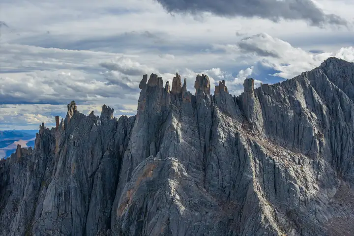
Lianbao Yeze Scenic Area (莲宝叶则) covers a granite mountain range on the border of Aba County (阿坝县), Sichuan, and Jiuzhi County (久治县), Qinghai, a southern spur of the Bayan Har Mountains (巴颜喀拉山). Aba County's government puts it 39 km from the county town and gives its area as more than 500 km².
The range divides the Yellow River and Yangtze drainage basins, and Chinese Wikipedia gives its highest peak as 5,369 m. The county government, which also calls the area Stone Mountain (石头山), describes it as the foremost of the sacred mountains of Amdo (安多) and lists it as a provincial eco-tourism demonstration area built around odd peaks and rocks, glacial remains and snow-mountain lakes.
A 2026 Huanqiu report on the area's geology explains the landscape. Its core is a granite body formed when magma intruded about 200 million years ago, in the Late Triassic, and later exposed as the Tibetan Plateau rose. Quaternary glaciers then cut U-shaped valleys, sharp horn peaks, knife-edge ridges and cirques, and left more than 300 glacial lakes (海子). The same report records that the area is a nationally rated AAAA scenic area and a national geopark, and that in 2025 it was named one of Sichuan's first "best stargazing spots".
China News Service describes mountains, lakes, grassland and great boulders across the scenic area, and the county government reports summer visitors at the clear water of Baixiang Lake (柏香海). The area has a geoscience museum, and school study trips use set stops: measuring rock beds in the "trees growing from stone" (石生树) area, studying a glacier-carved lake at Zhaga'er Lake (扎尕尔措) and looking for old glacial scratches at Panyang Ping (盘羊坪).
What to look for
- Granite peak forests shaped by Quaternary glaciers into horns, knife-edge ridges and cirques
- Baixiang Lake (柏香海), a clear lake visited in summer
- Zhaga'er Lake (扎尕尔措), a glacier-carved lake, and Zhaga'er Valley (扎尕尔沟)
- Panyang Ping (盘羊坪), where old glacial scratches can be found in the rock
- The "trees growing from stone" (石生树) area
- Longke Valley (龙克沟) and Zhumu Valley (珠姆沟), and Luoyun Lake (罗云措) and Zhumu Lake (珠姆措)
- The Red Stone River (红石头河)
- The geoscience museum (地学博物馆) in the scenic area
Location & getting there
Getting to Lianbao Yeze Scenic Area
- Search for 莲宝叶则 with 阿坝藏族羌族自治州 and 阿坝县.
Find Lianbao Yeze Scenic Area
莲宝叶则 · 阿坝县
No reliable map pin yet: search by the Chinese name.
Sources & visit information
Written from the linked sources and checked sentence by sentence against quoted extracts by a separate reviewer on 2026-09-23. Opening hours, admission and access arrangements are not covered; confirm current visitor information with the site.
- 莲宝叶则 - 维基百科,自由的百科全书 ↗
- 莲宝叶则石头山风景区_阿坝县人民政府 ↗
- 阿坝县莲宝叶则景区迎来避暑游高峰_阿坝县人民政府 ↗
- “研”值爆表!四川阿坝县锚定世界级资源 打造高原冬季研学“新极地” ↗
- 四川阿坝:莲宝叶则-石头山景区风光旖旎-中新网 ↗
Some facts checked against Wikipedia contributors, "莲宝叶则" · CC BY-SA 4.0.