

Entry & permits for Tibet (Xizang)
Foreign tourists need Tibet entry approval, commonly called a Tibet Travel Permit, and an organised visit arranged through a specialist travel agency in China. Confirm your approved route before booking transport. Requirements differ for Taiwan residents and for travellers using mainland or Hong Kong/Macao Chinese resident documents; check the document guide before you book.
Check the travel-document requirements →Policy scope verified: 2026-09-06. UK FCDO: China regional travel advice ↗ State Council Taiwan Affairs Office: Tibet entry approval ↗ Xizang Department of Culture and Tourism: Medog border permit notice ↗

Explore the region
About Rakshastal Lake Official Viewpoint
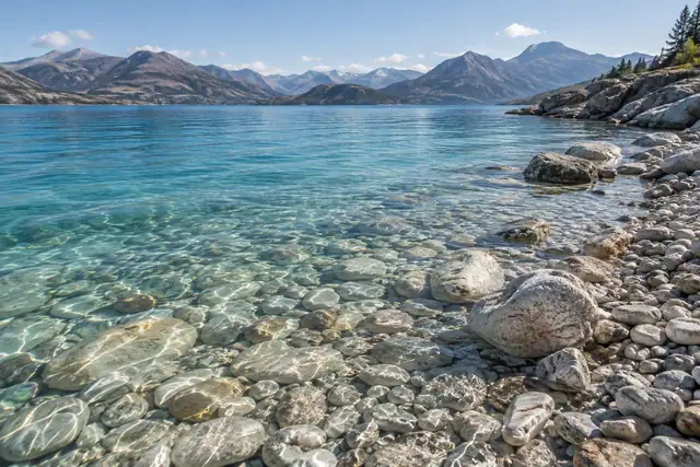
The county commentary explains the name. It records that herdsmen's cattle and sheep never drank from the lake, that no plants grew around it, and that wind at night sometimes produced a sound like roaring and patches of mist over the water, which local people took as a sign of an unlucky place, and that this is why they called it the ghost lake. A 2015 article on the Tibet Autonomous Region's news portal gives the Tibetan meaning as the poisonous black lake and records two other names it carries, Li'ang Co and Guai Hu. That article describes the water as deep blue and the lake as slightly brackish, and the county commentary likewise calls it a slightly brackish lake.
The two lakes were once one. The county commentary places both between the Gangdise and the Himalaya ranges and says the single body was divided when glacial debris piled up in the middle of its bed after the ice melted and raised the centre, and warming then increased evaporation and lowered the water level, so that the higher middle emerged as a hill and cut the lake in two. It adds that the ghost lake lies upwind, that Namnani peak has a gap on its southwestern side, so that moist air from the Indian Ocean reaches the ghost lake first and Manasarovar only after passing the exposed hill, that this leaves the ghost lake slightly warmer and more humid and evaporating faster, and that three or four rivers flow into it against ten into Manasarovar. On those differences the commentary rests its explanation of why one lake is fresh and the other brackish. The 2015 article puts the division differently, saying the two are separated by a narrow low hill and joined by a channel it names Ganpa Chu, which it says has usually been dry, and that a branch of National Highway 219 runs between them.
In 1906 the Swedish geographer Sven Hedin, having measured the depth of Manasarovar, tried to sound the ghost lake and could not, the county commentary says, because of the wind, so that its depth is still unknown. A 2023 Xinhua photo report carried on the Tibet channel of People's Daily Online places the lake in Huoer township in the northeast of the county at 4,573 metres, separated from Manasarovar by no more than a road, with the main peak of the Gangdise range, Kailash, standing in the distance. The same report describes the Tibetan wild ass as a national first-class protected animal endemic to the Qinghai-Tibet Plateau and says that as ecological protection in Tibet has strengthened its numbers have risen from about 50,000 to about 90,000.
The catalogue calls this entry 拉昂错正规观景点, a formal viewing point. No cited source designates one, names a platform, describes an approach to the shore or states any access rule. What the sources establish is the lake, its names, its relation to Manasarovar, the county's account of how the two were divided, and the wildlife the Xinhua report photographed beside it. The county commentary places the lake in Baga township while the Xinhua report places it in Huoer township; this record does not adjudicate between them. The county commentary and the Xinhua report give the surface as 4,573 metres and the 2015 article gives 4,574; the two sources that give an area give different ones, and this record carries no area.
What to look for
- The channel the county commentary says is all that separates the ghost lake from Manasarovar, and the narrow low hill the 2015 article says divides them
- The stretch of the branch of National Highway 219 that the 2015 article says runs between the sacred lake and the ghost lake
- The view of Kailash, main peak of the Gangdise range, standing in the distance across the water, as the Xinhua report records it
- Tibetan wild ass, described by the Xinhua report as a national first-class protected animal endemic to the plateau, which its photographers pictured beside the lake
- The deep blue water the 2015 article records, on a shore the county commentary says carries no plants
Location & getting there
Getting to Rakshastal Lake Official Viewpoint
Confirm the visitor entrance and which boat or walking routes operate on your date. Rainfall, water levels and weather can change access.
- Search for 拉昂错正规观景点 with 阿里地区 and 普兰县.
Find Rakshastal Lake Official Viewpoint
拉昂错正规观景点 · 普兰县
No reliable map pin yet: search by the Chinese name.
Sources & visit information
The linked sources support the identity and background described in this introduction. Opening hours, admission, activity availability and exact arrival arrangements have not been comprehensively checked. Confirm current visitor information with the venue; the original catalogue locality and editorial review flag are retained.