

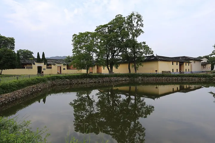
Photo adjustments
Full frame retained; proportionally resized and converted to WebP. No retouching or changes to the photographed subject. Card displays may crop the view.
Explore the region
About Ruijin
The modern history museum supplies the wider chronology through documents and objects. Plan these as separate precincts around the city, leaving time for transfers and for the smaller buildings within each.
The area was established as Xianghu town (象湖镇) under Yudu County in AD 202, during the Han dynasty. In 904, during the Tang dynasty, it was separated from Yudu County to form the Ruijin supervisory office; the name Ruijin is associated with gold found in the earth and regarded as auspicious.
The office was raised to a county in 953, under the Southern Tang, and subsequently belonged to Huichang prefecture under the Yuan dynasty, Ganzhou prefecture under the Ming, and the Ningdu sub-prefecture under the Qing, before coming under Jiangxi province in the early Republican period.
Ruijin lies in southern Jiangxi on the western foothills of the southern Wuyi Mountains (武夷山脉), at the eastern source of the Gan River (赣江) and the upper reaches of the Gong River (贡水), bordering Changting County in Fujian to the east, Huichang County to the south, Yudu County to the west, and Ningdu and Shicheng counties to the north. It is a longstanding centre of Hakka settlement and one of the birthplaces of Hakka culture.
What to look for
- Yeping’s First Soviet Congress meeting place and former communications offices.
- The Red Well and restored government premises in Shazhouba Village.
Background & history
Ruijin (Chinese: 瑞金; pinyin: Ruìjīn) is a county-level city of Ganzhou in the mountains bordering Fujian Province in the south-eastern part of Jiangxi Province. Formerly a county, Ruijin became a county-level city on May 18, 1994. It was an early center of Chinese communist activity and developed a reputation as cradle of the Chinese Communist Revolution. In the late-1920s, the Nationalists forced the Communists out of the Jinggang Mountains, sending them fleeing to Ruijin and the safety of its relative isolation in the rugged mountains along Jiangxi-Fujian border. In 1931, Mao Zedong founded the Chinese Soviet Republic (CSR) with Ruijin as its capital; it was called Ruijing by the CSR. The Communists withdrew in 1934 on the Long March after being surrounded again by the Nationalists. During the Cultural Revolution, the Ruijin Massacre in September and October 1968 killed over 300 people in the county. Ruijin is a popular destination for red tourism and ecotourism. It is a pilgrimage for Maoists from China and around the globe.
Excerpt from Wikipedia: Ruijin · Wikipedia contributors · CC BY-SA 4.0. Selected introductory sentences; formatting simplified. Background information, not current visitor-service advice.
Location & getting there
Getting to Ruijin
For a practical first stop, travel to the Central Revolutionary Base History Museum at 1 Longzhu Road, Xianghu. From there, arrange separate road transfers to Yeping Village east of the centre and Shazhouba’s Red Well precinct to the west.
Combine your visit
A suggested sequence linking the specific features of this visit.
-
Central Revolutionary Base History Museum中央革命根据地历史博物馆
Understand the sequence of events before visiting the original settings.
-
Yeping叶坪革命旧址群
See the first congress and provisional-government precinct.
-
Shazhouba Red Well沙洲坝红井景区
Continue to the government’s later village base.
This order is editorial. Confirm access and any transfers between stops; it does not establish a walking route, same-day connection or common admission ticket.
Find Ruijin overview
瑞金 · 赣州市
The pin marks the area, not the entrance.
More places nearby
Approximate straight-line distances between map pins, not travel distances.
Central Revolutionary Base History Museum 中央革命根据地历史博物馆
2 km awayRuijin’s Central Revolutionary Base History Museum presents the Chinese Soviet Republic through objects, documents and reconstructed scenes. The main exhibition follows its formation, governing experiments and eventual strategic…
View guide →Shazhouba Red Well Scenic Area 沙洲坝红井景区
2 km awayThe Red Well precinct preserves the village setting of the Chinese Soviet government’s second base in Ruijin. The well associated with Mao Zedong is the best-known feature, but the surrounding former offices make the visit more…
View guide →Yeping Revolutionary Site 叶坪革命旧址群
5 km awayYeping’s village buildings and memorial grounds mark the establishment of the Chinese Soviet Republic in 1931. The First National Soviet Congress meeting place anchors the visit, with former government and communications offices…
View guide →Sources & visit information
The sources below support the place-specific description and arrival information. Suggested combinations are editorial planning ideas; confirm current opening, entry arrangements and transport services for your date.
Visitor information adapted and edited from Wikipedia contributors, “Ruijin” · CC BY-SA 4.0. Source revision 1357004325.
Background paragraphs translated and condensed from Wikipedia contributors, "瑞金市", Chinese Wikipedia · CC BY-SA 4.0. Source revision 89578980.