


Get to know Ganzhou

Photo adjustments
Full frame retained; proportionally resized and converted to WebP. No retouching or changes to the photographed subject. Card displays may crop the view.
- Administrative area
- Prefecture-level city · 地级市
- Part of
- Jiangxi
- Chinese name
- 赣州市
- Local areas
- 18 local areas
Area & population
- Area in the source
- 39,379.64 km²
- Population · 2020 census
- 8,970,014
- Administrative seat
- Zhanggong District
Source: cited geographic source, as of the dates shown.
Tourism
Ganzhou is known as the "Orange Capital of the World" as well as the "Tungsten Capital of the World". The world's largest mechanical clock is located in Ganzhou called the Harmony Clock Tower, which was manufactured by UK-based clockmakers Smith of Derby Group. Though encircled by mountain scenery, other notable attractions in Jiangxi are Jingdezhen, Nanchang and Lushan among others. Some of the places of interest in Ganzhou include: Mount Jiulian (九连山), Longnan County Mei Pass, Dayu County Cuiwei Peak (翠微峰), Ningdu County Hakka architecture: Some of the most representative Hakka houses include Guanxi Xinwei (关西新围) of Longnan; Yanji Wei (燕翼围), of Yangcun (杨村); Longguang Wei (龙光围) of Taojiang (桃江); and Dongsheng Wei (东生围) of Anyuan, etc. Yugu Pavilion, Zhanggong District Bajing Pavilion, Zhanggong District Dongjin Bridge: Pontoon bridges have been constructed over the Zhang and Gong rivers since the Song dynasty. The Dongjin Bridge is one that can still be seen. It is 400 metres long, made up of wooden planks placed on around 100 wooden boats linked together with iron chains. Zao'er Alley (灶儿巷), Zhanggong District: An alley dating to at least the Song dynasty, with a length of 227.3 m.
Zhanggong has a city wall dating to the Song dynasty, as well as a number of pavilions and Buddhist and Taoist temples from the Ming and Qing. Altogether there are some 17 National Cultural Relic Protection Units in Ganzhou and 48 Provincial-level Cultural Relic Protection Units.
Explore Ganzhou
Core places to explore, with English and Chinese names.
Ganzhou 赣州
Tongtian Rock 通天岩
Ruijin 瑞金
Ganzhou Museum 赣州市博物馆
Ganzhou Ancient Floating Bridge 赣州古浮桥
Shazhouba Red Well Scenic Area 沙洲坝红井景区
Yeping Revolutionary Site 叶坪革命旧址群
Central Revolutionary Base History Museum 中央革命根据地历史博物馆
Luohanyan Scenic Area 罗汉岩
Yunshi Mountain 云石山
Ruijin Cradle of the Republic Historic Area 瑞金共和国摇篮景区
Anyuan Sanbai Mountain 安远三百山
Central Red Army Long March Departure Memorial Park 中央红军长征出发地纪念园
Yaxi Old Village 雅溪古村
Meiguan Ancient Road 梅关古道
Yashan Scenic Area 丫山
Cuiwei Peak 翠微峰
Sanbai Mountains 三百山
Shangbao Rice Terraces 上堡梯田
Yangmingshan National Forest Park 阳明山国家森林公园
Cradle of the Republic Scenic Area 共和国摇篮景区
Tongtianzhai Scenic Area 通天寨
Fushougou Museum 福寿沟博物馆
Ganzhou Ancient City Wall and Song Dynasty Quarter 赣州古城墙与宋代街区
Bajing Terrace 八境台
Yugu Terrace 郁孤台
Guanxi Hakka Walled Houses 关西围屋
Qianxin Resort Town 虔心小镇
Zhanggong District 章贡区
Nankang District 南康区
Ganxian District 赣县区
Xinfeng County 信丰县
Dayu County 大余县
Shangyou County 上犹县
Chongyi County 崇义县
Anyuan County 安远县
Dingnan County 定南县
Quannan County 全南县
Ningdu County 宁都县
Yudu County 于都县
Xingguo County 兴国县
Huichang County 会昌县
Xunwu County 寻乌县
Shicheng County 石城县
Ruijin 瑞金市
Longnan 龙南市
Places to explore around Ganzhou
Ganzhou Railway Station and its forecourt, photographed in 2016 · 赣州 Photograph date recorded by the source: 2016-06-17 07:42:21.Ganzhou赣州
Ganzhou’s old city occupies the meeting place of the Zhang and Gong rivers. Its surviving wall sections and the boat-supported bridge at Jianchun Gate show two different responses to that river setting: defence and everyday…
Read the place guide → Cliff inscription at Tongtianyan · 通天岩 Photograph date recorded by the source: 2002-10-04 10:11:04.
Tongtian Rock通天岩
Tongtian Rock is a Danxia landscape in Shuixi town, Ganzhou’s Zhanggong district. Grottoes and niches cut into the red rock hold Buddhist carvings, mostly from the Song period with some earlier Tang figures.
Read the place guide →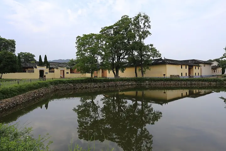 Historic buildings at Shazhouba in Ruijin, photographed in 2014 · 瑞金沙洲坝 Photograph date recorded by the source: 30 May 2014, 16:39:34.
Ruijin瑞金
Ruijin’s most distinctive visits lie in the villages and museum grounds associated with the Chinese Soviet Republic of the 1930s. Yeping preserves the setting of its first congress; the Red Well precinct at Shazhouba combines a…
Read the place guide →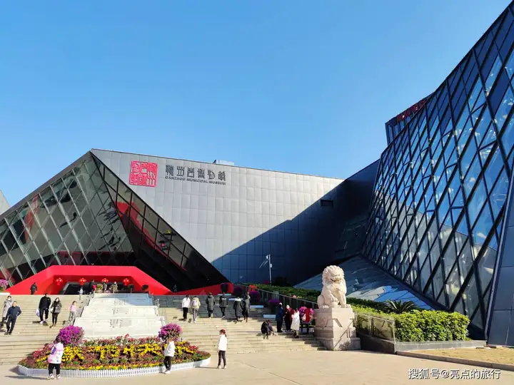 Ganzhou Museum · 赣州市博物馆
Ganzhou Museum赣州市博物馆
Ganzhou Museum brings local pottery and Hakka history together in the city’s newer urban area. The Qilizhen kiln displays are particularly revealing: green, pale blue-white, brown and black glazes show a ceramic tradition…
Read the place guide → Jianchunmen floating bridge across the Gong River, Ganzhou · 赣州建春门古浮桥 Photograph date recorded by the source: 18 April 2014, 15:10:02.
Ganzhou Ancient Floating Bridge赣州古浮桥
Ganzhou’s eastern floating bridge crosses the Gong River outside Jianchun Gate. Its wooden deck rests on connected boats, allowing the crossing to rise and fall with the river instead of standing on fixed stone piers. The bridge…
Read the place guide → Former central government offices at Shazhouba Revolutionary Site, Ruijin · 瑞金沙洲坝中央政府旧址建筑 Photograph date recorded by the source: 30 May 2014, 16:25:45.
Shazhouba Red Well Scenic Area沙洲坝红井景区
The Red Well precinct preserves the village setting of the Chinese Soviet government’s second base in Ruijin. The well associated with Mao Zedong is the best-known feature, but the surrounding former offices make the visit more…
Read the place guide →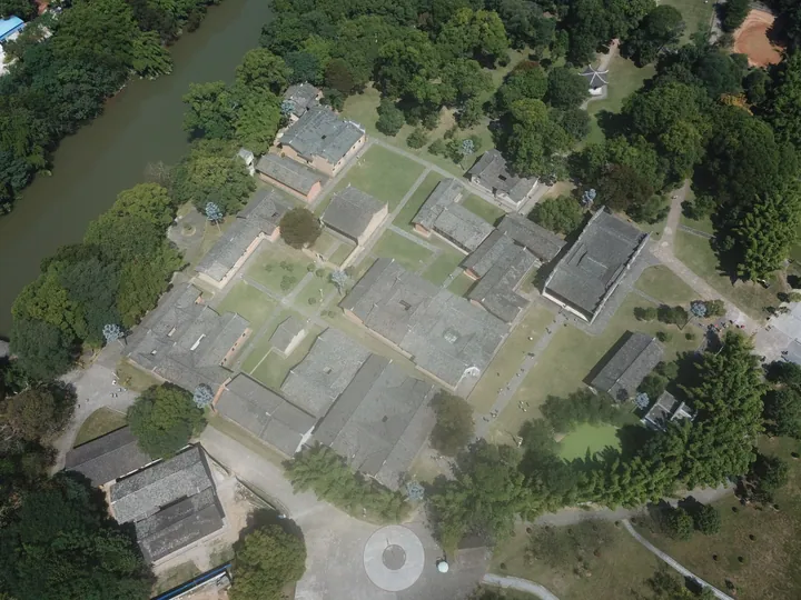 An aerial view of the Yeping revolutionary site: a large complex of grey-tiled single-storey halls and courtyards laid out among lawns and mature trees, with paths, a circular paved plaza with a monument at the bottom, a river and further houses along the upper left and a dirt bank at the upper right.
Yeping Revolutionary Site叶坪革命旧址群
Yeping’s village buildings and memorial grounds mark the establishment of the Chinese Soviet Republic in 1931. The First National Soviet Congress meeting place anchors the visit, with former government and communications offices…
Read the place guide → Central Revolutionary Base History Museum · 中央革命根据地历史博物馆
Central Revolutionary Base History Museum中央革命根据地历史博物馆
Ruijin’s Central Revolutionary Base History Museum presents the Chinese Soviet Republic through objects, documents and reconstructed scenes. The main exhibition follows its formation, governing experiments and eventual strategic…
Read the place guide → AI illustration · AI 示意图(仅供参考,非该地点实拍)
Luohanyan Scenic Area罗汉岩
Luohanyan is a Danxia landscape northeast of Ruijin, where steep red-rock forms rise above wooded valleys. Candle Peak is a striking freestanding pillar near the entrance. Farther along the visitor paths, Crescent Moon Lake…
Read the place guide → Rock outcrop inscribed "长征第一山" ("First Hill of the Long March") at Yunshi Mountain, Ruijin · 瑞金云石山“长征第一山”摩崖石刻 Source-recorded photograph date: 23 August 2010 (original upload date).
Yunshi Mountain云石山
Yunshi Mountain is a small, steep-sided limestone hill west of Ruijin, remembered as a departure place of the Long March. A stone path passes through two defensive gateways to Yunshan Temple, a modest Hakka-style courtyard…
Read the place guide → Ruijin Cradle of the Republic Historic Area (瑞金共和国摇篮景区), Ruijin. Photograph: "瑞金中央革命根据地纪念馆 (12733634133)".
Ruijin Cradle of the Republic Historic Area瑞金共和国摇篮景区
Ruijin's Cradle of the Republic area brings together sites associated with the Chinese Soviet Republic of the 1930s.
Read the place guide → Anyuan Sanbai Mountain (安远三百山), Anyuan County. Photograph: "Mount Sanbai, source of the Dongjiang River".
Anyuan Sanbai Mountain安远三百山
Sanbai Mountain is a forested mountain area in southeastern Anyuan associated with the headwaters of the Dongjiang River.
Read the place guide → The commemorative monument at the Memorial Garden for the Long March Starting Point of the Central Red Army, Yudu County · 于都县中央红军长征出发地纪念园纪念雕塑 Source-recorded photograph date: 2014-05-30 11:05:59.
Central Red Army Long March Departure Memorial Park中央红军长征出发地纪念园
The memorial park for the departure point of the Central Red Army's Long March (中央红军长征出发地纪念园) stands on the bank of the Yudu River in Yudu County, southern Jiangxi, at the ferry landing from which the march began in October 1934.
Read the place guide →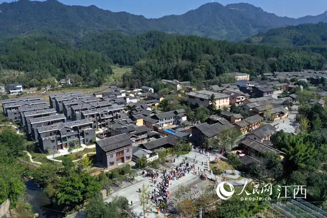 Yaxi Old Village · 雅溪古村
Yaxi Old Village雅溪古村
Yaxi (雅溪古村) is a Hakka village on the south-eastern side of Longyuanba town in Quannan County, in the far south of Jiangxi, built around two surviving walled enclosure houses.
Read the place guide → The stone gate tower of Meiguan Pass on the ancient post road, Dayu County · 大余县梅关古驿道关楼 Source-recorded photograph date: 2014-01-12 13:57:42.
Meiguan Ancient Road梅关古道
The Meiguan old road (梅关古道) is a cobbled Tang-dynasty post road that climbs to the pass on Meiling in Dayu County, southern Jiangxi, at the point where the province meets Guangdong.
Read the place guide →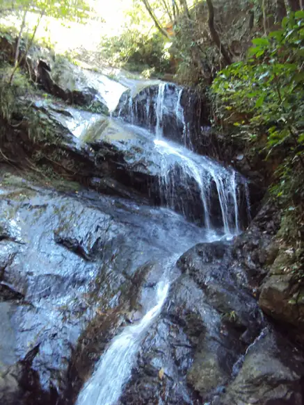 Yashan Scenic Area · 丫山
Yashan Scenic Area丫山
Yashan (丫山) is a forested hill scenic area about 9.5 kilometres from the county town of Dayu in southern Jiangxi, combining a waterfall gorge, an old temple and rural leisure development.
Read the place guide →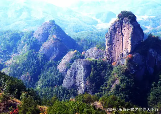 Cuiwei Peak · 翠微峰
Cuiwei Peak翠微峰
4A mountain area in Ningdu, southeastern Jiangxi, where the Nine Masters of Yitang lived after the Ming fell, with a summit pavilion and a 1949 battle site.
Read the place guide →Sanbai Mountains (三百山), Anyuan County. Photograph: "Mount Sanbai, source of the Dongjiang River".Sanbai Mountains三百山
Forested range in Anyuan County, Ganzhou, Jiangxi, at the source of the Dong River that supplies Hong Kong, with a crater lake, waterfalls and plank roads.
Read the place guide →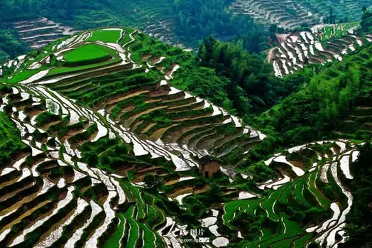 Shangbao Rice Terraces · 上堡梯田
Shangbao Rice Terraces上堡梯田
The Shangbao terraces (上堡梯田) are a system of hillside rice terraces in Shangbao Township in the west of Chongyi County, southern Jiangxi, on the border with Hunan.
Read the place guide →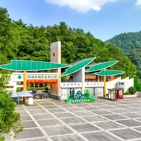 Yangmingshan National Forest Park · 阳明山国家森林公园
Yangmingshan National Forest Park阳明山国家森林公园
Yangmingshan National Forest Park (阳明山国家森林公园) is a forested upland in Chongyi County, southern Jiangxi, rising to the peak of Yangling at 1,259.5 metres.
Read the place guide →Cradle of the Republic Scenic Area (共和国摇篮景区), Ruijin. Photograph: "瑞金中央革命根据地纪念馆 (12733634133)".Cradle of the Republic Scenic Area共和国摇篮景区
The Cradle of the Republic scenic area (共和国摇篮景区) in Ruijin, southern Jiangxi, groups four separate sites where the Chinese Soviet Republic's central institutions were based in the early 1930s.
Read the place guide → Tongtianzhai Scenic Area · 通天寨
Tongtianzhai Scenic Area通天寨
Tongtianzhai (通天寨) is a Danxia massif in the villages of Dashe and Qianjiang, about five kilometres south-east of the county town of Shicheng in south-eastern Jiangxi, rising to 601.7 metres above sea level.
Read the place guide → Fushougou Museum · 福寿沟博物馆
Fushougou Museum福寿沟博物馆
The Fushougou Museum (福寿沟博物馆) in Zhanggong District, Ganzhou, is built over an excavated stretch of the city's Northern Song drainage system, which still carries waste water and storm water beneath the old town.
Read the place guide → AI illustration · AI 示意图(仅供参考,非该地点实拍)
Ganzhou Ancient City Wall and Song Dynasty Quarter赣州古城墙与宋代街区
The Ganzhou city wall (赣州古城墙) is a brick-faced rampart running along the Zhang and Gong rivers through the old core of Zhanggong District in Ganzhou, Jiangxi, and it forms the edge of the old-town quarter that the district promotes as its Song city.
Read the place guide → Bajing Pavilion viewed across the park pond, Ganzhou · 赣州八境台,隔水塘眺望 Source-recorded photograph date: 06/09/2007.
Bajing Terrace八境台
Three-storey tower on Ganzhou's Song city wall above the meeting of the Zhang and Gong rivers, named for the eight views seen from its top.
Read the place guide → Yugu Terrace (Yugu Terrace), a multi-storey pavilion in Zhanggong District, Ganzhou · 赣州市章贡区郁孤台 Source-recorded photograph date: 2026-05-03 17:15:09.
Yugu Terrace郁孤台
Hilltop pavilion tower over old Ganzhou, first recorded in the Tang, rebuilt in 1984 and famous from a Xin Qiji poem.
Read the place guide →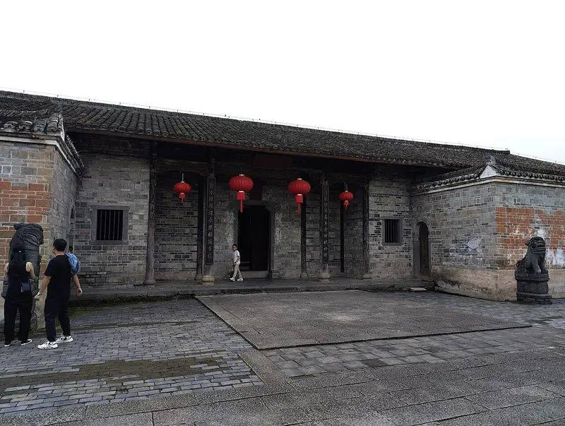 Guanxi Hakka Walled Houses (关西围屋), Longnan. Photograph: "Guanxi Xinwei inside the wall 2023-05-13 05".
Guanxi Hakka Walled Houses关西围屋
Guanxi Weiwu (关西围屋) is a group of Hakka walled dwellings at Guanxi Town in Longnan, southern Jiangxi, built around the fortified rectangular compound known as Guanxi Xinwei.
Read the place guide → Qianxin Resort Town · 虔心小镇
Qianxin Resort Town虔心小镇
Qianxin Xiaozhen (虔心小镇) is a tea-and-forest estate turned resort at Dongkeng Village in Lintang Township, Longnan, southern Jiangxi, on the north-eastern flank of the Jiulianshan national nature reserve and national forest park.
Read the place guide →Local life & food
Ganzhou local specialties
赣州市特色美食 · 13 specialties to discover
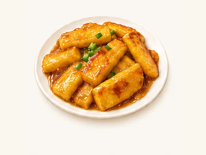 Huangyuan golden rice cakes 黄元米果AI dish illustration / AI 菜品示意图
The cakes are dense and chewy, with a different bite from ordinary cooked rice. Thin slices pick up seasoning well.
Source ↗Read the dish guide → Shicheng taro dumplings 石城芋饺AI dish illustration / AI 菜品示意图
A smooth, soft wrapper surrounds a more strongly seasoned filling. The contrast differs from an ordinary flour dumpling.
Source ↗Read the dish guide →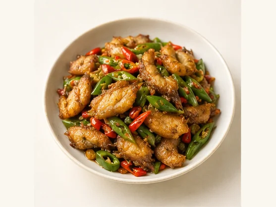 Gannan vinegar-chilli fish 赣南小炒鱼AI dish illustration / AI 菜品示意图
The signature contrast is tender fish against a sharp, savoury sauce. Chilli gives heat while vinegar provides a separate sourness. A dark sauce need not be sweet, and choosing less chilli does not remove the vinegar character.
Source ↗Read the dish guide → Ningdu three-cup chicken 宁都三杯鸡AI illustration · AI 示意图
The result is aromatic, savory and glossy, with a rich reduced sauce. Chicken bones contribute flavor but require careful eating.
Source ↗Read the dish guide → Ruijin beef soup 瑞金牛肉汤AI dish illustration · AI 菜品示意图
Tender beef and a savory liquid make the main impression, with pepper or chili adjusted to the particular version. It differs from a noodle bowl because beef and broth lead.
Source ↗Read the dish guide →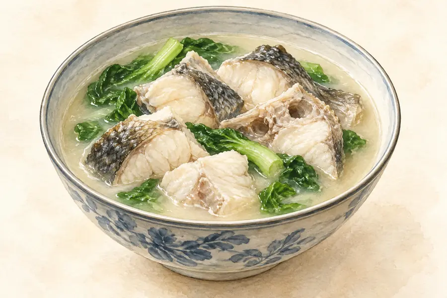 Xingguo Steamed Fish with Rice Meal 兴国米粉鱼AI illustration · AI 示意图(仅供参考,非实拍)
Xingguo Steamed Fish with Rice Meal (兴国米粉鱼) is a traditional dish of Xingguo County (兴国县), Jiangxi: thin slices of grass carp, coated in flour and steamed in a round bamboo steamer under a paste of chilli, ginger and sesame.
Read the dish guide → Yudu Fried Rice-Flour Crisps 于都烧卷子AI illustration · AI 示意图(仅供参考,非实拍)
Yudu Fried Rice-Flour Crisps (于都烧卷子) are thin, golden slices of spiced rice-flour dough fried in oil, a snack that the Yudu (于都) county government in Ganzhou (赣州), Jiangxi, calls the county's most distinctive traditional snack.
Read the dish guide → Nan'an Pressed Duck 南安板鸭AI illustration · AI 示意图(仅供参考,非实拍)
Nan'an Pressed Duck (南安板鸭) is a salted, sun-dried flat duck from Dayu County (大余县) in Ganzhou (赣州), in the far south-west of Jiangxi. Nan'an (南安) is the county's old name, and the county government still sits in Nan'an town.
Read the dish guide →All dish names · 全部菜名 (13)
- Huangyuan golden rice cakes · 黄元米果
- Shicheng taro dumplings · 石城芋饺
- Gannan vinegar-chilli fish · 赣南小炒鱼
- Ningdu three-cup chicken · 宁都三杯鸡
- Ruijin beef soup · 瑞金牛肉汤
- Xingguo Steamed Fish with Rice Meal · 兴国米粉鱼
- Yudu Fried Rice-Flour Crisps · 于都烧卷子
- Nan'an Pressed Duck · 南安板鸭
- Anyuan pork-and-offal rice noodles · 安远三鲜粉
- Xinfeng Radish Dumplings · 信丰萝卜饺
- Huichang Dried Tofu · 会昌豆干
- Dingnan Sour Wine Duck · 定南酸酒鸭
- Xunwu Stuffed Tofu · 寻乌酿豆腐
More dishes from across Jiangxi are in the Jiangxi food guide.
Counties & districts in Ganzhou
18 areas belong directly to Ganzhou.
18 areas
Zhanggong District 章贡区
Zhanggong District (simplified Chinese: 章贡区; traditional Chinese: 章貢區; pinyin: Zhānggòng Qū) is the administrative center of the prefecture-level city of Ganzhou in the south of Jiangxi Province, China.
Explore the area →DistrictNankang District 南康区
Nankang is a district of the city of Ganzhou in southern Jiangxi province. It was a county-level city until November 2013, when the State Council made it a district of Ganzhou.
Explore the area →DistrictGanxian District 赣县区
Ganxian District (simplified Chinese: 赣县区; traditional Chinese: 贛縣區; pinyin: Gànxiàn Qū) is a district in the municipal region of Ganzhou, Jiangxi Province.
Explore the area →CountyXinfeng County 信丰县
Xinfeng County (simplified Chinese: 信丰县; traditional Chinese: 信豐縣; pinyin: Xìnfēng Xiàn) is a county under the jurisdiction of the prefecture-level city of Ganzhou, in the far south of Jiangxi province…
Explore the area →Show fewer areas
Dayu County 大余县
Dayu is a county in the west of the prefecture-level city of Ganzhou, in the southwest of Jiangxi Province, bordering Guangdong Province to the south. It is known for The Capital of Tungsten.
Explore the area →CountyShangyou County 上犹县
Shangyou County (simplified Chinese: 上犹县; traditional Chinese: 上猶縣; pinyin: Shàngyóu Xiàn) is a county in the southwest of Jiangxi province, bordering Hunan province to the west.
Explore the area →CountyChongyi County 崇义县
Chongyi County (simplified Chinese: 崇义县; traditional Chinese: 崇義縣; pinyin: Chóngyì Xiàn) is a county under the jurisdiction of Ganzhou Municipality, in the southwest of Jiangxi province, China.
Explore the area →CountyAnyuan County 安远县
Anyuan County (simplified Chinese: 安远县; traditional Chinese: 安遠縣; pinyin: Ānyuǎn Xiàn) is a rural county in the prefecture-level city of Ganzhou, Jiangxi.
Explore the area →CountyDingnan County 定南县
Dingnan is a county under the jurisdiction of the prefecture-level city of Ganzhou, in the far south of Jiangxi province, China, bordering Guangdong province to the south.
Explore the area →CountyQuannan County 全南县
Quannan County (simplified Chinese: 全南县; traditional Chinese: 全南縣; pinyin: Quánnán Xiàn) is a county under the jurisdiction of Ganzhou City.
Explore the area →CountyNingdu County 宁都县
Ningdu County is a county in the southeast of Jiangxi province, People's Republic of China. It is the northernmost county-level division under the administration of the prefecture-level city of Ganzhou.
Explore the area →CountyYudu County 于都县
Yudu County is a county under the administration of the prefecture-level city of Ganzhou, located in the south of Jiangxi province, China. It is located in the east of Ganzhou City.
Explore the area →CountyXingguo County 兴国县
Xingguo County (simplified Chinese: 兴国县; traditional Chinese: 興國縣; pinyin: Xīngguó Xiàn) is a county in south central Jiangxi province, People's Republic of China.
Explore the area →CountyHuichang County 会昌县
Huichang County (simplified Chinese: 会昌县; traditional Chinese: 會昌縣; pinyin: Huìchāng Xiàn) is a county, under the jurisdiction of Ganzhou, in the south of Jiangxi province, People's Republic of China.
Explore the area →CountyXunwu County 寻乌县
Xunwu County (simplified Chinese: 寻乌县; traditional Chinese: 尋烏縣; pinyin: Xúnwū Xiàn) is a county in the far south of Jiangxi province, People's Republic of China, bordering the provinces of Fujian to the east…
Explore the area →CountyShicheng County 石城县
Shicheng County is a county in the southeast of Jiangxi province, People's Republic of China, bordering Fujian province to the east.
Explore the area →County-level cityRuijin 瑞金市
Ruijin is a county-level city of Ganzhou in the mountains bordering Fujian Province in the south-eastern part of Jiangxi Province. Formerly a county, Ruijin became a county-level city on May 18, 1994.
Explore the area →County-level cityLongnan 龙南市
Longnan (simplified Chinese: 龙南; traditional Chinese: 龍南; pinyin: Lóngnán) is a county-level city under the jurisdiction of Ganzhou Municipality, in the far southwest of Jiangxi province, China, bordering…
Explore the area →No areas match this name.
Plan your visit
Getting there
Search for 赣州市 in a map app to find stations and your accommodation.
Where to stay →Build your route
Ganzhou and Tongtian Rock are about 10 km apart in a straight line. The linked place guides have entrance and visit details.
Continue with Jiangxi →More in Jiangxi
Sources & geographic information
Administrative names and parent areas: Official geographic directory · Reference date 2026-09-06.
Background text adapted from Ganzhou — Wikipedia contributors, under CC BY-SA 4.0. Text has been shortened and reorganized; source revision 1367655042.
Photo: Ganzhou · Zhangzhugang · CC BY-SA 4.0. Full frame retained; proportionally resized and converted to WebP. No retouching or changes to the photographed subject. Card displays may crop the view.

Photo: Tongtian Rock · Sino Yu · CC BY-SA 4.0. Full frame retained; proportionally resized and converted to WebP. No retouching or changes to the photographed subject. Card displays may crop the view.

Photo: Ruijin · Zhangzhugang · CC BY-SA 3.0. Full frame retained; proportionally resized and converted to WebP. No retouching or changes to the photographed subject. Card displays may crop the view.

Photo: Ganzhou Museum · Source photographer · License not provided. EXIF orientation normalized; resized without changing aspect ratio; converted to WebP. No subject edits.
Photo: Ganzhou Ancient Floating Bridge · Underbar dk · Underbar dk — Ganzhou_Pontoon_Bridge.jpg — CC BY-SA 4.0 · CC BY-SA 4.0. The exact downloaded source bytes are separately retained and hashed. Prepared JPEG is proportionally reduced to a maximum 720-pixel long edge; full frame retained, no subject alteration. Final website rendition: full frame retained, proportionally resized to at most 720 pixels and converted to WebP. No additional retouching or subject alteration. Card displays may crop the view.

Photo: Shazhouba Red Well Scenic Area · Zhangzhugang · Zhangzhugang — Ruijin_Shazhouba_Geming_Jiuzhi_2014.05.30_16-25-45.jpg — CC BY-SA 3.0 · CC BY-SA 3.0. Full frame retained; proportionally resized and converted to WebP. No retouching or changes to the photographed subject. Card displays may crop the view.

Photo: Yeping Revolutionary Site · Zhangzhugang · CC BY-SA 4.0. Full frame retained; proportionally resized and converted to WebP. No retouching or changes to the photographed subject. Card displays may crop the view.

Photo: Central Revolutionary Base History Museum · Source photographer · License not provided. EXIF orientation normalized; resized without changing aspect ratio; converted to WebP. No subject edits.
Photo: Yunshi Mountain · wanghongliu · CC BY-SA 3.0. Full frame retained; proportionally resized and converted to WebP. No retouching or changes to the photographed subject. Card displays may crop the view.

Photo: Ruijin Cradle of the Republic Historic Area · 郭 敏 · CC BY 2.0. Full frame retained; EXIF orientation normalized, proportionally resized to at most 800 pixels and converted to WebP. No generated pixels or subject changes. Cards may crop the display.

Photo: Anyuan Sanbai Mountain · Underbar dk · CC BY-SA 4.0. Full frame retained; EXIF orientation normalized, proportionally resized to at most 800 pixels and converted to WebP. No generated pixels or subject changes. Cards may crop the display.

Photo: Central Red Army Long March Departure Memorial Park · Zhangzhugang · CC BY-SA 3.0. Full frame retained; proportionally resized and converted to WebP. No retouching or changes to the photographed subject. Card displays may crop the view.

Photo: Yaxi Old Village · Source photographer · License not provided. EXIF orientation normalized; resized without changing aspect ratio; converted to WebP. No subject edits.
Photo: Meiguan Ancient Road · Zhangzhugang · CC BY-SA 3.0. Full frame retained; proportionally resized and converted to WebP. No retouching or changes to the photographed subject. Card displays may crop the view.

Photo: Yashan Scenic Area · Source photographer · License not provided. EXIF orientation normalized; resized without changing aspect ratio; converted to WebP. No subject edits.
Photo: Cuiwei Peak · Source photographer · License not provided. EXIF orientation normalized; resized without changing aspect ratio; converted to WebP. No subject edits.
Photo: Sanbai Mountains · Underbar dk · CC BY-SA 4.0. Full frame retained; EXIF orientation normalized, proportionally resized to at most 800 pixels and converted to WebP. No generated pixels or subject changes. Cards may crop the display.
Photo: Shangbao Rice Terraces · Source photographer · License not provided. EXIF orientation normalized; resized without changing aspect ratio; converted to WebP. No subject edits.
Photo: Yangmingshan National Forest Park · Source photographer · License not provided. EXIF orientation normalized; resized without changing aspect ratio; converted to WebP. No subject edits.
Photo: Cradle of the Republic Scenic Area · 郭 敏 · CC BY 2.0. Full frame retained; EXIF orientation normalized, proportionally resized to at most 800 pixels and converted to WebP. No generated pixels or subject changes. Cards may crop the display.
Photo: Tongtianzhai Scenic Area · Sino Yu · CC BY-SA 4.0. EXIF orientation normalized; resized without changing aspect ratio; converted to WebP. No subject edits.

Photo: Fushougou Museum · Source photographer · License not provided. EXIF orientation normalized; resized without changing aspect ratio; converted to WebP. No subject edits.
Photo: Bajing Terrace · Liangxiao · Public domain. Full frame retained; proportionally resized and converted to WebP. No retouching or changes to the photographed subject. Card displays may crop the view.

Photo: Yugu Terrace · BMSBridge · CC BY-SA 4.0. Full frame retained; proportionally resized and converted to WebP. No retouching or changes to the photographed subject. Card displays may crop the view.

Photo: Guanxi Hakka Walled Houses · Sino Yu · CC BY-SA 4.0. Full frame retained; EXIF orientation normalized, proportionally resized to at most 800 pixels and converted to WebP. No generated pixels or subject changes. Cards may crop the display.

Photo: Qianxin Resort Town · Source photographer · License not provided. EXIF orientation normalized; resized without changing aspect ratio; converted to WebP. No subject edits.
Map data © OpenStreetMap contributors. Pins mark approximate centres, not entrances or boundaries.