

Explore the region
About Cheshi Ancient Road Hiking Section
The road is 200 kilometres long and more than 2,000 years old. In the Western Han period the Cheshi state was split into a nearer and a farther kingdom on opposite sides of the mountains, and trade, messages and seasonal movement between them gradually formed the route that carries the name. In the Tang dynasty the Anxi Protectorate at Jiaohe and the Beiting Protectorate in the farther Cheshi kingdom were connected by it, saving more than 170 kilometres against the detour through Urumqi, and merchants were still using it in the Qing dynasty.
The newspaper feature records stone gates, chasms, waterfalls and grassland along the way, and remains including ancient fort sites, beacon towers and tombs. At Sandaoqiao, a place called Jingou (金沟) keeps a large stone roller from earlier gold working, and stone wall footings on the grass beside the bridge are the remains of an old inn. Between Wudaoqiao and Liudaoqiao the route passes Shimenzi (石门子), a defile one metre wide and 40 metres long, and Liudaoqiao (六道桥) itself is a natural bridge more than 20 metres above a mountain stream.
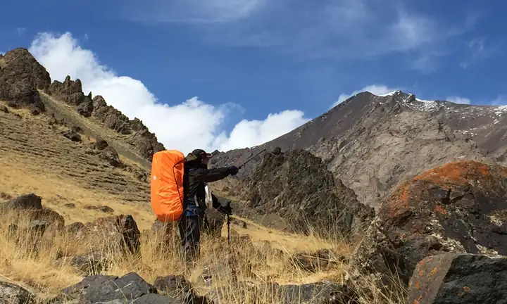
No cited source designates any particular section of the road as an official or regular walking route, and none gives a boundary for the Che Shi Ancient Road scenic area in Quanzijie township. The herder interviewed by China News Service in 2023 describes hikers with backpacks on the road between May and October.
What to look for
- Shimenzi (石门子), the defile between Wudaoqiao and Liudaoqiao that is one metre wide and 40 metres long
- Liudaoqiao (六道桥), a natural bridge more than 20 metres above the stream in the valley
- The stone roller and the old-inn wall footings at Sandaoqiao, at the place called Jingou (金沟)
- The remains along the route described as ancient fort sites, beacon towers and tombs
Location & getting there
Getting to Cheshi Ancient Road Hiking Section
Follow the currently permitted path and arrange the return before setting out. Do not infer trail continuity or difficulty from the route name alone.
- Search for 车师古道正规徒步段 with 昌吉回族自治州 and 吉木萨尔县.

Find Cheshi Ancient Road Hiking Section
车师古道正规徒步段 · 吉木萨尔县
No reliable map pin yet: search by the Chinese name.
Sources & visit information
The linked sources support the identity and background described in this introduction. Opening hours, admission, activity availability and exact arrival arrangements have not been comprehensively checked. Confirm current visitor information with the venue; the original catalogue locality and editorial review flag are retained.
Image credits & notes (1)
- Cheshi Ancient Road Hiking Section · 车师古道正规徒步段Photo: 2bulu.comResized for the web; the photo itself has not been edited.