
Northwest · Destination guide
Xinjiang 新疆
Xinjiang's scale makes a regional choice essential. The Altai, Tianshan and Kunlun mountains frame vast basins, with oases, grasslands and forested uplands creating sharply different environments. Urumqi is the capital, but Ili, Altay, Turpan and Kashgar are separate journeys rather than nearby extensions of one city. Choose the landscape and cultural setting that interest you most before assembling an itinerary. A coherent regional route allows time for local food, neighbourhood life and the individual communities that would disappear in a hurried attempt to cover the whole autonomous region.

Xinjiang at a glance
- Population
- 26,390,000Year-end resident population, entire provincial-level administrative area · 2025Source ↗
- Income per person
- 32,881Mean annual disposable income per person, all residents · 2025 · CNYSource ↗
- Languages & dialects
- Mandarin/Chinese and Uyghur (维吾尔语), alongside other community languages.Source ↗
- Geography
- Altai, Tianshan and Kunlun mountain systems frame the Junggar and Tarim basins; settlements cluster in oases.Source ↗
- Elevation
- Some basins lie below sea level: Ayding Lake depression is about 154 m below sea level, contrasting with high mountain regions.The depression figure describes a specific surveyed low point, not the lake surface or a regional average.Source ↗
- Main gateway
- UrumqiAutonomous region
Map & places
Explore Xinjiang
Browse places and sight guides by category, or choose a city below the map to see its location and boundary.
Browse 170 places; 99 have map coordinates. Some listings cover overlapping areas.
Colour-coded categories. Pins are approximate; confirm entrances and routes in Amap or Apple Maps before setting off. District boundaries: © OpenStreetMap contributors (ODbL), simplified, for travel reference only.
Cities, counties & districts in Xinjiang
Select a city name to show its boundaries on the map above; its details remain available separately.
Top sights in Xinjiang
- 1Trip.Best #1
Sayram Lake赛里木湖
Sayram Lake sits in a high mountain basin in Bortala, surrounded by grassland and ridges. Different shores offer different combinations of open water, meadow, wetland and woodland, so a circuit is more varied than one viewpoint…
- 2Trip.Best #2
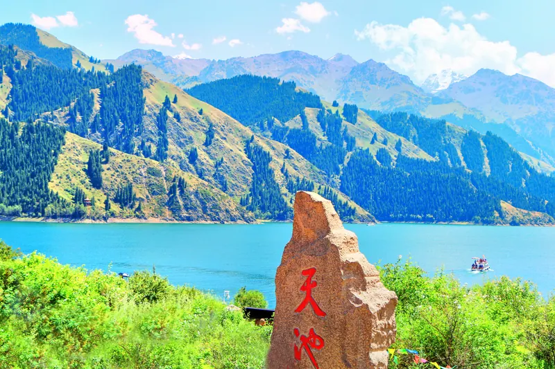
Tianshan Tianchi天山天池
Tianchi lies in the Bogda section of the Tianshan, where dark conifer slopes frame an alpine lake.
- 3Trip.Best #3
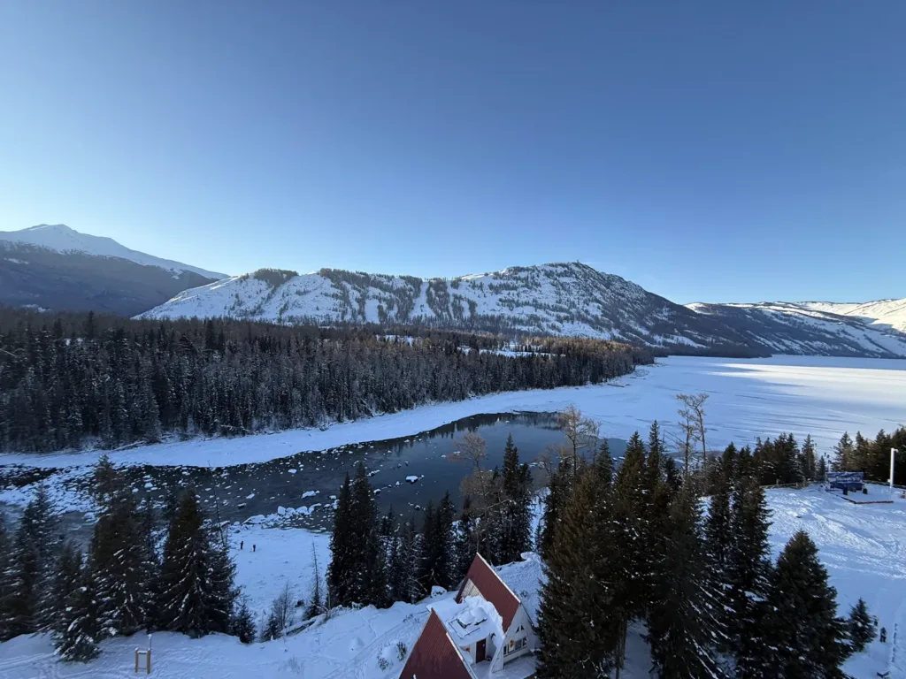
Kanas Lake喀纳斯湖
Kanas Lake is a glacial mountain lake in the Altai Mountains where a lakeshore walk, the misty bends of the Three Bays, and the high view from Guanyutai each reveal a different scale of the same protected landscape. Its appeal is not a single photo stop: plan the transfer and return first, then choose the viewpoints that fit the day's operating conditions.
- 4Trip.Best #4
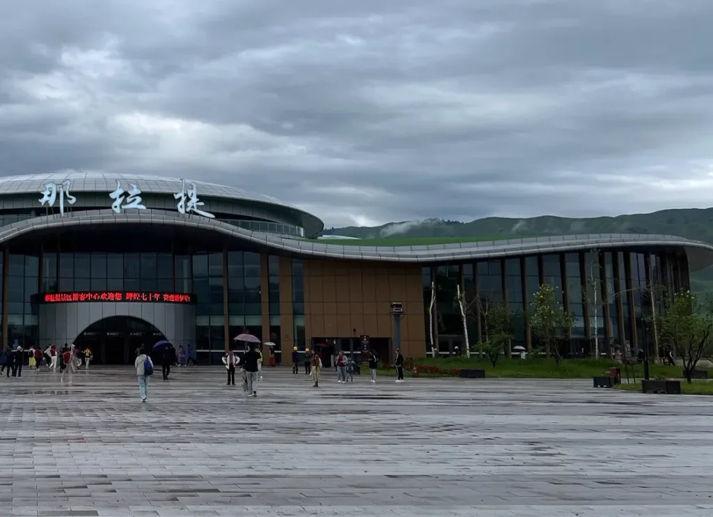
Nalati Grassland那拉提草原
A large, managed scenic area in Xinyuan County where high Tianshan meadows, spruce valleys and seasonal pastoral landscapes are experienced through separate sightseeing routes—not a town-centre attraction.
- 5Trip.Best #5
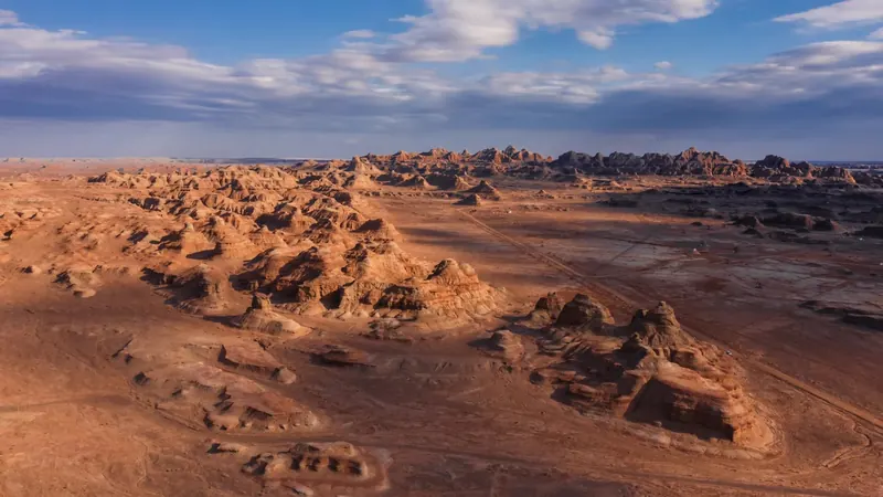
World Mystery Town世界魔鬼城
World Devil City (世界魔鬼城), also called Wuerhe Wind City (乌尔禾风城), is a wind-eroded yardang landscape in Wuerhe District (乌尔禾区), Karamay (克拉玛依市), Xinjiang.
- 6Trip.Best #6
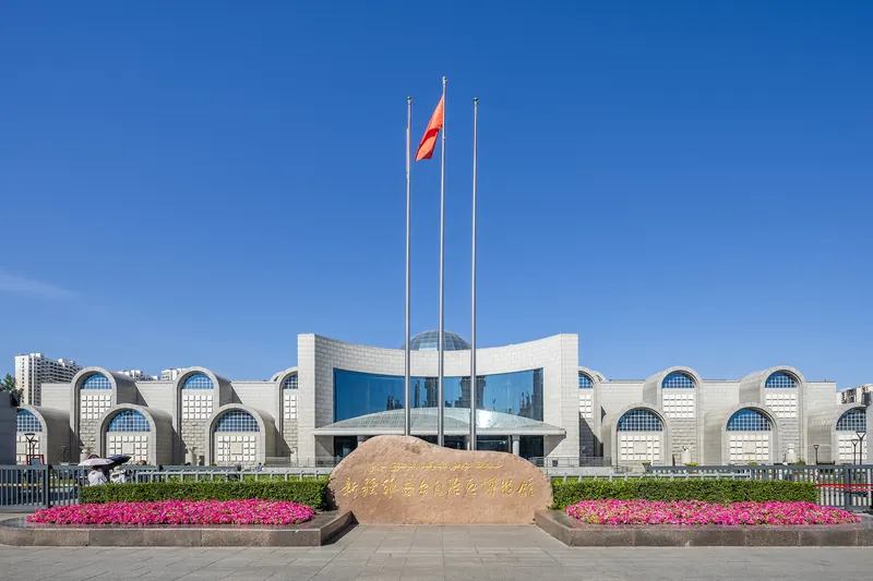
The Xinjiang Museum新疆维吾尔自治区博物馆
Xinjiang Museum brings together archaeology from the region’s deserts, oases and mountain corridors.
- 7Trip.Best #7
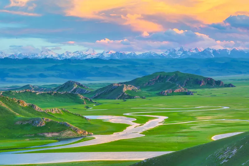
Bayanbulak Grassland Scenic Area巴音布鲁克草原景区
Bayanbulak is a high mountain basin where open grassland surrounds the winding Kaidu River and wetland habitats. The Nine Bends viewpoint is especially associated with late-day light, while the Swan Home area introduces the…
- 8Trip.Best #8
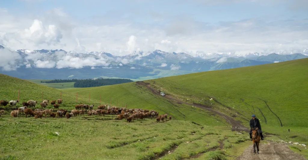
Kalajun Grassland喀拉峻
Kalajun is a large alpine landscape in Tekes County, where rolling meadows, snow peaks, forests and river-cut valleys make a more layered visit than a single “grassland viewpoint.” It is part of the Kalajun–Kuerdening component of the Xinjiang Tianshan World Heritage property, while the wider tourism area contains several distinct zones.
- 9Trip.Best #9
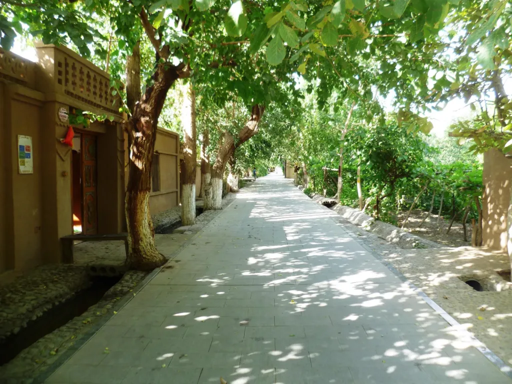
Grape Valley葡萄沟
Grape Valley is an irrigated vineyard corridor beneath Turpan’s Flaming Mountains, where shaded vines, water channels and a spread-out scenic area make the contrast between oasis and red desert visible on foot.
- 10Trip.Best #10
International Grand Bazaar新疆国际大巴扎
A contemporary market-and-cultural complex in Ürümqi’s Erdaoqiao area, worth visiting for its brickwork, tower, regional goods, food spaces and occasional stage performances—not as a preserved ancient bazaar.


Xinjiang travel guides
In-depth articles and itineraries for planning your time in Xinjiang.
SOON
Itinerary
3 days in Xinjiang: a first-timer's itinerary
How to split your days between the essential sights, neighbourhood walks and a relaxed evening, with transport tips between each stop.
Coming soonSOON
Food
Where to eat in Xinjiang
Local dishes worth seeking out, how to order and what to expect.
Coming soonSOON
Transport
Getting around Xinjiang by metro and taxi
Cards, apps and station tips for moving between sights.
Coming soonSOON
Day trip
Day trips from Xinjiang
Plan the outward and return journeys and visiting time before mapping out your day.
Coming soonSOON
Neighbourhoods
Neighbourhood walks in Xinjiang
Discover everyday Xinjiang on a slow walk.
Coming soonSOON
Seasons
Choosing a season for Xinjiang
See how visiting changes from spring to winter.
Coming soonLocal dishes
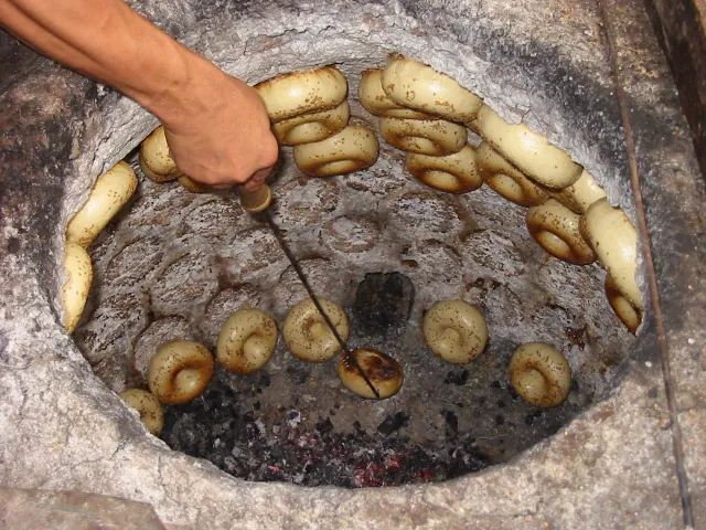
Nang bread馕
Nang (馕) is a family of round baked breads rather than one fixed recipe. In Kashgar it belongs to everyday local food culture, with flour-based dough, a patterned surface, and versions that may be plain, sesame-topped, oily, sweet, meat-filled or made with dried fruit.
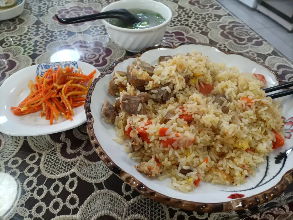
Polo rice抓饭
Polo rice (抓饭, often called polo in Uyghur and zhuafan in Chinese) is a Xinjiang rice dish built around rice, lamb, carrots, onion and oil, with raisins or dried apricots in some versions. Kashgar’s local-government food guide includes 抓饭 among the city’s foods, and a 2026 Peking University event used the specific name “Kashgar lamb polo rice.”
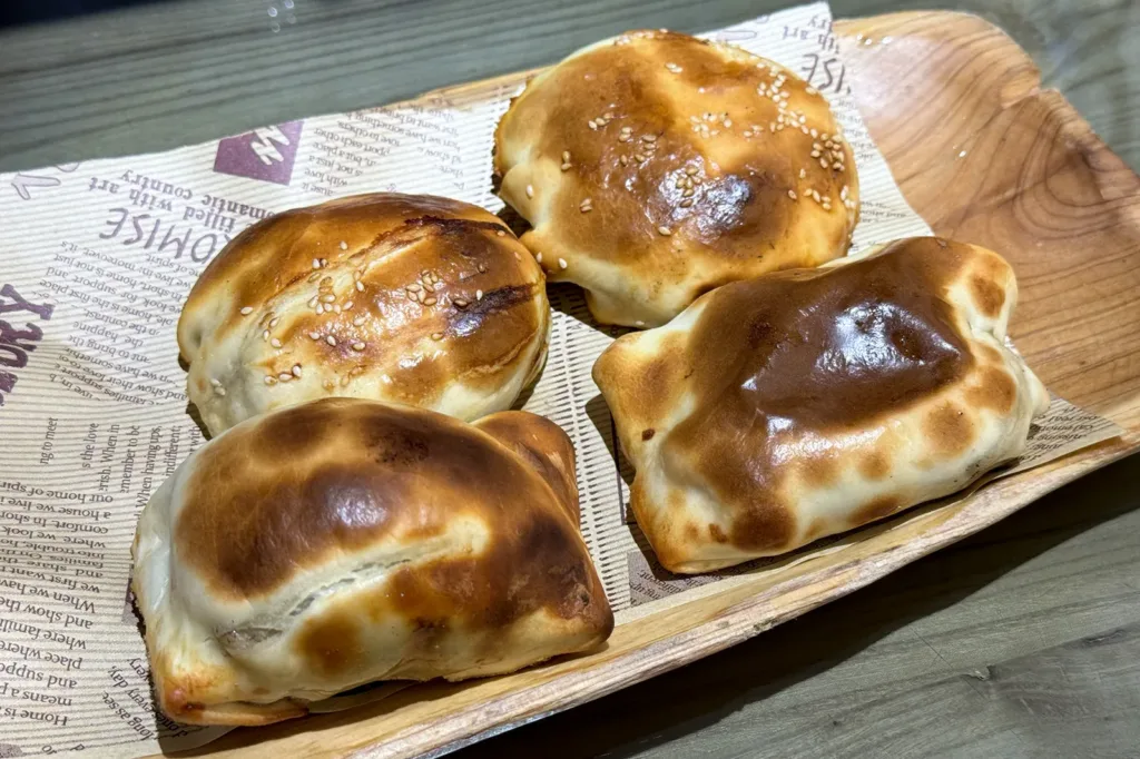
Baked samsa buns烤包子
Baked samsa buns (烤包子), also called 撒木萨 in a Kashgar municipal food guide, are thin-wrapped lamb pastries baked against the wall of a nang pit. In Kashgar they are part of everyday food culture rather than a dish tied to one canonical shop: expect a crisp shell, juicy lamb, sweet onion and warm spice.
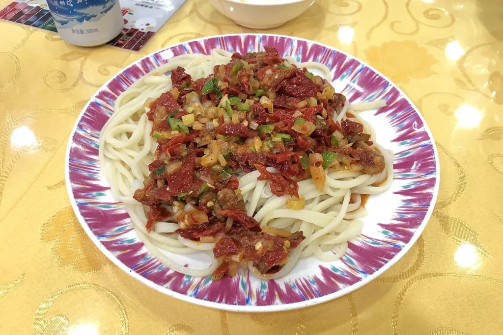
Tokxun mixed noodles托克逊拌面
Hand-pulled wheat noodles from the Tokxun tradition are served with a separately stir-fried meat-and-vegetable topping, combining springy strands with a glossy, savoury sauce.
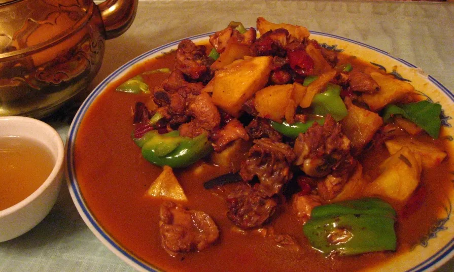
Big-plate chicken大盘鸡
Dapanji (大盘鸡) is a generous Xinjiang chicken-and-potato dish, usually served with peppers and broad wheat noodles; in Ürümqi it is a regional specialty to share, with recipes that vary by kitchen.

Kashgar pigeon soup noodles喀什鸽子汤面
AI dish illustration · AI 菜品示意图Kashgar pigeon soup noodles is a Kashgar-associated set built around a whole slow-simmered pigeon, its clear orange-gold broth, and a bowl of fine noodles. Its appeal is the composed sequence of bird, soup, and noodles—and the fact that shops keep their own variations—rather than a single fixed recipe.
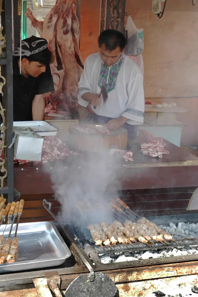
Xinjiang lamb skewers烤羊肉串
Xinjiang lamb skewers (烤羊肉串) are a regional grilled-lamb snack: small pieces of lamb, rendered fat and cumin-led seasoning, served hot and varied by kitchen.

Peppery braised lamb trotters胡辣羊蹄
AI illustration · AI 示意图The texture is sticky, gelatinous and chewy rather than meaty like a lamb chop. Spices contribute a strong savory fragrance.
Arrival, stays & getting around
Arrive, stay & get around Xinjiang
Check the precise airport or station name on the ticket before arranging the final transfer to your hotel.
Your arrival gateway
Urumqi 乌鲁木齐
This Xinjiang entry uses Urumqi as its selected gateway city. It does not describe transport coverage across the entire region.
Airports
Urumqi Tianshan International Airport
乌鲁木齐天山国际机场
The airport formerly called Diwopu now uses the Tianshan name. Follow directions for the current northern terminal area.
Railway stations
Urumqi Railway Station
乌鲁木齐站
Main modern rail gateway in the western city; commonly called the high-speed railway station locally.
Urumqi South Railway Station
乌鲁木齐南站
The separate older southern rail gateway. Use the exact station shown by 12306.
Metro & city transport
Urumqi Metro
乌鲁木齐地铁
The metro serves a north–south urban corridor. For the current airport terminal, follow the signed metro-transfer arrangement rather than old terminal directions.
Bus stations
Tianshan Airport bus services
天山国际机场机场巴士
Airport buses form part of the current terminal’s ground-transport center. Confirm the city route and stop in the airport’s transport information.
More about getting around
Urumqi is a major air and rail gateway, with separate regional connections toward Turpan and Kashgar. Distances make selective flights or longer rail journeys worth comparing. Allow extra time for security checks, carry your passport, and verify access before arranging remote road extensions.
Transport reference review: 2026-09-06. Consult the operator for current services and timetables.
Accommodation
Stay in Xinjiang
Choose an Urumqi base with straightforward station or airport access for a connecting itinerary. In Turpan, consider how your hotel handles excursions to scattered sites. For Kashgar, balance proximity to the historic centre with vehicle access, and confirm the property can process your booking details.
Find hotels on Trip.com ↗Change your destination, dates and guests on Trip.com.
Weather
Urumqi weather
Loading the current-hour forecast…
Turpan and desert areas can become intensely hot in summer, while uplands remain much cooler. Winters are cold, particularly in the north, and mountain access is seasonal. Pack for the actual route and elevations, with enough flexibility to change outdoor plans during extreme conditions.
Seasons & when to go
Check the city forecast ↗Bookings & travel
Make your travel plans a reality
Stays
Find hotels in Xinjiang on Trip.com
Change your destination, dates and guests on Trip.com.
Find hotels on Trip.comWhy I recommend Trip.comFlights
Search for flights on Trip.com
Change your destination, dates and passengers on Trip.com.
Search flights on Trip.comWhy I recommend Trip.comTrains
Search for trains on Trip.com
Change your stations, travel date and passengers on Trip.com.
Search trains on Trip.comWhy I recommend Trip.comCars
Browse car rentals on Trip.com
Change your pick-up location and rental dates on Trip.com.
Open Trip.comWhy I recommend Trip.comActivities
Explore activities on Trip.com
Change your destination, dates and participants on Trip.com.
Explore activities on Trip.comWhy I recommend Trip.comFood
Explore local food guides
Browse local dishes, breakfast ideas, snacks and regional cooking.
Explore food guidesWhat to eat in XinjiangWritten by China Revealed · Editorially updated 2026-09-07
Maps & transport note
Transport suggestions on this site may be inaccurate or out of date. Confirm your exact destination, visitor entrance, current route and return connection before setting off.
For travel in mainland China, we recommend Amap (高德地图) or Apple Maps (苹果地图) for checking local directions. Both support English. Keep the Chinese place name and full address handy, and compare the result with the venue or transport operator’s latest information.
Do not rely on Google Maps or another overseas map as your only route check for mainland China. Map coverage and features vary, and no app can guarantee an error-free route.
Amap’s English interface depends on the app version and store region. Apple Maps follows your device or app language settings; some place labels may remain in Chinese. Apple states that its map service in China uses AutoNavi (Amap). Features differ in Hong Kong, Macao and Taiwan.
Information checked 2026-09-07.Photo credits (6)
- Tianshan Tianchi Lake · XinjiangPhoto: Caitriana Nicholson from 北京 ~ Beijing, 中国 ~ China · CC BY-SA 2.0
- Sayram Lake (赛里木湖)Photo: Trip.com
- Tianshan Tianchi (天山天池)Photo: Trip.com
- World Mystery Town (世界魔鬼城)Photo: Trip.com
- The Xinjiang Museum (新疆维吾尔自治区博物馆)Photo: Trip.com
- Bayanbulak Grassland Scenic Area (巴音布鲁克草原景区)Photo: Trip.com
Sources & useful links (58)
- China National Tourist Office: Xinjiang
- China National Tourist Office: Turpan
- Xinjiang Culture and Tourism: regional food essays
- Xinjiang Transport Department: Kashgar-themed service-area report
- Xinjiang Culture and Tourism: Tianshan holiday travel report
- Ministry of Culture and Tourism: Ili route
- Gaochang district government: cultural resources
- Xinjiang Transport Department: 2026 holiday travel guide
- UNESCO: Xinjiang Tianshan
- UK FCDO: China regional travel advice
- Ministry of Culture and Tourism: Altay visitor context
- Xinjiang — population background
- Xinjiang — languages background
- Xinjiang — geography background
- Xinjiang — elevation background
- Xinjiang — Urumqi map reference
- Xinjiang — Turpan map reference
- Xinjiang — Jiaohe ruins map reference
- Xinjiang — Gaochang ruins map reference
- Xinjiang — Kashgar map reference
- Xinjiang — Tianchi / Heavenly Lake map reference
- Xinjiang — Kanas Lake map reference
- Xinjiang — Hemu, Xinjiang map reference
- Xinjiang — Sayram Lake map reference
- Xinjiang — Id Kah Mosque map reference
- Xinjiang — Emin Minaret map reference
- Xinjiang — Bezeklik Thousand Buddha Caves map reference
- Xinjiang — Kizil Caves map reference
- Xinjiang — Subashi Temple map reference
- Xinjiang — Karakul (China) map reference
- Xinjiang — Tashkurgan map reference
- Xinjiang — Xinjiang Regional Museum map reference
- Xinjiang — Kumtag Desert map reference
- Xinjiang — Kumtag Desert (Shanshan) map reference
- Xinjiang attraction ranking source
- Xinjiang specialty reference — wlt.xinjiang.gov.cn
- Xinjiang specialty reference — wlt.xinjiang.gov.cn
- Xinjiang specialty reference — wlt.xinjiang.gov.cn
- Xinjiang specialty reference — wlt.xinjiang.gov.cn
- Destination food reference — ydyl.gansu.gov.cn
- Kashgar city government: market foods and seasoned roasted goose eggs
- Kizilsu tourism: dingding fried noodles
- Xinjiang: marentang confectionery identity
- 白沙湖景区(185团) — place reference
- 泽普金湖杨景区 — place reference
- 喀什古城景区 — place reference
- 帕米尔旅游区 — place reference
- 乌鲁木齐天山大峡谷 — place reference
- 阿拉尔三五九旅文化旅游区 — place reference
- 天山托木尔旅游区 — place reference
- 新疆油塔子 — local food reference
- 塔城奶酪包 — local food reference
- Local food reference: 天山雪莲牛排
- Local food reference: 烤全羊
- Local food reference: 油香
- Local food reference: 蒙古奶茶
- Local food reference: 马奶酒
- Local food reference: 萨其马