

Explore the region
About Kongur Tiube Peak Highway Viewpoint
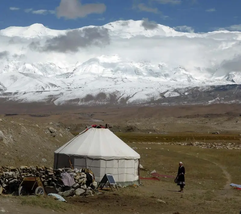
No page cited here names a viewpoint, a viewing platform or a designated viewing place for the peak. What the prefecture's account establishes is that the China–Pakistan international highway runs past the foot of the two mountains and that the ice formations on the peaks can be clearly seen from that road. The same account groups Muztagh Ata, which it calls 冰山之父 (father of ice mountains), with Kongur, which it calls 冰山公主 (princess of ice mountains), and with Kongur's sister peak Kongur Tiubie as three peaks 并称为“昆仑三雄”, the three heroes of Kunlun. It says all three are bases of modern glaciers, and that from 中巴公路 the small ice caps on the summits, the glaciers hanging on the slopes, the ice waterfalls and the valley glaciers in the gullies are all clearly visible. It places both Kongur and Kongur Tiubie on the Pamir in the south-west of Akto County, and records that Kongur Tiubie stands shoulder to shoulder with Kongur, the two 并称“姊妹峰”, called sister peaks.
The county's gazetteer entry for Bulunkou township gives the township's setting as the Pamir, south-west of the Akto county town, and records its high mountains and valleys as alternating between 3,000 and 4,500 metres. It lists Karakul Lake and Baisha Mountain among the township's main tourist sites. That entry describes the township, not the viewpoint: no cited page places the highway viewpoint inside Bulunkou township, and this record does not assert that it is.
What to look for
- The small ice caps on the summits of the three 昆仑三雄 peaks, together with the glaciers hanging on their slopes, the ice waterfalls and the valley glaciers in the gullies below — all of which the prefecture's account says are clearly visible from 中巴公路.
- Kongur Tiubie standing shoulder to shoulder with Kongur, the pair the prefecture's account calls 姊妹峰, sister peaks.
- The grouping the prefecture's account makes of Muztagh Ata as 冰山之父, Kongur as 冰山公主, and Kongur Tiubie beside them as the 昆仑三雄.
- The China–Pakistan international highway itself, which the prefecture's account says runs 从山脚下穿行而过 — through the foot of the two mountains.
Location & getting there
Getting to Kongur Tiube Peak Highway Viewpoint
Check weather, trail access and the last return service. A mountain or forest area is not one entrance, and a map’s central pin may be far from the trailhead.
- Search for 公格尔九别峰公路观景 with 克孜勒苏柯尔克孜自治州 and 阿克陶县.
Find Kongur Tiube Peak Highway Viewpoint
公格尔九别峰公路观景 · 阿克陶县
No reliable map pin yet: search by the Chinese name.
Sources & visit information
The linked sources support the identity and background described in this introduction. Opening hours, admission, activity availability and exact arrival arrangements have not been comprehensively checked. Confirm current visitor information with the venue; the original catalogue locality and editorial review flag are retained.
Image credits & notes (1)
- Kongur Tiube Peak Highway Viewpoint · 公格尔九别峰公路观景Photo: cn.tripadvisor.comResized for the web; the photo itself has not been edited.