


Get to know Huoshan County
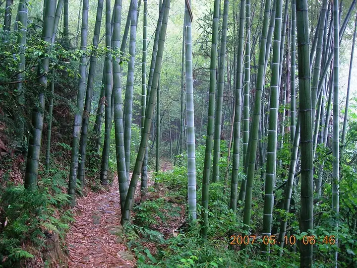
Photo adjustments
Full frame retained; resized proportionally to a maximum dimension of 960 pixels and converted to WebP quality 88. No crop, retouch, generated elements, or subject alteration. Final website rendition: full frame retained, proportionally resized to at most 720 pixels and converted to WebP. No additional retouching or subject alteration. Card displays may crop the view.
- Administrative area
- County · 县
- Part of
- Lu'an
- Chinese name
- 霍山县
- Local areas
- County guide
Area & population
- Area in the source
- 2,043.00 km²
- Population · 2018
- 370,000
Source: cited geographic source, as of the dates shown.
Setting and landscape
The county is mostly mountains, with the ground tilting from southeast to northwest. Its highest point is Baimajian (白马尖), the main peak of the Dabie Mountains at 1,777 metres, about 90 kilometres from the county town. The county government notes that blue-throated bee-eaters breed here, and that Siberian cranes (白鹤) and scaly-sided mergansers (中华秋沙鸭) spend the winter in the county.
History
A county was set up here in 106 BC under the Han, and the name Huoshan dates from the Sui. After the Tang it was renamed several times; under the Song it was reduced to a town, and the Ming restored the county in the Hongzhi reign. The county government lists four revolutionary firsts for Anhui: the Zhufo'an militia uprising (诸佛庵民团起义), the province's first regular Red Army unit (the 33rd Division of the 11th Red Army), its first county-level soviet government, and the first county to come wholly under Red control.
What to see
Fuziling Reservoir (佛子岭水库) sits on the eastern source of the Pi River, 17 kilometres south of the county town. Built between January 1952 and November 1954 as part of the Huai River works, it was the first large water project of the People's Republic and is officially called "New China's first dam". Its concrete multiple-arch dam is a national protected site.
The county has six 4A scenic areas: Fuziling, Nanyue Mountain (南岳山), the Dabie Mountains main peak, Tongluozhai (铜锣寨), the Grand Canyon (大峡谷) and Liuwan Qingxia (六万情峡). The county government also names a hot-spring town at Doushahe (陡沙河) in Shangtushi (上土市).
Food and local products
Huoshan Huangya (霍山黄芽) is a yellow tea grown mainly around Dahuaping (大化坪镇); the county government says it has been a tribute tea since the Tang. Huoshan dendrobium (霍山石斛), a medicinal orchid, is included in the 2020 Chinese Pharmacopoeia. Manshuihe lily bulbs (漫水河百合) and Yingjia liquor (迎驾贡酒) are also national geographical-indication products. Moso bamboo covers 357,000 mu, and the forestry ministry named Huoshan a "home of bamboo".
Getting oriented
Huoshan borders the urban districts of Lu'an to the north, Jinzhai (金寨县) to the west, Shucheng (舒城县) to the east, Yuexi (岳西县) in Anqing to the south, and Yingshan (英山县) in Hubei to the southwest. It lies about 120 kilometres from Hefei (合肥). The Jinan–Guangzhou (济广高速) and Hexiang (和襄高速) expressways cross the county.
Highlights
- Fuziling Reservoir 佛子岭水库: Built 1952–1954; officially called New China's first dam, with a multiple-arch dam listed as a national protected site.
- Baimajian 白马尖: Main peak of the Dabie Mountains, 1,777 metres.
- Tongluozhai 铜锣寨: One of the county's six 4A scenic areas.
- Huoshan Huangya 霍山黄芽: Yellow tea grown mainly around Dahuaping; a tribute tea since the Tang.
- Huoshan dendrobium 霍山石斛: Medicinal orchid included in the 2020 Chinese Pharmacopoeia.
Sources for this guide
霍山概况_霍山县人民政府 · Huoshan County People's Government
霍山县 - 维基百科,自由的百科全书 · Wikipedia (Chinese) · CC BY-SA 4.0
佛子岭水库 - 维基百科,自由的百科全书 · Wikipedia (Chinese) · CC BY-SA 4.0
白马尖 - 维基百科,自由的百科全书 · Wikipedia (Chinese) · CC BY-SA 4.0
Original English written from the listed sources and checked sentence by sentence against quoted extracts by a separate reviewer. Updated 2026-09-25.
Explore Huoshan County
Core places to explore, with English and Chinese names.
Places to explore around Huoshan County
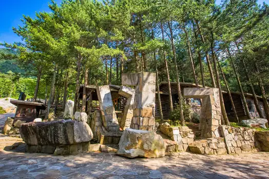 Baimajian Peak · 白马尖
Baimajian Peak白马尖
Baimajian in Huoshan County is the highest peak of the Dabie Mountains, rising to 1,777 metres.
Read the place guide → Foziling Reservoir · 佛子岭水库
Foziling Reservoir佛子岭水库
Reservoir in Huoshan County's Dabie Mountains, behind the 1954 multiple-arch dam officially called 'the first dam in New China', now a national protected site.
Read the place guide → Tongluozhai Scenic Area · 铜锣寨
Tongluozhai Scenic Area铜锣寨
Tongluozhai in Huoshan County combines a 1,096-metre peak, pines growing among rocks and the cliffs and waterfalls of Tongluo Grand Canyon.
Read the place guide →Plan your visit
Getting there
Huoshan County is about 55 km in a straight line from central Lu'an. Search for 霍山县 in a map app to find stations and your accommodation.
Where to stay →Build your route
Baimajian Peak and Foziling Reservoir are both listed here. The linked place guides have entrance and visit details.
Continue with Lu'an →More in Lu'an
Sources & geographic information
Administrative names and parent areas: Official geographic directory · Reference date 2026-09-06.
Some facts checked against 霍山县 — Wikipedia contributors, CC BY-SA 4.0.
Some facts checked against 佛子岭水库 — Wikipedia contributors, CC BY-SA 4.0.
Some facts checked against 白马尖 — Wikipedia contributors, CC BY-SA 4.0.
Photo: Baimajian Peak · Source photographer · License not provided. EXIF orientation normalized; resized without changing aspect ratio; converted to WebP. No subject edits.
Photo: Foziling Reservoir · The original uploader was Lastman at Chinese Wikipedia . · CC BY-SA 3.0. EXIF orientation normalized; resized without changing aspect ratio; converted to WebP. No subject edits.

Photo: Tongluozhai Scenic Area · Source photographer · License not provided. EXIF orientation normalized; resized without changing aspect ratio; converted to WebP. No subject edits.
Map data © OpenStreetMap contributors. Pins mark approximate centres, not entrances or boundaries.