


Get to know Yu'an District
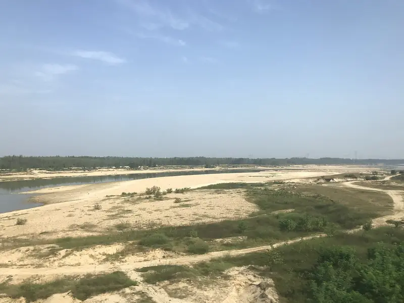
Photo adjustments
EXIF orientation normalized; resized without changing aspect ratio; converted to WebP. No subject edits.
- Administrative area
- District · 市辖区
- Part of
- Lu'an
- Chinese name
- 裕安区
- Local areas
- District guide
Area & population
- Population · 2017
- 905,000
Source: cited geographic source, as of the dates shown.
Setting and landscape
The land falls from south-west to north-east, and mountains, low ridges and river flats each cover about a third of the district. The hills are outliers of the Dabie range; the highest, Huangchaojian (黄巢尖), reaches only 583 metres. The district lies on the Yangtze–Huai watershed: Qingshan township (青山乡) and some villages of Chengnan (城南) drain to the Yangtze, and the rest to the Huai. The Old Pi River (老淠河), the main canal of the Pishihang irrigation system (淠史杭总干渠) and the East and West Ji rivers (汲河) cross it.
History
The district government records traces of Neolithic settlement and links the area with Gaoyao (皋陶), the legendary adviser to Shun and Yu. A Liu county (六县) was set up in 221 BC, and Ying Bu (英布), King of Huainan, made his capital here during the Chu–Han wars. In 121 BC Liu Qing (刘庆) became King of Liu'an. Later names were Shengtang county (盛唐县) under the Tang, Lu'an county under the Song and Lu'an prefecture under the Yuan, Ming and Qing. During the war against Japan the Anhui provincial government moved here for a time.
Yu'an was part of the Hubei–Henan–Anhui revolutionary base. The Dushan uprising (独山暴动) and the 48-day battle of Sujiabu (苏家埠) took place here, and the district counts 32 natives among the founding generals of the People's Republic. During the Land Revolution war the town of Dushan (独山镇) alone sent thousands of people to the Red Army and produced 16 major generals.
Food and local products
Yu'an is the original home of Lu'an Guapian tea (六安瓜片) and the main breeding area of the Wanxi white goose (皖西白鹅). Other local foods include white radish from sandy riverside soil, dried into shreds, air-dried mutton from household-raised goats, and dried purslane.
Highlights
- Dushan revolutionary sites 独山革命旧址群: Dushan town sent thousands of men to the Red Army and produced 16 major generals.
- Lu'an Guapian tea 六安瓜片: The district government names Yu'an as the tea's original home.
- Wanxi white goose 皖西白鹅: Yu'an is the main breeding area of this goose.
Sources for this guide
概述篇_六安市裕安区人民政府 · Yu'an District People's Government, Lu'an
历史篇_六安市裕安区人民政府 · Yu'an District People's Government, Lu'an
地理篇_六安市裕安区人民政府 · Yu'an District People's Government, Lu'an
人文篇_六安市裕安区人民政府 · Yu'an District People's Government, Lu'an
将军故里_六安市裕安区人民政府 · Yu'an District People's Government, Lu'an
裕安区 - 维基百科,自由的百科全书 · Wikipedia (Chinese) · CC BY-SA 4.0
Original English written from the listed sources and checked sentence by sentence against quoted extracts by a separate reviewer. Updated 2026-09-23.
Explore Yu'an District
Core places to explore, with English and Chinese names.
Places to explore around Yu'an District
 Dushan Revolutionary Sites ·
 Plan your visit
Getting there
Yu'an District is about 4 km in a straight line from central Lu'an. Search for 裕安区 in a map app to find stations and your accommodation.
Where to stay →Build your route
Start with Dushan Revolutionary Sites. The linked place guides have entrance and visit details.
Continue with Lu'an →More in Lu'an
Sources & geographic information
Administrative names and parent areas: Official geographic directory · Reference date 2026-09-06.
Some facts checked against 裕安区 — Wikipedia contributors, CC BY-SA 4.0.
Photo: Dushan Revolutionary Sites · Source photographer · License not provided. EXIF orientation normalized; resized without changing aspect ratio; converted to WebP. No subject edits.
Map data © OpenStreetMap contributors. Pins mark approximate centres, not entrances or boundaries.