


Get to know Hanshan District
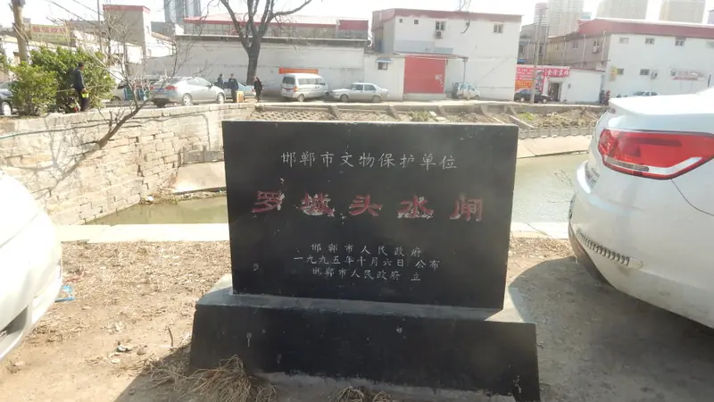
Photo adjustments
Full frame retained; EXIF orientation normalized, proportionally resized to at most 800 pixels and converted to WebP. No generated pixels or subject changes. Cards may crop the display.
- Administrative area
- District · 市辖区
- Part of
- Handan
- Chinese name
- 邯山区
- Local areas
- District guide
Area & population
- Area in the source
- 427.70 km²
- Population · 2020 census
- 837,419
Source: cited geographic source, as of the dates shown.
Setting and landscape
The district sits in the transition from the Taihang Mountains (太行山) to the North China Plain. Ground falls from about 305 metres on the western edge, with a high point of 498 metres, to about 50 metres in the east, through hills, sloping uplands, alluvial plain and low-lying land. Spring and autumn are short and winter and summer long, and summer brings about 60 per cent of the year's rain. Feixiang (肥乡区) and Cheng'an (成安县) lie to the east, Linzhang (临漳县) and the Jinan New Area (冀南新区) to the south, Fuxing (复兴区) to the west and Congtai (丛台区) to the north.
History
The district government describes the area as part of the Shang royal domain more than 3,000 years ago; in the Warring States period the area formed part of the Zhao capital and was an iron-smelting centre. Hanshan was liberated in October 1945 and became a district in October 1980. Matou (马头镇) joined in 1986, and when Handan County was abolished in 2016 Heshazhen town (河沙镇镇), Nanbao (南堡乡) and Daizhao (代召乡) were added.
The Beizhangzhuang tombs (北张庄墓群) of the Han became a national monument in 2019. Hebei provincial sites include the Warring States tomb of Yue Yi (乐毅墓) at Dalebao village in Daizhao, the Ming-dynasty Tongji Bridge (通济桥) at Zhangzhuangqiao village, and the 1945 headquarters of the Handan Uprising (邯郸起义指挥部旧址) in Matou.
What to see
The Jin-Ji-Lu-Yu Martyrs' Cemetery (晋冀鲁豫烈士陵园) on Lingyuan Road (陵园路), dating from 1946, is a provincial monument; inside it, the 1950 tomb of General Zuo Quan (左权将军墓) has been a national monument since 2019. The Jin-Ji-Lu-Yu Revolutionary Memorial Park (晋冀鲁豫革命纪念园) is rated a national 4A scenic area. Other sights the district lists include the Pinghan Campaign Memorial Hall (平汉战役纪念馆), the Handan Memories museum (邯郸往事纪念馆), Handan Ocean World (邯郸海洋世界), Zhuheyuan Country Park (渚河源郊野公园), Nanhu and Fuyang parks, and the large peach orchards of Nanbao. Xiaodi village (小堤村) was named a national key village for rural tourism in 2020.
Food and local products
The district's featured tourist products include Huangliangmeng millet (黄粱梦小米), Xiaodi rice noodles (小堤米线), Xiaodi old jujubes (小堤古枣), Zhaowang liquor (赵王酒), Hanxue foods (邯雪食品) and bamboo crafts.
Highlights
- Jin-Ji-Lu-Yu Martyrs' Cemetery 晋冀鲁豫烈士陵园: Cemetery from 1946 on Lingyuan Road; holds General Zuo Quan's tomb, a national monument since 2019.
- Tomb of Yue Yi 乐毅墓: Warring States tomb at Dalebao village, a Hebei provincial monument since 2008.
- Tongji Bridge 通济桥: Ming-dynasty bridge at Zhangzhuangqiao village, a Hebei provincial monument since 2008.
- Xiaodi village 小堤村: National key village for rural tourism (2020), known for rice noodles and old jujubes.
Sources for this guide
走进邯山-邯郸市邯山区人民政府 · Hanshan District People's Government, Handan
邯山区各级文物保护单位列表 - 维基百科,自由的百科全书 · Chinese Wikipedia · CC BY-SA 4.0
Original English written from the listed sources and checked sentence by sentence against quoted extracts by a separate reviewer. Updated 2026-09-24.
Explore Hanshan District
Core places to explore, with English and Chinese names.
Hanshan District 邯山区
Plan your visit
Getting there
Hanshan District covers the centre of Handan. Search for 邯山区 in a map app to find stations and your accommodation.
Where to stay →More in Handan
Sources & geographic information
Administrative names and parent areas: Official geographic directory · Reference date 2026-09-06.
Some facts checked against 邯山区各级文物保护单位列表 — Wikipedia contributors, CC BY-SA 4.0.
Map data © OpenStreetMap contributors. Pins mark approximate centres, not entrances or boundaries.