

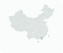
Get to know Barra/Manduco
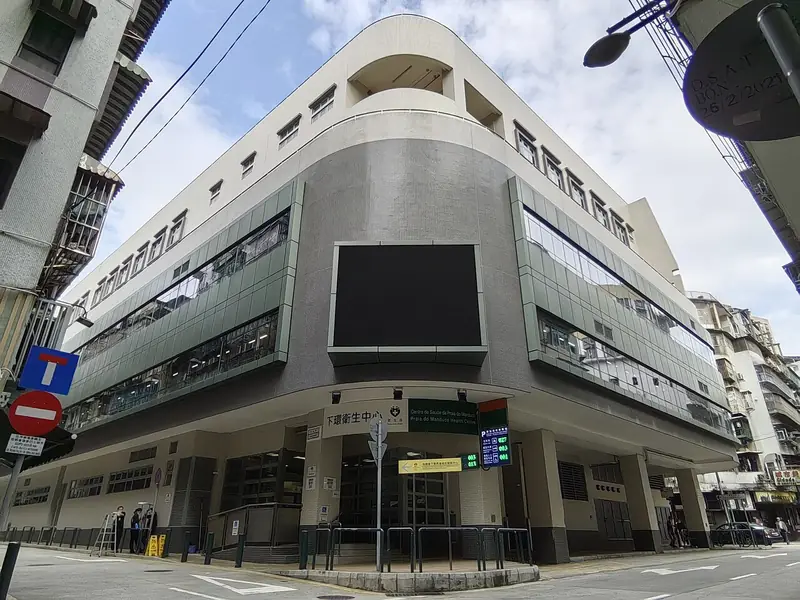
Photo adjustments
Full frame retained; EXIF orientation normalized, proportionally resized to at most 800 pixels and converted to WebP. No generated pixels or subject changes. Cards may crop the display.
- Administrative area
- Statistical area · 統計分區
- Part of
- Macau
- Chinese name
- 下環區
- Local areas
- Statistical area guide
Setting and landscape
Barra lies in the south-west of the peninsula, west of Penha Hill (西望洋山) and Barra Hill (媽閣山). Its Portuguese name means the narrow entrance to a harbour. A fishing village stood beside the temple until the area was developed in the late nineteenth century.
Rua da Praia do Manduco (下環街), one of Macau's oldest streets, began as the shore of a small bay. A 1948 map still marks a beach beside it as Praia do Manduco (蛤蟆灣, "Toad Bay"). Reclamation of the Inner Harbour in the late nineteenth century pushed the coast out to Rua do Almirante Sérgio (河邊新街) and left the old shore road as an inland street.
History
From the first years of the port, Rua da Praia do Manduco served as a trading centre, landing place and depot; the Portuguese first did business with Chinese traders along it, and before the Opium War British merchants stored smuggled opium in the area. It is now the district's main everyday shopping street, with more than five supermarkets and designated hawker areas along the road.
What to see
A-Ma Temple (媽閣廟), halfway up the western slope of Barra Hill, existed before the city of Macau; the name "Macao" is believed to come from "A-Ma-Gau", the Bay of A-Ma. Its Gate Pavilion, Memorial Arch, Prayer Hall, Hall of Benevolence, Hall of Guanyin and the Buddhist pavilion Zhengjiao Chanlin serve different deities in one complex. The Hall of Benevolence is thought to date from 1488, and the temple reached its present size in 1828. It was inscribed as part of the Historic Centre of Macau World Heritage Site in 2005.
Barra Square (媽閣廟前地) in front of the temple faces the Maritime Museum (澳門海事博物館), with two stone flagpoles before the museum. The square hosts dragon dances at New Year and opera staged for deities' birthdays (神功戲).
The former Moorish Barracks, built in 1874 on the slope of Barra Hill for an Indian regiment from Goa sent to reinforce Macau's police, is a neo-classical building with Mughal touches and four-metre verandas of pointed arches. It is now the headquarters of the Marine and Water Bureau.
Highlights
- A-Ma Temple 媽閣廟: Temple complex on Barra Hill whose Hall of Benevolence is thought to date from 1488; part of the Historic Centre of Macau.
- Barra Square 媽閣廟前地: Square before the temple, facing the Maritime Museum; used for New Year dragon dances and opera for deities' birthdays.
- Former Moorish Barracks 海事及水務局大樓: 1874 building for a Goan regiment, with pointed-arch verandas; now the Marine and Water Bureau headquarters.
- Rua da Praia do Manduco 下環街: One of Macau's oldest streets, a former shoreline turned inland by Inner Harbour reclamation.
Sources for this guide
A-Ma Temple (Barra Temple) - The Historic Centre of Macao · Cultural Affairs Bureau of the Macao SAR Government
Headquarters Building of the Marine and Water Bureau (Former Moorish Barracks) - The Historic Centre of Macao · Cultural Affairs Bureau of the Macao SAR Government
澳門行政區劃 - 維基百科,自由的百科全書 · Chinese Wikipedia · CC BY-SA 4.0
媽閣 - 維基百科,自由的百科全書 · Chinese Wikipedia · CC BY-SA 4.0
下環街 - 維基百科,自由的百科全書 · Chinese Wikipedia · CC BY-SA 4.0
Original English written from the listed sources and checked sentence by sentence against quoted extracts by a separate reviewer. Updated 2026-09-23.
Find Barra/Manduco
A reliable area-level map point is not available in the current sources.
Plan your visit
Getting there
Search for 下環區 in a map app to find stations and your accommodation.
Where to stay →More in Macau
Sources & geographic information
Administrative names and parent areas: Official geographic directory · Reference date 2026-09-06.
DSEC statistical-zone directory
MGTO: Strolling Through the Historic Centre of Macao
Some facts checked against 澳門行政區劃 — Wikipedia contributors, CC BY-SA 4.0.
Some facts checked against 媽閣 — Wikipedia contributors, CC BY-SA 4.0.
Some facts checked against 下環街 — Wikipedia contributors, CC BY-SA 4.0.
Map data © OpenStreetMap contributors. Pins mark approximate centres, not entrances or boundaries.