

Get to know Cotai

Photo adjustments
Full frame retained; proportionally resized and converted to WebP. No retouching or changes to the photographed subject. Card displays may crop the view.
- Administrative area
- Statistical area · 統計分區
- Part of
- Macau
- Chinese name
- 路氹填海區
- Local areas
- Statistical area guide
From causeway to resort district
The area began as open water between the two islands. The Estrada do Istmo (路氹連貫公路), a 2,250-metre sea-wall road linking Taipa and Coloane, was started in May 1963 and completed in June 1968. Once the road divided the channel, mangroves grew on its western side, while mudskippers filled the eastern mudflats and oyster farming developed there. Both sides were filled in from the 1990s, reclamation continued after the 1999 handover, and by 2005 the two islands were joined into one landmass.
The new land was first planned as a new town serving the nearby Concordia Industrial Park (聯生工業村). An economic downturn delayed that plan, and the demand for land that followed the opening of the gaming industry led to it being shelved. The Venetian Macao opened on 28 August 2007. To mark the handover, sculptures of the twelve Chinese zodiac animals were placed in the causeway's central divider in 1999.
What to see
Many hotels and casinos stand on Cotai, among them The Venetian Macao, City of Dreams, Galaxy Macau, Studio City, Wynn Palace, MGM Cotai, The Parisian Macao, The Londoner Macao and Grand Lisboa Palace. The Macau East Asian Games Dome (澳門東亞運動會體育館), nicknamed the Macau Egg, was one of the venues of the 2005 East Asian Games and is part of a Cotai sports complex that also holds a shooting centre, a bowling centre and a tennis school. The Macau University of Science and Technology (澳門科技大學) is here too, and its foundation's hospital opened in 2006. The Cotai Ecological Zone (路氹生態保護區) lies within the area as well.
Getting oriented
The Lotus Bridge (蓮花大橋), opened in March 2000, runs 1,756 metres from Cotai to the Macau port zone of the Hengqin (橫琴) crossing on the Zhuhai (珠海) side. The Taipa Line of the Macau Light Rapid Transit crosses Cotai with five stations, including Lotus and East Asian Games.
Highlights
- Estrada do Istmo 路氹連貫公路: The 1960s sea-wall road between Taipa and Coloane from which the reclamation grew; zodiac sculptures were added in 1999.
- Macau East Asian Games Dome 澳門東亞運動會體育館: Built as a venue for the 2005 East Asian Games; part of a sports complex.
- Lotus Bridge 蓮花大橋: Opened in March 2000; 1,756 metres long, linking Cotai with the Hengqin crossing.
Sources for this guide
Cotai - Wikipedia · Wikipedia (English) · CC BY-SA 4.0
路氹城 - 维基百科,自由的百科全书 · Wikipedia (Chinese) · CC BY-SA 4.0
路氹连贯公路 - 维基百科,自由的百科全书 · Wikipedia (Chinese) · CC BY-SA 4.0
莲花大桥 - 维基百科,自由的百科全书 · Wikipedia (Chinese) · CC BY-SA 4.0
Original English written from the listed sources and checked sentence by sentence against quoted extracts by a separate reviewer. Updated 2026-09-23.
Find Cotai
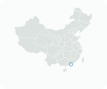
A reliable area-level map point is not available in the current sources.
Plan your visit
Getting there
Search for 路氹填海區 in a map app to find stations and your accommodation.
Where to stay →More in Macau
Sources & geographic information
Administrative names and parent areas: Official geographic directory · Reference date 2026-09-06.
DSEC statistical-zone directory
MGTO: MGM COTAI Art Collection
Macao Light Rapid Transit: LRT Lines
Some facts checked against Cotai — Wikipedia contributors, CC BY-SA 4.0.
Some facts checked against 路氹城 — Wikipedia contributors, CC BY-SA 4.0.
Some facts checked against 路氹连贯公路 — Wikipedia contributors, CC BY-SA 4.0.
Some facts checked against 莲花大桥 — Wikipedia contributors, CC BY-SA 4.0.
Map data © OpenStreetMap contributors. Pins mark approximate centres, not entrances or boundaries.