


Photo adjustments
Full frame retained; proportionally resized and converted to WebP. No retouching or changes to the photographed subject. Card displays may crop the view.
Explore the region
About Mount Guanzhai
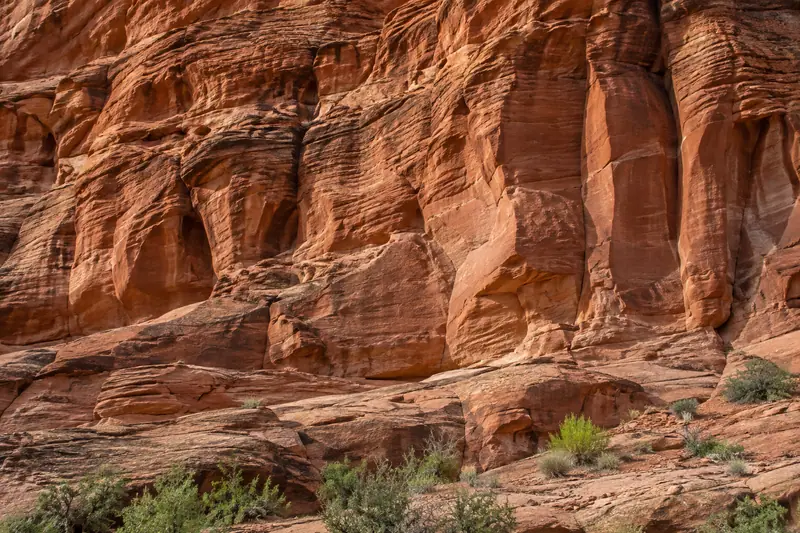
Rock pillars and steep isolated formations define its scenery.
The main peak is Wulao Peak, while the wider scenic area also includes Shimen Lake and Zhuanzhai. Select the specific sector you want to visit because the named mountain encompasses several separate touring areas.
Mount Guanzhai, formerly known as Dongtian Rock (东田石) and also called Lotus Mountain (莲花山), was named a top-ten scenic area of Fujian province in 1986 (福建省十佳风景区), designated a National Key Scenic Area (国家重点风景名胜区) in 1994, rated a national 4A tourist attraction (国家4A级旅游景区) in 2000, and shortlisted for the fifth group of National Geoparks (国家地质公园) in 2009.
The mountain lies about 1.5 kilometres east of Liancheng county town. Its main peak, Wulao Peak (五老峰), rises 661 metres above sea level, and a large rock partway up the slope is shaped like the head of a xiezhi (獬豸), a mythical creature, which gives the mountain its name. The wider scenic area covers 123 square kilometres and comprises nine touring sections, including Xiezhiguan (獬豸冠), Shimen Lake (石门湖), Zhu'anzhai (竹安寨), Jiulong Lake (九龙湖) and Qishizhai (旗石寨).
What to look for
- Pillars and isolated steep rocks define the mountain silhouette.
- Wulao Peak and Shimen Lake offer contrasting mountain and waterside sectors.
Location & getting there
Getting to Mount Guanzhai
Approach from Liancheng county town on the western side of the mountain area. Decide whether your visit focuses on the peak route or Shimen Lake before arranging the last leg.
- Confirm the visitor entrance and access to the named areas before departure.
Combine your visit
A suggested sequence through the named features described in the source.
-
Mountain rock-formations route
Pillars and isolated steep rocks define the mountain silhouette.
-
Shimen Lake sector
Wulao Peak and Shimen Lake offer contrasting mountain and waterside sectors.
The order is an editorial suggestion. Internal opening arrangements and transfers between sectors need checking; no walking duration or access entitlement is implied.
Find Mount Guanzhai
冠豸山 · 龙岩市
The pin marks the area, not the entrance.
More places nearby
Approximate straight-line distances between map pins, not travel distances.
Gutian Congress 古田会议会址
55 km awayThe Gutian conference site is a former Liao clan ancestral hall that also served as Shuguang Primary School. In December 1929, the Red Army meeting held here established principles of party control over the military. The…
View guide →Longyan Museum 龙岩市博物馆
75 km awayLongyan City Museum uses the rounded architectural language of Yongding’s tulou to introduce western Fujian. Its Hakka Homeland exhibition traces migration through documents, photographs, objects and reconstructed settings…
View guide →Dajin Lake 泰宁大金湖
116 km awayDajin Lake places red sandstone cliffs, narrow water passages and wooded slopes around a reservoir. Ganlu Temple is a particular architectural focus, sheltered under the rock and supported by an unusual timber arrangement. The…
View guide →Sources & visit information
The linked encyclopedia sources support background and place descriptions. Current opening hours, ticket prices, booking rules and transport schedules have not been independently verified for this guide. Confirm them with the venue or operator before travelling.
Visitor information adapted and edited from Wikipedia contributors, “冠豸山” · CC BY-SA 4.0. Source revision 89265675.
Background paragraphs translated and condensed from Wikipedia contributors, "冠豸山", Chinese Wikipedia · CC BY-SA 4.0. Source revision 89265675.