


Get to know Gaoming District
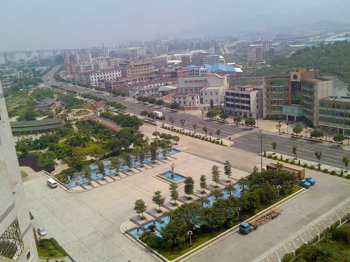
Photo adjustments
Full frame retained; proportionally resized and converted to WebP. No retouching or changes to the photographed subject. Card displays may crop the view.
- Administrative area
- District · 市辖区
- Part of
- Foshan
- Chinese name
- 高明区
- Local areas
- District guide
Area & population
- Area in the source
- 967.40 km²
- Population · 2020 Census
- 469,038
Source: cited geographic source, as of the dates shown.
Setting and landscape
Gaoming lies in the hilly country on the western fringe of the Pearl River Delta, high in the southwest and low in the northeast, where the Xi River runs along its border. The district describes its land as "six parts hills, one part water, three parts fields" (六山一水三分田). The Cang River (沧江河) and its 15 tributaries cross the district from west to east and drain into the Xi River. Zaomu Mountain (皂幕山), promoted as the highest peak in Foshan, and Daxiang Mountain (大香山), the second highest, rise here, along with Yunyong National Forest Park (云勇国家森林公园). The climate is subtropical monsoon, with a January mean of 12 °C and a July mean of 27 °C; snow fell during the 2016 Spring Festival for the first time since 1949.
History
The name comes from Gaoming Stockade (高明寨), a garrison set up in 111 BC under the Han on high, bright ground south of the hills and north of the water, which is what "Gaoming" ("high and bright") describes. Pingxing County (平兴县) was created here at the end of the Jin around AD 420, and Gaoming County was established under the Ming. Gaoming and Heshan (鹤山) were merged as Gaohe County in 1958 and split again in 1981; Gaoming became a county-level city in 1994 and a district of Foshan in 2002. People from Gaoming include the Ming poet Ou Daxiang (区大相) and Liang Fa (梁发), the Qing-era woodblock engraver remembered as China's "first newspaperman".
What to see
The Guye Shell Midden Site (古椰贝丘遗址), in Taixing village in Hecheng, is a national key cultural relic protection unit. Archaeologists date it to roughly the Xia and Shang period, when the area was at a Neolithic level, and it was named one of China's ten major archaeological discoveries of 2008. Linggui Pagoda (灵龟塔) and Wenchang Pagoda (文昌塔) are Ming-dynasty towers, and the remains of a Tang-dynasty dragon kiln lie below Linggui Pagoda. For hills and water, the main spots are Zaomu Mountain, the forest at Gengge (更合) and Xikeng Reservoir (西坑水库) in Yanghe (杨和).
Food and local products
Local products listed for Gaoming include Sanzhou (三洲) black geese, Xi'an (西安) lotus root, Heshui (合水) watermelons, yellow ginger (黄姜), Genglou (更楼) preserved plums (话梅) and Duichuan (对川) tea. Sanzhou, Xi'an, Heshui and Genglou were among the district's former towns.
Highlights
- Guye Shell Midden Site 古椰贝丘遗址: Neolithic shell-midden site in Hecheng, a national key cultural relic protection unit and one of China's ten major archaeological discoveries of 2008.
- Zaomu Mountain 皂幕山: Promoted by the district as the highest peak in Foshan.
- Linggui Pagoda 灵龟塔: Ming-dynasty pagoda with the remains of a Tang-dynasty dragon kiln below it.
- Sanzhou black goose 三洲黑鹅: Black goose named after Sanzhou, one of Gaoming's former towns.
Sources for this guide
高明概况 — 区域概况 · 佛山市高明区人民政府
高明区 · 维基百科 (Chinese Wikipedia) · CC BY-SA 4.0
古椰贝丘遗址 · 维基百科 (Chinese Wikipedia) · CC BY-SA 4.0
Original English written from the listed sources and checked sentence by sentence against quoted extracts by a separate reviewer. Updated 2026-09-23.
Explore Gaoming District
Core places to explore, with English and Chinese names.
Places to explore around Gaoming District
 Zaomu Mountain ·
 Plan your visit
Getting there
Gaoming District is about 25 km in a straight line from central Foshan. Search for 高明区 in a map app to find stations and your accommodation.
Where to stay →Build your route
Start with Zaomu Mountain. The linked place guides have entrance and visit details.
Continue with Foshan →More in Foshan
Sources & geographic information
Administrative names and parent areas: Official geographic directory · Reference date 2026-09-06.
Some facts checked against 高明区 — Wikipedia contributors, CC BY-SA 4.0.
Some facts checked against 古椰贝丘遗址 — Wikipedia contributors, CC BY-SA 4.0.
Photo: Zaomu Mountain · Source photographer · License not provided. EXIF orientation normalized; resized without changing aspect ratio; converted to WebP. No subject edits.
Map data © OpenStreetMap contributors. Pins mark approximate centres, not entrances or boundaries.