


Get to know Xinyi
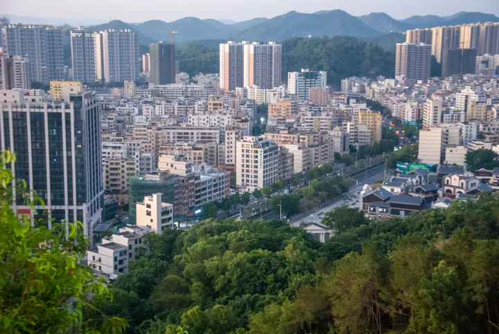
Photo adjustments
Full frame retained; proportionally resized and converted to WebP. No retouching or changes to the photographed subject. Card displays may crop the view.
- Administrative area
- County-level city · 县级市
- Part of
- Maoming
- Chinese name
- 信宜市
- Local areas
- County-level city guide
Area & population
- Area in the source
- 3,081.00 km²
- Population · 2020 census
- 1,014,577
Source: cited geographic source, as of the dates shown.
Setting and landscape
Mountains cover about 63 percent of the city, and the land is higher in the east than in the west; the flat land lies along the Jianjiang valley. More than 80 peaks pass 1,000 metres. The highest, Datianding (大田顶, 1,703.8 m) in the Yunkai Mountain National Nature Reserve (云开山国家级自然保护区), is described by the Xinyi government as the highest peak in western Guangdong. Tianma Mountain (天马山), Jilongding (鸡笼顶) and Bapaiding (八排顶) carry large summit grasslands.
History
In 502, under the Southern Liang, Liangde County (梁德县) was carved out here as the forerunner of Xinyi. The Tang created Xinyi County (信义) in 621, naming it after Mount Xin to the south and Mount Zhaoyi to the north, and in 634 the prefecture here became Douzhou (窦州). In 976 the name changed to its present characters to avoid the personal name of Emperor Taizong of Song. The county seat moved from Zhenlong (镇隆) to Dongzhen (东镇) in 1952, and the county became a county-level city in 1995. A Western Zhou bronze he (铜盉) vessel found here in 1974 is shown at the Guangdong Museum, and the Xinyi government says more bronze drums have been unearthed in Xinyi than in any other county or city in Guangdong.
What to see
Douzhou Ancient City (窦州古城), seat of successive prefectures and counties with a history of more than 1,400 years, and Lianhua Lake Manor (莲花湖庄园) are the two national 4A scenic areas. The 3A list includes Tianma Mountain, the Xijiang Hot Spring resort (西江温泉度假村) and the Douzhouli Cultural and Creative Street (窦州里文化创意街), rated a provincial tourism and leisure street. Provincial protected sites include the Dahong Kingdom palace site (大洪国王宫旧址), Wenming Gate (文明门), Qifeng Academy (起凤书院) and the former home of Ling Shiba (凌十八故居).
Food and local products
Huaixiang three-yellow chicken (怀乡三黄鸡) and Dangzai fish (氹仔鱼) are national geographical-indication products. Xinyi is a main production base for Xinyi plums (信宜李), jade ware, bamboo ware, southern medicinal herbs and granite slabs, and Sanhua plums (三华李) are among its best-known farm products. Its jade, known as "southern jasper" (南方碧玉), earned it the 2013 title "Capital of Southern Jade" (中国南玉之都) from the China Arts and Crafts Association. Jade carving, bamboo weaving, the Zhenlong piaose float parade (飘色) and the Liushuang lantern festival (六双花灯节) are on Guangdong's intangible heritage list.
Highlights
- Datianding 大田顶: 1,703.8 m peak in the Yunkai Mountain National Nature Reserve, called the highest in western Guangdong.
- Douzhou Ancient City 窦州古城: National 4A scenic area on the seat of old Douzhou, over 1,400 years old.
- Tianma Mountain 天马山: 3A scenic area with a large summit grassland.
- Huaixiang three-yellow chicken 怀乡三黄鸡: National geographical-indication product.
- Xinyi jade carving 信宜玉雕: On the Guangdong provincial intangible heritage list.
Sources for this guide
信宜市 茂名市人民政府门户网站 · Maoming Municipal People's Government (Maoming Party History and Local Chronicles Office)
旅游资源-信宜市人民政府网 · Xinyi Municipal People's Government (Culture, Radio, Television, Tourism and Sports Bureau)
历史沿革-信宜市人民政府网 · Xinyi Municipal People's Government
信宜市 - 维基百科,自由的百科全书 · Wikipedia (Chinese) · CC BY-SA 4.0
Original English written from the listed sources and checked sentence by sentence against quoted extracts by a separate reviewer. Updated 2026-09-23.
Explore Xinyi
Core places to explore, with English and Chinese names.
Places to explore around Xinyi
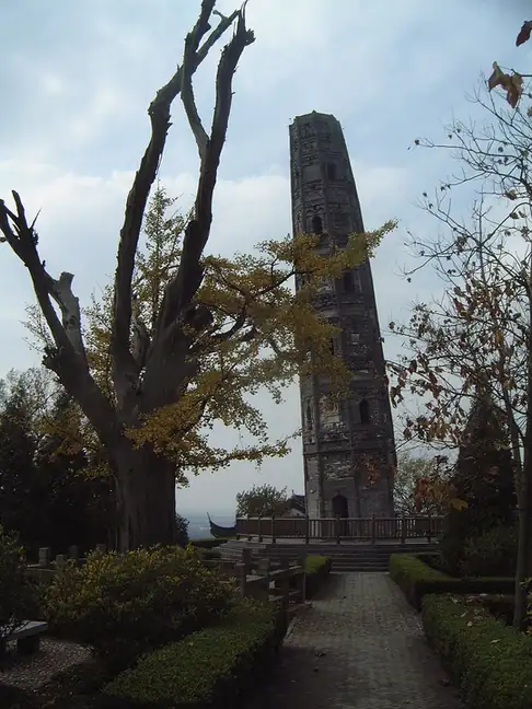 Tianma Mountain ·
 Plan your visit
Getting there
Xinyi is about 75 km in a straight line from central Maoming. Search for 信宜市 in a map app to find stations and your accommodation.
Where to stay →Build your route
Start with Tianma Mountain. The linked place guides have entrance and visit details.
Continue with Maoming →More in Maoming
Sources & geographic information
Administrative names and parent areas: Official geographic directory · Reference date 2026-09-06.
Some facts checked against 信宜市 — Wikipedia contributors, CC BY-SA 4.0.
Photo: Tianma Mountain · CyberCop · CC BY 3.0. EXIF orientation normalized; resized without changing aspect ratio; converted to WebP. No subject edits.

Map data © OpenStreetMap contributors. Pins mark approximate centres, not entrances or boundaries.