


Get to know Longhu District
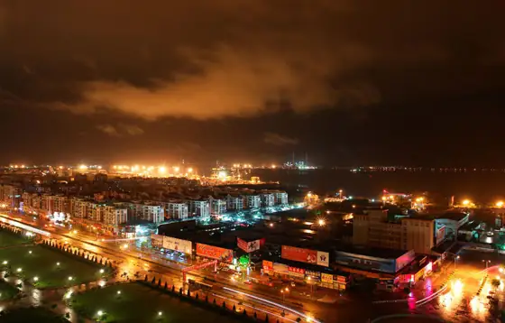
Photo adjustments
Resized and WebP compressed; subject not altered.
- Administrative area
- District · 市辖区
- Part of
- Shantou
- Chinese name
- 龙湖区
- Local areas
- District guide
Area & population
- Area in the source
- 103.58 km²
- Population · 2020 census
- 630,749
Source: cited geographic source, as of the dates shown.
Setting and landscape
Most of the district is alluvial delta plain just 1 to 3 metres above sea level, tilting gently from northwest to southeast. Three lower branches of the Han, the Waisha (外砂河), Xinjin (新津河) and Meixi (梅溪河) rivers, flow through it, and the coastline runs for 35.4 km. Mayu Island (妈屿岛) is its only island; Luan Hill (鸾山) on the island reaches 39 metres. The Tropic of Cancer crosses the Outing (鸥汀) and Waisha subdistricts.
History
Much of Longhu rose out of the sea only in the last few centuries. Villages appeared around Waisha, Daya and Outing in the Song dynasty, while the land around Xinjin, Zhuchi and Longhu formed in the late Ming and early Qing. After Chenghai County was created, most of the area belonged to it, but Mayu Island stayed with Chaoyang. The Longhu section of the Shantou Special Economic Zone, 22.6 square kilometres, was drawn in November 1984, and Longhu District was set up on that base in November 1991. Waisha and Xinxi joined from Chenghai in 2003, and the East Coast New Town reclamation finished in 2014 added 20 square kilometres of new land.
What to see
In 2025 Mayu Island held a Lantern Festival temple fair with Yingge dancers, a hands-on display of Mazu belief (妈祖信俗) and demonstrations of paper-cutting and Chaozhou embroidery. At the old Chao Customs commissioner's building (潮海关税务司旧址) on the island, an exhibition traces Shantou's opening to the outside world.
In Waisha, Pengsha Academy (蓬沙书院) has four themed halls on revolutionary history, overseas-Chinese culture, local food and intangible heritage. Dongxi village (东溪村), an old emigrant village also in Waisha, has the Wang ancestral hall (王氏大宗祠), the Mingxin study (明新书斋), Wang Jingren's former residence (王景仁故居) and a long banyan-lined embankment.
Food and local culture
Dongxi village pairs Yingge shows with old-style big-wok rice (大鼎饭), cooked slowly over firewood in one huge wok and eaten from old rooster-pattern bowls. A local tradition-bearer recalls that before emigrants left for Southeast Asia the whole village ate this rice together, with rice gathered from every household and meat pooled by neighbours. The village also has a youth Yingge troupe of 126 dancers.
Getting oriented
Longhu lies in the northeast of Shantou. The Waisha River separates it from Chenghai District (澄海区) to the northeast and the Meixi River from Chao'an District (潮安区) to the northwest; Jinping District (金平区) adjoins it to the west, and the sea lies to the south and southeast. Shantou railway station is in the district.
Highlights
- Mayu Island 妈屿岛: The district's only island, with the old Chao Customs commissioner's building and a Lantern Festival temple fair.
- Pengsha Academy 蓬沙书院: Academy in Waisha with halls on revolutionary history, overseas Chinese, food and intangible heritage.
- Dongxi Village 东溪村: Emigrant village with an ancestral hall, old study and former residences.
- Big-wok rice 大鼎饭: Firewood-cooked communal rice once shared before emigrants left for Southeast Asia.
Sources for this guide
汕头市龙湖区概况_汕头市龙湖区人民政府 · Longhu District People's Government, Shantou
设置沿革_汕头市龙湖区人民政府 · Longhu District People's Government, Shantou
地形地貌_汕头市龙湖区人民政府 · Longhu District People's Government, Shantou
地理位置_汕头市龙湖区人民政府 · Longhu District People's Government, Shantou
龙湖区举行“巳巳如意——妈屿岛元宵文化庙会”活动_汕头市龙湖区人民政府 · Longhu District People's Government, Shantou
外砂街道校地共建新成果 蓬沙书院红色沉浸式侨韵剧本游正式推出_汕头市龙湖区人民政府 · Waisha Subdistrict, Longhu District, Shantou
【聚焦“百千万工程”】外砂东溪村的大鼎饭,够“火”!_汕头市龙湖区人民政府 · Waisha Subdistrict and Longhu District Media Centre, Shantou
Longhu, Shantou - Wikipedia · Wikipedia (English) · CC BY-SA 4.0
Original English written from the listed sources and checked sentence by sentence against quoted extracts by a separate reviewer. Updated 2026-09-23.
Explore Longhu District
Core places to explore, with English and Chinese names.
Longhu District 龙湖区
Plan your visit
Getting there
Longhu District is about 4 km in a straight line from central Shantou. Search for 龙湖区 in a map app to find stations and your accommodation.
Where to stay →More in Shantou
Sources & geographic information
Administrative names and parent areas: Official geographic directory · Reference date 2026-09-06.
Some facts checked against Longhu, Shantou — Wikipedia contributors, CC BY-SA 4.0.
Map data © OpenStreetMap contributors. Pins mark approximate centres, not entrances or boundaries.