


Get to know Suixi County
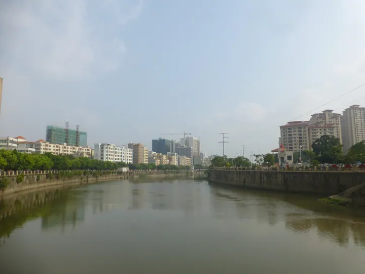
Photo adjustments
Full frame retained; proportionally resized and converted to WebP. No retouching or changes to the photographed subject. Card displays may crop the view.
- Administrative area
- County · 县
- Part of
- Zhanjiang
- Chinese name
- 遂溪县
- Local areas
- County guide
Area & population
- Area in the source
- 2,144.00 km²
- Population · 2020
- 824,608
Source: cited geographic source, as of the dates shown.
Setting and landscape
The county government describes Suixi as a tableland in the transition zone between the mainland and Hainan Island. Its main hills are Luogang Ling (螺岗岭) and Chengli Ling (城里岭), and its main rivers are the Suixi (遂溪河), Yanggan (杨柑河), Chengyue (城月河) and Lemin (乐民河). The coastline runs to 152.53 kilometres, with nine natural fishing harbours; the Jianghong (江洪渔港) and Caotan (草潭渔港) harbours were among the first designated national landing ports for fishing boats.
History
Suixi was anciently called Tiepa (铁杷), and the county government calls it an important cradle of the Leizhou Peninsula's red-earth culture; the Liyudun shell midden (鲤鱼墩贝丘遗址) is a Neolithic dwelling site seven to eight thousand years old. In 743, under the Tang, Tiepa County was renamed Suixi, from a phrase meaning that where streams join, the people benefit. The county seat moved to today's Suicheng in 1149, and in the Ming and Qing Suixi belonged to Leizhou prefecture. It was merged into a larger Leibei County (雷北县) in 1957 and restored as Suixi in 1961.
Lion dancing has been a local custom since the Ming and Qing, and in 2003 the China Folk Literature and Art Association named Suixi a "Home of Chinese Lion Dance" (中国醒狮之乡).
What to see
The aqueduct of the Leizhou Youth Canal (雷州青年运河东海河天桥), known locally as the Great Aqueduct (大渡槽), crosses the Xixi River (西溪河) on the north-eastern edge of the county town. Built between 1960 and 1962 of stone and reinforced concrete, it runs 1,200 metres in 40 spans of 30 metres, on piers up to 29.5 metres high, so that canal water flows above the river below.
Su'er Village (苏二村) in Jianxin town (建新镇) was the first Chinese Historic and Cultural Village in western Guangdong, with more than a hundred Ming and Qing houses decorated with wood, stone and brick carving. Local legend holds that it was once Lychee Village and was renamed after the poet Su Shi (苏轼) returned on his way north and finally tasted its lychees.
Food and local products
Suixi's waters supply eel maw, squid, cuttlefish, prawns, crab, Spanish mackerel, pomfret, grouper and peanut worms. Named local products include Xialiu peanut worms (下六沙虫), Caotan dried scallops (草潭瑶柱), Jianghong fish sauce (江洪鱼露), Suixi brown sugar (遂溪红糖), Jianxin crab sauce (建新蟛蜞汁) and red-fleshed dragon fruit.
Getting oriented
The county town, Suicheng Subdistrict (遂城街道), lies 16 kilometres from urban Zhanjiang. The Litang–Zhanjiang railway (黎湛铁路), the Chongqing–Zhanjiang (渝湛高速) and Maoming–Zhanjiang (茂湛高速) expressways and National Highways 325 and 207 pass through the county.
Highlights
- Leizhou Youth Canal aqueduct 雷州青年运河东海河天桥: 1,200-metre aqueduct of 1960-62 carrying the canal over the Xixi River.
- Su'er Village 苏二村: First Chinese Historic and Cultural Village in western Guangdong, with over a hundred Ming and Qing houses.
- Liyudun shell midden 鲤鱼墩贝丘遗址: Neolithic dwelling site seven to eight thousand years old.
- Suixi lion dance 遂溪醒狮: Local custom since the Ming and Qing; Suixi was named a Home of Chinese Lion Dance in 2003.
Sources for this guide
遂溪县概况 · Suixi County People's Government (county gazetteer office)
遂溪县历史文化 · Suixi County People's Government
运河天桥:最雄伟的天桥 · Suixi County Bureau of Culture, Radio, Television, Tourism and Sports
苏二村:荔香牵诗韵,东坡留美名 · Suixi County People's Government (from the Suixi culture and tourism bureau)
Original English written from the listed sources and checked sentence by sentence against quoted extracts by a separate reviewer. Updated 2026-09-23.
Explore Suixi County
Core places to explore, with English and Chinese names.
Suixi County 遂溪县
Plan your visit
Getting there
Suixi County is about 15 km in a straight line from central Zhanjiang. Search for 遂溪县 in a map app to find stations and your accommodation.
Where to stay →More in Zhanjiang
Sources & geographic information
Administrative names and parent areas: Official geographic directory · Reference date 2026-09-06.
Map data © OpenStreetMap contributors. Pins mark approximate centres, not entrances or boundaries.