


Get to know Xuwen County
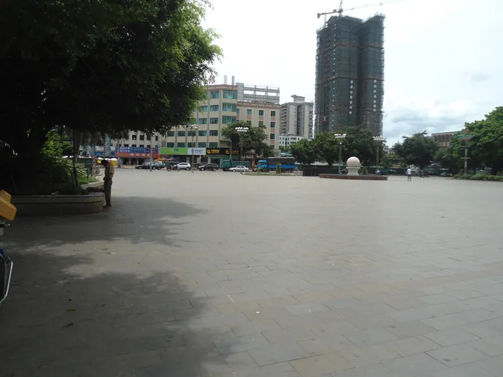
Photo adjustments
Full frame retained; proportionally resized and converted to WebP. No retouching or changes to the photographed subject. Card displays may crop the view.
- Administrative area
- County · 县
- Part of
- Zhanjiang
- Chinese name
- 徐闻县
- Local areas
- County guide
Area & population
- Area in the source
- 1,800.00 km²
- Population · 2020
- 633,258
Source: cited geographic source, as of the dates shown.
Setting and landscape
Xuwen is a country of low hills and tableland shaped by Quaternary lava flows and the sea, and basalt covers almost the whole county. The ground is highest in the north, at 100 to 150 metres, and falls towards the coast on the east, west and south; Shiban Ling (石板岭) is the highest point at 245.4 metres. The coastline runs for 378 kilometres, with inlets, bays, islands and tidal mudflats. The climate is tropical monsoon, and on average about 3.5 typhoons a year affect the county, mostly from July to October.
History
Xuwen County was founded in 111 BC, after the Han conquered the Nanyue kingdom, and at first covered the whole Leizhou Peninsula (雷州半岛), making it one of the earliest counties in Lingnan. Its first seat was Taowang village (讨网村) on the south-west coast, which also served as the seat of Hepu commandery (合浦郡). The county government presents Xuwen as the departure port of the Han-dynasty Maritime Silk Road and quotes Su Shi (苏轼) calling it the "throat" of four prefectures. The county was renamed Leinan (雷南县) in 1958 and took back the name Xuwen in 1960.
What to see
Denglou Cape (灯楼角) in Jiaowei township (角尾乡) is the southernmost point of the Chinese mainland, a spit of sand that marks the meeting line of the South China Sea and the Beibu Gulf, 12 nautical miles from Lingao Cape in Hainan. A Qing navigation light was put up here in 1890 and a French steel lighthouse in 1894; today's lighthouse dates from 1994. In 1950 the People's Liberation Army set out from the cape to take Hainan, and the departure point became a provincial protected site in 2022.
Off the west coast of Jiaowei, Maichen (迈陈镇) and Xilian (西连镇), the Xuwen Coral Reef National Nature Reserve (广东徐闻珊瑚礁国家级自然保护区) protects what the county government calls the largest and best-preserved continuous coral reef along the mainland Chinese coast, with 82 coral species; it became a national reserve in 2007. Inland, the Sea of Pineapples (菠萝的海) in Qujie town (曲界镇) is open tableland planted with pineapples as far as the eye can see, named one of the new Eight Views of Zhanjiang in 2013. Dahan Sandun (大汉三墩旅游区), in Nanshan town on the north shore of the strait facing Haikou, is built around the site of the Han-era Xuwen port, with three islands, fishing villages and a mangrove reserve.
Highlights
- Denglou Cape 灯楼角: Southernmost point of mainland China, where the South China Sea meets the Beibu Gulf.
- Xuwen Coral Reef National Nature Reserve 广东徐闻珊瑚礁国家级自然保护区: National reserve since 2007, with 82 coral species.
- Sea of Pineapples 菠萝的海: Pineapple-covered tableland in Qujie town; one of the new Eight Views of Zhanjiang.
- Dahan Sandun 大汉三墩旅游区: Scenic area built around the site of the Han-era Xuwen port.
Explore Xuwen County
Core places to explore, with English and Chinese names.
Places to explore around Xuwen County
 Pineapple Sea · 菠萝的海
Pineapple Sea菠萝的海
Pineapple Sea (菠萝的海), the 'pineapple sea', is the stretch of pineapple country around Qujie town in Xuwen county, at the southern tip of mainland China in Zhanjiang, Guangdong. The county's own account explains the name by the landform: the ground is a tableland, and the unbroken fields read as a sea of pineapples.
Read the place guide → Lighthouses at Dengloujiao, the southernmost point of mainland China, Xuwen County · 徐闻县灯楼角,中国大陆最南端的灯塔 Source-recorded photograph date: 2024-02-19 14:32:28.
Denglou Cape灯楼角
Headland in Xuwen County at the southern tip of mainland China, where two sea currents meet, with two lighthouses and the 1950 Hainan crossing site.
Read the place guide →Plan your visit
Getting there
Xuwen County is about 105 km in a straight line from central Zhanjiang. Search for 徐闻县 in a map app to find stations and your accommodation.
Where to stay →Build your route
Pineapple Sea and Denglou Cape are both listed here. The linked place guides have entrance and visit details.
Continue with Zhanjiang →More in Zhanjiang
Sources & geographic information
Administrative names and parent areas: Official geographic directory · Reference date 2026-09-06.
Photo: Pineapple Sea · Source photographer · License not provided. EXIF orientation normalized; resized without changing aspect ratio; converted to WebP. No subject edits.
Photo: Denglou Cape · N509FZ · CC BY-SA 4.0. Full frame retained; proportionally resized and converted to WebP. No retouching or changes to the photographed subject. Card displays may crop the view.
.jpg)
Map data © OpenStreetMap contributors. Pins mark approximate centres, not entrances or boundaries.