


Get to know Sanjiang Dong Autonomous County
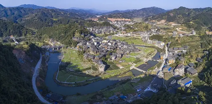
Photo adjustments
Full frame retained; resized proportionally to a maximum dimension of 960 pixels and converted to WebP quality 88. No crop, retouch, generated elements, or subject alteration. Final website rendition: full frame retained, proportionally resized to at most 720 pixels and converted to WebP. No additional retouching or subject alteration. Card displays may crop the view.
- Administrative area
- Autonomous county · 自治县
- Part of
- Liuzhou
- Chinese name
- 三江侗族自治县
- Local areas
- Autonomous county guide
Area & population
- Area in the source
- 2,455.00 km²
- Population · 2010
- 297,244
- Administrative seat
- Guyi Town
Source: cited geographic source, as of the dates shown.
Setting and landscape
The main river is the Rong River (融江), known upstream of Laobao (老堡) as the Duliu River (都柳江). The highest point is Baiyun Mountain (白云山), 1,448 metres, on the south-western border with Rongshui (融水). The county lies in the humid subtropical Nanling climate zone; the county government gives forest cover of 79.7% and an average annual temperature of 17 to 19°C.
History
In 1105, under the Northern Song, a Huaiyuan military prefecture (怀远军) was set up at Sankouzhai (三口寨) in Rongshui County (融水县), later becoming Huaiyuan County with its seat at today's Danzhou (丹洲). The county was re-established in 1380 and renamed Sanjiang in 1914 because Anhui already had a Huaiyuan County. A county-level Dong autonomous region was founded on 3 December 1952 and became the autonomous county in September 1955. Danzhou Ancient City (丹洲古城), the old county town begun in the Ming dynasty, keeps some of its old structures and is a Guangxi-protected site.
What to see
Chengyang Eight Villages (程阳八寨) in Linxi (林溪) was Liuzhou's first 5A scenic area. It has more than 2,000 stilt houses, 13 drum towers and 11 wind-and-rain bridges, among them the nationally protected Chengyang Yongji Bridge (程阳永济桥) and the Helong (合龙桥), Puxiu (普修桥) and Wanshou (万寿桥) bridges, plus a group of old waterwheels. Venues there include a Dong silver-ornament museum of about 3,000 pieces in the south area and the China Dong Painting Museum (中国侗画博物馆), with more than 500 works.
Batuan Bridge (岜团桥) in Dudong (独峒) and Mapang Drum Tower (马胖鼓楼) in Bajiang (八江) are also national protected sites. At Liangkou (良口), the Heli Sanwang Temple (和里三王宫) is a Dong temple that mixes Han and Dong building styles.
Food and local products
A Dong saying, "侗不离酸" (the Dong are never without sour food), refers to jar-pickled vegetables, pork, beef, duck, fish and goose. Oil tea (油茶), made with tea leaves, puffed rice, crisp soybeans, fried peanuts, spring onion and glutinous rice, is served to guests. Sanjiang tea, Sanjiang tea oil and Sanjiang rice-paddy carp are national geographical-indication products.
Getting oriented
The county town, Guyi (古宜), is 203 kilometres from Liuzhou and 167 kilometres from Guilin (桂林). The Guiyang–Guangzhou high-speed railway, the Jiaozuo–Liuzhou railway, the Xiamen–Chengdu expressway and national roads 209 and 321 meet at the county town, which is served by Sanjiang South station (三江南站).
Highlights
- Chengyang Eight Villages 程阳八寨: Liuzhou's first 5A scenic area, with more than 2,000 stilt houses, 13 drum towers and 11 wind-and-rain bridges.
- Chengyang Yongji Bridge 程阳永济桥: Wind-and-rain bridge in Linxi listed as a national key protected site.
- Danzhou Ancient City 丹洲古城: The old county town, begun in the Ming dynasty and protected by Guangxi.
- Mapang Drum Tower 马胖鼓楼: Drum tower in Bajiang listed as a national key protected site.
- Oil tea 油茶: Dong guest dish of tea leaves, puffed rice, soybeans, peanuts, spring onion and glutinous rice.
Sources for this guide
三江概况 · Sanjiang Dong Autonomous County People's Government
三江侗族自治县 · Wikipedia (Chinese) · CC BY-SA 4.0
游玩+出片攻略|到了程阳八寨,这些活动及场馆一定要打卡! · Sanjiang Dong Autonomous County People's Government
Original English written from the listed sources and checked sentence by sentence against quoted extracts by a separate reviewer. Updated 2026-09-25.
Explore Sanjiang Dong Autonomous County
Core places to explore, with English and Chinese names.
Places to explore around Sanjiang Dong Autonomous County
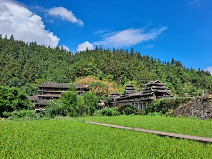 Wooden stilt houses and a wind-and-rain bridge amid rice paddies at Chengyang Eight Villages, Sanjiang · 三江侗族自治县程阳八寨吊脚楼与风雨桥,周边为稻田 Source-recorded photograph date: 2022-10-02.
Chengyang Eight Villages程阳八寨
Chengyang Eight Villages is a Dong village destination in Linxi Town, extending beyond the well-known Chengyang covered bridge.
Read the place guide →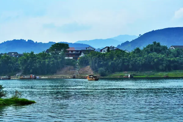 Danzhou Ancient Town · 丹洲古镇
Danzhou Ancient Town丹洲古镇
Danzhou Ancient Town occupies a river island in Danzhou village, Sanjiang Dong Autonomous County.
Read the place guide →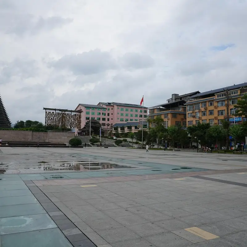 Sanjiang Drum Tower and County Town Riverside · 三江鼓楼与县城江岸
Sanjiang Drum Tower and County Town Riverside三江鼓楼与县城江岸
Sanjiang Drum Tower and County Town Riverside covers Sanjiang Drum Tower and the riverbank of Sanjiang's county town, where Dong timber forms appear both in a freestanding landmark tower and in the county seat's modern river crossings.
Read the place guide →Plan your visit
Getting there
Sanjiang Dong Autonomous County is about 165 km in a straight line from central Liuzhou. Search for 三江侗族自治县 in a map app to find stations and your accommodation.
Where to stay →Build your route
Chengyang Eight Villages and Danzhou Ancient Town are both listed here. The linked place guides have entrance and visit details.
Continue with Liuzhou →More in Liuzhou
Sources & geographic information
Administrative names and parent areas: Official geographic directory · Reference date 2026-09-06.
Some facts checked against 三江侗族自治县 — Wikipedia contributors, CC BY-SA 4.0.
Photo: Chengyang Eight Villages · EditQ · CC BY-SA 4.0. Full frame retained; proportionally resized and converted to WebP. No retouching or changes to the photographed subject. Card displays may crop the view.

Photo: Danzhou Ancient Town · Source photographer · License not provided. EXIF orientation normalized; resized without changing aspect ratio; converted to WebP. No subject edits.
Photo: Sanjiang Drum Tower and County Town Riverside · Source photographer · License not provided. EXIF orientation normalized; resized without changing aspect ratio; converted to WebP. No subject edits.
Map data © OpenStreetMap contributors. Pins mark approximate centres, not entrances or boundaries.