


Get to know Yuzhou District
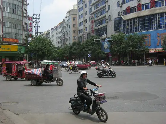
Photo adjustments
Resized and WebP compressed; subject not altered.
- Administrative area
- District · 市辖区
- Part of
- Yulin
- Chinese name
- 玉州区
- Local areas
- District guide
Area & population
- Area in the source
- 435.54 km²
- Population · 2020 census
- 908,121
- Administrative seat
- Yucheng Subdistrict
Source: cited geographic source, as of the dates shown.
Setting and landscape
Most of the district is basin floor. The higher ground belongs to a spur of the Darong Mountains (大容山) and to the Hanshan Ridge (寒山岭), which rises 14 km north-west of the urban area to a 720-metre summit. Its rivers belong to the Nanliu River (南流江) system; the district government calls the Nanliu the largest Guangxi river flowing independently to the sea, and the Qingwan River (清湾江) is one of its three first-order tributaries in the district. The climate is south-subtropical monsoon: warm and wet, with long, hot summer days and dry winters.
History
The area's old name, Yulin (鬱林), used a different first character from the present name (玉林). Nanliu County (南流县), re-established in 621 with its seat in today's urban area, took its name from the river a hundred paces south of the county seat. In 996 the seat of Yulin prefecture moved to Nanliu, and the district government counts more than 1,500 years of town history. Yulin County took its present characters (玉林县) in 1956, became a county-level city in 1983, and on 22 April 1997 was split to create Yuzhou District and Xingye County. Fumian District, which had run five of Yuzhou's towns and one township as an outpost office since 1997, became a separate district in 2013.
What to see
Three sites are on the Guangxi protected list: the Ming-to-Qing buildings of Gaoshan village (高山村古建筑群) in Chengbei subdistrict (城北街道); the Yuan-dynasty Dacheng Hall of the Yulin Confucian Temple (玉林文庙大成殿), inside Guding Primary School (古定小学) on Jiefang Road (解放路); and the Zhushadong Hakka walled house (朱砂垌客家围屋) at Lingtang village (岭塘村) in Nanjiang subdistrict (南江街道). Hakka settlers from Meizhou (梅州) in Guangdong built Zhushadong in 1745; a horseshoe wall 6 metres high with seven watchtowers encloses the village, whose courtyard houses stand in rows on either side of the ancestral hall, and the district government describes it as the largest and most complete Hakka enclosure surviving in Guangxi.
Sites on the Yulin city protected list include the Qing-dynasty Yunlong Bridge (云龙桥) over the Nanliu River in the urban area and the 1933 Butterfly Building (蝴蝶楼), inside the district government compound. Shizijie (十字街, "Crossroads Street") has been named a Guangxi tourism and leisure street.
Food and local products
The district government names three products it promotes: sanhuang ("three-yellow") chicken (三黄鸡), Yulin fragrant garlic (玉林香蒜), and Yulin beef brisket rice noodles (玉林牛腩粉), which now have their own industrial park in the district.
Highlights
- Zhushadong Hakka walled house 朱砂垌客家围屋: Built in 1745 by Hakka settlers from Meizhou; horseshoe wall with seven watchtowers; on the Guangxi protected list.
- Dacheng Hall of the Yulin Confucian Temple 玉林文庙大成殿: Yuan-dynasty hall inside Guding Primary School; on the Guangxi protected list.
- Gaoshan village ancient buildings 高山村古建筑群: Ming-to-Qing village buildings in Chengbei subdistrict; on the Guangxi protected list.
- Shizijie 十字街: Named a Guangxi tourism and leisure street.
Sources for this guide
玉州区概况 - 玉州概况 - 广西玉林玉州区人民政府门户网站 · Yuzhou District People's Government, Yulin
历史沿革 - 广西玉林玉州区人民政府门户网站 · Yuzhou District People's Government, Yulin
【南江印记】岭塘村硃砂垌客家围垅屋 - 广西玉林玉州区人民政府门户网站 · Yuzhou District People's Government, Yulin
玉州区各级文物保护单位列表 · Wikipedia (Chinese) · CC BY-SA 4.0
Original English written from the listed sources and checked sentence by sentence against quoted extracts by a separate reviewer. Updated 2026-09-24.
Explore Yuzhou District
Core places to explore, with English and Chinese names.
Places to explore around Yuzhou District
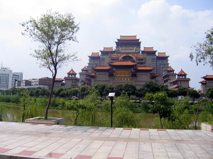 The Yuntian Cultural City complex seen across the river in Yuzhou District, Yulin ·
 Plan your visit
Getting there
Yuzhou District is about 4 km in a straight line from central Yulin. Search for 玉州区 in a map app to find stations and your accommodation.
Where to stay →Build your route
Start with Yuntian Cultural City. The linked place guides have entrance and visit details.
Continue with Yulin →More in Yulin
Sources & geographic information
Administrative names and parent areas: Official geographic directory · Reference date 2026-09-06.
Some facts checked against 玉州区各级文物保护单位列表 — Wikipedia contributors, CC BY-SA 4.0.
Photo: Yuntian Cultural City · ufoismey3k · CC BY-SA 3.0. Full frame retained; proportionally resized and converted to WebP. No retouching or changes to the photographed subject. Card displays may crop the view.

Map data © OpenStreetMap contributors. Pins mark approximate centres, not entrances or boundaries.