


Get to know Xiuying District
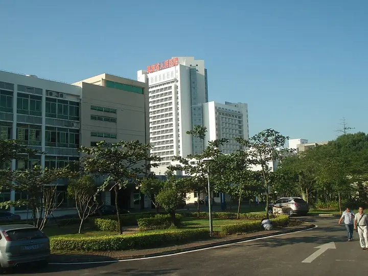
Photo adjustments
Full frame retained; proportionally resized and converted to WebP. No retouching or changes to the photographed subject. Card displays may crop the view.
- Administrative area
- District · 市辖区
- Part of
- Haikou
- Chinese name
- 秀英区
- Local areas
- District guide
Area & population
- Population · 2025
- 603,600
Source: cited geographic source, as of the dates shown.
Setting and landscape
The land is mostly low plain built up by sediments with layers of volcanic rock, higher in the south-west and lower in the north-east. The highest point is Ma'anling (马鞍岭) in Shishan (石山镇), at 222.8 metres. The Nandu River (南渡江) crosses the district for 17 kilometres, and the Wuyuan (五源河) and Rongshan (荣山河) rivers run separately into the sea.
History
The name comes from a village once called Xiaoying (小英). In 1887 the Viceroy of Liangguang, Zhang Zhidong (张之洞), found the name too plain and changed it to the similar-sounding Xiuying. A Xiuying township was first set up in 1947, the area took the Xiuying District name in 1980, and in 1990 it became a county-level district of Haikou. The towns of Yongxing (永兴镇), Shishan and Dongshan (东山镇) joined it at the end of 2002. Haikou Port, historically called Xiuying Port, was opened as a treaty port in 1858 and to foreign trade in 1876.
What to see
Most of Haikou's 4A scenic areas are in the district, including the Hainan Tropical Wildlife Park and Botanical Garden (海南热带野生动植物园), the Haikou volcano crater global geopark (海口火山口世界地质公园) and Holiday Beach (假日海滩) on the west coast. The tomb of Qiu Jun (丘濬墓) is a national protected site; provincial sites include the Changzhu Pagoda (常住宝塔) and the Rufu stone pagoda (儒符石塔).
Villages at the foot of the volcanoes were built from local materials, and several are listed as Chinese traditional villages: Meishe (美社村), founded in the Tang, Sanqing (三卿村) in the Song, Meixiao (美孝村) in the Ming Jiajing reign and Fengtang (冯塘村) at the end of the Ming. The Hainan International Convention and Exhibition Center (海南国际会展中心) and the national windsurfing base are also here.
Food and local products
Yongxing lychees and wampee (黄皮), Shishan goat (石山壅羊) and Shishan black beans (石山黑豆) all carry geographical-indication status. Local crafts and traditions on heritage lists include Shishan bayin music (石山八音), Dongshan grass weaving (东山草编) and the Yongxing qilin dance (永兴麒麟舞).
Highlights
- Haikou volcano crater global geopark 海口火山口世界地质公园: One of the district's 4A scenic areas.
- Hainan Tropical Wildlife Park and Botanical Garden 海南热带野生动植物园: 4A scenic area in the district.
- Holiday Beach 假日海滩: West-coast 4A beach area.
- Tomb of Qiu Jun 丘濬墓: National protected site.
- Fengtang village 冯塘村: Founded at the end of the Ming; on the Chinese traditional villages list.
- Yongxing lychee 永兴荔枝: Geographical-indication product.
Sources for this guide
海口市秀英区人民政府_ 秀英概况 · Xiuying District People's Government, Haikou
Original English written from the listed sources and checked sentence by sentence against quoted extracts by a separate reviewer. Updated 2026-09-25.
Explore Xiuying District
Core places to explore, with English and Chinese names.
Places to explore around Xiuying District
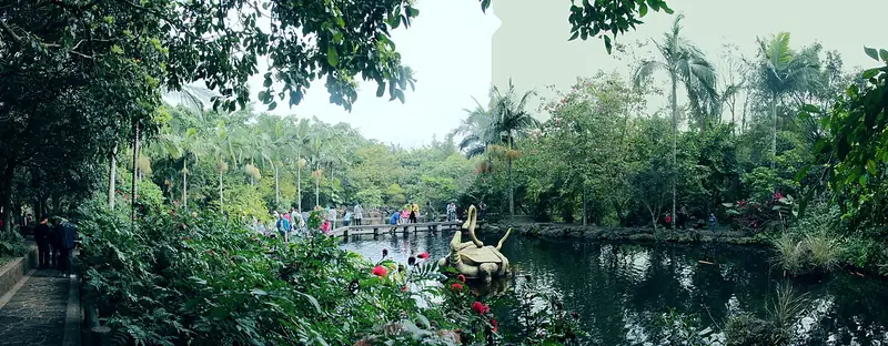 Haikou Volcanic Cluster Geopark (雷琼海口火山群地质公园), Xiuying District. Photograph: "海南国际旅游岛——海口.世界火山地质公园景观(宽幅)(东北向) - panoramio (1)".
Haikou Volcanic Cluster Geopark雷琼海口火山群地质公园
The Haikou volcanic cluster is the Hainan part of the wider Leiqiong UNESCO Global Geopark, whose volcanic landscapes extend across the Qiongzhou Strait.
Read the place guide →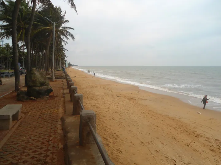 The palm-lined shore of Holiday Beach, Xiuying District, Haikou · 海口市秀英区假日海滩椰林海岸 Source-recorded photograph date: 2013-10-29 05:09:05.
Holiday Beach假日海滩
Holiday Beach is the western end of Haikou’s familiar seaside leisure circuit, with a broad sandy shore, palms and a promenade along Binhai West Road. It suits a relaxed afternoon outdoors after the city’s museums or old…
Read the place guide →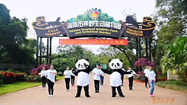 Hainan Tropical Wildlife Park and Botanical Garden · 海南热带野生动植物园
Hainan Tropical Wildlife Park and Botanical Garden海南热带野生动植物园
Hainan Tropical Wildlife Park and Botanical Garden is a large managed animal attraction in Dongshan, outside central Haikou. Its layout combines vehicle-based viewing areas with sections explored on foot, within a tropical…
Read the place guide →Plan your visit
Getting there
Xiuying District is about 6 km in a straight line from central Haikou. Search for 秀英区 in a map app to find stations and your accommodation.
Where to stay →Build your route
Haikou Volcanic Cluster Geopark and Holiday Beach are both listed here. The linked place guides have entrance and visit details.
Continue with Haikou →More in Haikou
Sources & geographic information
Administrative names and parent areas: Official geographic directory (dmfw.mca.gov.cn) · Reference date 2026-09-06.
Photo: Haikou Volcanic Cluster Geopark · 川号子 · CC BY 3.0. Full frame retained; EXIF orientation normalized, proportionally resized to at most 800 pixels and converted to WebP. No generated pixels or subject changes. Cards may crop the display.

Photo: Holiday Beach · Anna Frodesiak · CC0. Full frame retained; proportionally resized and converted to WebP. No retouching or changes to the photographed subject. Card displays may crop the view.

Photo: Hainan Tropical Wildlife Park and Botanical Garden · Source photographer · License not provided. EXIF orientation normalized; resized without changing aspect ratio; converted to WebP. No subject edits.
Map data © OpenStreetMap contributors. Pins mark approximate centres, not entrances or boundaries.