


Get to know Xisha District
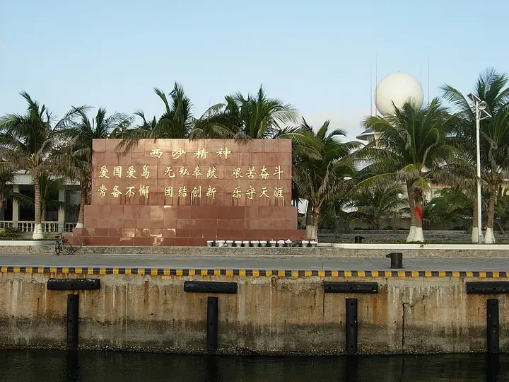
Photo adjustments
Full frame retained; proportionally resized and converted to WebP. No retouching or changes to the photographed subject. Card displays may crop the view.
- Administrative area
- District · 市辖区
- Part of
- Sansha
- Chinese name
- 西沙区
- Local areas
- District guide
Area & population
- Area in the source
- 10.07 km²
Source: cited geographic source, as of the dates shown.
History
The State Council approved Xisha and Nansha as Sansha's two districts on 18 April 2020, eight years after Sansha itself was set up in July 2012. Sovereignty over the Paracels is contested: the People's Republic of China, Vietnam and Taiwan all claim the islands, and the PRC has controlled the entire group since the Battle of the Paracel Islands in January 1974. The district's authority is not internationally recognised.
Setting and landscape
The Paracels lie in the northwest of the South China Sea, southeast of Hainan Island, and were anciently called Qianli Changsha (千里长沙), the "thousand-li sandbank". A Hainan Daily geography series, republished by the Sansha government, counts more than 40 islands, cays, reefs and banks spread across over 500,000 square kilometres of sea, with 22 islands and 7 sand cays giving about 10 square kilometres of land, the most of the four South China Sea island groups. Rocky Island (石岛) is the highest at 15.9 metres.
Roughly along 112 degrees east, the islands split into the western Yongle Islands (永乐群岛), the Crescent Group in English, and the eastern Xuande Islands (宣德群岛), the Amphitrite Group. A well on Ganquan Island (甘泉岛), in the Yongle group, is described as the only natural source of drinkable fresh water in the Paracels, and the series calls Gaojianshi (高尖石) on the Dongdao atoll the only volcanic-breccia island in the South China Sea.
Getting oriented
Yongxing Island, at the centre of the Paracels, is 330 kilometres from both Yulin port in Sanya (三亚) and Qinglan port in Wenchang (文昌). The series describes it as the largest of the South China Sea islands, at 2.1 square kilometres including its airstrip, with offices, a post office, a bank, shops, a weather station, a hospital, a ring road, an airport and a wharf.
Highlights
- Yongxing Island (Woody Island) 永兴岛: Seat of Sansha and of Xisha District; 330 km from Sanya's Yulin port and Wenchang's Qinglan port.
- Ganquan Island 甘泉岛: Has the only natural drinkable well in the Yongle and Xuande island groups.
- Rocky Island 石岛: Highest island in the Paracels at 15.9 m.
Sources for this guide
西沙群岛:南海陆地最多的群岛_三沙概况_三沙市人民政府网 · Sansha Municipal People's Government (reprinted from Hainan Daily)
Xisha, Sansha - Wikipedia · Wikipedia (English) · CC BY-SA 4.0
Paracel Islands - Wikipedia · Wikipedia (English) · CC BY-SA 4.0
市情_三沙市人民政府网 · Sansha Municipal People's Government
Woody Island (South China Sea) - Wikipedia · Wikipedia (English) · CC BY-SA 4.0
Original English written from the listed sources and checked sentence by sentence against quoted extracts by a separate reviewer. Updated 2026-09-24.
Explore Xisha District
Core places to explore, with English and Chinese names.
Xisha District 西沙区
Plan your visit
Getting there
Xisha District covers the centre of Sansha. Search for 西沙区 in a map app to find stations and your accommodation.
Where to stay →More in Sansha
Sources & geographic information
Administrative names and parent areas: Official geographic directory · Reference date 2026-09-06.
Some facts checked against Xisha, Sansha — Wikipedia contributors, CC BY-SA 4.0.
Some facts checked against Paracel Islands — Wikipedia contributors, CC BY-SA 4.0.
Some facts checked against Woody Island (South China Sea) — Wikipedia contributors, CC BY-SA 4.0.
Map data © OpenStreetMap contributors. Pins mark approximate centres, not entrances or boundaries.