


Get to know Jiyang District
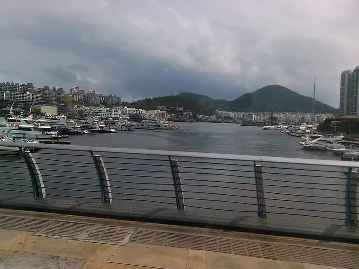
Photo adjustments
Full frame retained; proportionally resized and converted to WebP. No retouching or changes to the photographed subject. Card displays may crop the view.
- Administrative area
- District · 市辖区
- Part of
- Sanya
- Chinese name
- 吉阳区
- Local areas
- District guide
Area & population
- Area in the source
- 372.61 km²
- Population · 2013
- 240,000
Source: cited geographic source, as of the dates shown.
Getting oriented
The district was created in 2014 from the former Hedong (河东) district, Jiyang town and the Yalong Bay administration. Sanya railway station, served by the Guangdong–Hainan railway, the western Hainan line and the round-island high-speed line, is in the district, and the high-speed line also stops at Yalong Bay station.
What to see
Yalong Bay, about 10 km from the city centre, is a crescent-shaped bay with a 7 km white beach. Its coral is part of the Sanya Coral Reef national marine nature reserve, and the Jinmu (锦母角) and Yalong capes are used for rock climbing. Wild Boar Island (野猪岛) sits in the middle of the bay, with Dongzhou (东洲岛) and Xizhou (西洲岛) islands to the south.
Luhuitou Park (鹿回头公园) covers a 181 m hill that juts into the sea across the Sanya River, south of the city centre, with views north over the city and east over the Dadonghai beach. A 12 m stone statue on the summit, by the Hainan sculptor Lin Yuhao (林毓豪), tells the Li legend of a young hunter and a sika deer that turns its head and becomes a young woman; the story gave Sanya its nickname "Deer City" (鹿城).
Dadonghai (大东海), just east of Luhuitou, has a beach about a kilometre long and is the closest beach to the city centre; winter water temperatures fall to around 20°C. The Luobi Cave site (落笔洞遗址) in the district is listed as a national key cultural relics protection site.
Highlights
- Yalong Bay 亚龙湾: Crescent bay with a 7 km beach and coral in a national marine nature reserve.
- Luhuitou Park 鹿回头公园: 181 m hill with the deer statue behind Sanya's "Deer City" nickname.
- Dadonghai 大东海: The beach closest to central Sanya.
- Luobi Cave site 落笔洞遗址: An ancient site listed as a national key cultural relics protection site.
Sources for this guide
区情_吉阳区人民政府 · Jiyang District People's Government, Sanya
吉阳区 - 维基百科,自由的百科全书 · Chinese Wikipedia · CC BY-SA 4.0
亚龙湾 - 维基百科,自由的百科全书 · Chinese Wikipedia · CC BY-SA 4.0
鹿回头 - 维基百科,自由的百科全书 · Chinese Wikipedia · CC BY-SA 4.0
大东海 - 维基百科,自由的百科全书 · Chinese Wikipedia · CC BY-SA 4.0
海南省境内的全国重点文物保护单位列表 - 维基百科,自由的百科全书 · Chinese Wikipedia · CC BY-SA 4.0
Original English written from the listed sources and checked sentence by sentence against quoted extracts by a separate reviewer. Updated 2026-09-25.
Explore Jiyang District
Core places to explore, with English and Chinese names.
Places to explore around Jiyang District
 The turquoise waters and sandy beach of Yalong Bay, with a wooden pier, Jiyang District, Sanya. · 三亚市吉阳区亚龙湾碧海沙滩及木栈桥。 Source-recorded photograph date: Taken on 18 June 2015.
Yalong Bay亚龙湾
Yalong Bay is a crescent-shaped bay east of central Sanya, with a broad sandy shore backed by hills and resort development.
Read the place guide →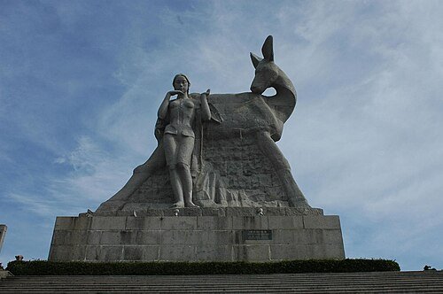 Luhuitou · 鹿回头
Luhuitou鹿回头
Luhuitou is a wooded hill above central Sanya, with viewpoints that make the city’s bays and river mouth easier to understand. Its name, often translated as “deer turning its head”, comes from a Li love legend represented by the…
Read the place guide →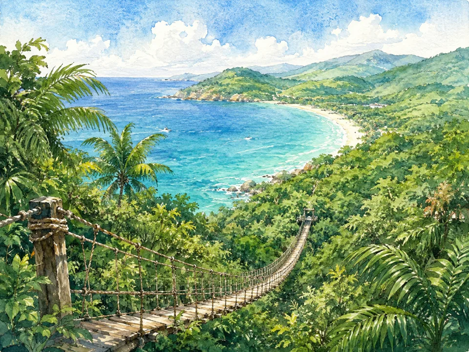 AI illustration; an interpretive view, not a photograph. AI 示意图,非景点实拍。
Yalong Bay Tropical Paradise Forest Park亚龙湾热带天堂森林公园
Yalong Bay Tropical Paradise Forest Park combines hillside tropical planting with elevated visitor structures above the bay. The orchid garden offers a close view of cultivated flowers, while the rope-chain bridge and glass…
Read the place guide → Dadonghai beach in Sanya, with hotels along the shoreline · 三亚大东海海滨,岸边可见酒店建筑 Source-recorded photograph date: Taken on 23 February 2011.
Dadonghai大东海
Dadonghai is a sandy bay on the developed edge of Sanya. Its combination of an urban neighbourhood, beachfront businesses and an open stretch of sand makes it different from the more isolated resort bays. The land behind the…
Read the place guide →Plan your visit
Getting there
Jiyang District is about 8 km in a straight line from central Sanya. Search for 吉阳区 in a map app to find stations and your accommodation.
Where to stay →Build your route
Yalong Bay and Luhuitou are both listed here. The linked place guides have entrance and visit details.
Continue with Sanya →More in Sanya
Sources & geographic information
Administrative names and parent areas: Official geographic directory · Reference date 2026-09-06.
Some facts checked against 吉阳区 — Wikipedia contributors, CC BY-SA 4.0.
Some facts checked against 亚龙湾 — Wikipedia contributors, CC BY-SA 4.0.
Some facts checked against 鹿回头 — Wikipedia contributors, CC BY-SA 4.0.
Some facts checked against 大东海 — Wikipedia contributors, CC BY-SA 4.0.
Some facts checked against 海南省境内的全国重点文物保护单位列表 — Wikipedia contributors, CC BY-SA 4.0.
Photo: Yalong Bay · 江上清风1961 · CC BY 3.0. Full frame retained; proportionally resized and converted to WebP. No retouching or changes to the photographed subject. Card displays may crop the view.
.jpg)
Photo: Luhuitou · Brookqi · Public domain. Wikimedia thumbnail; fitted to the ranking-card frame.

Photo: Dadonghai · mayanming · CC BY-SA 3.0. Full frame retained; proportionally resized and converted to WebP. No retouching or changes to the photographed subject. Card displays may crop the view.

Map data © OpenStreetMap contributors. Pins mark approximate centres, not entrances or boundaries.