


Get to know Zanhuang County
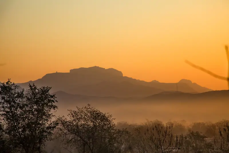
Photo adjustments
EXIF orientation normalized; resized without changing aspect ratio; converted to WebP. No subject edits.
- Administrative area
- County · 县
- Part of
- Shijiazhuang
- Chinese name
- 赞皇县
- Local areas
- County guide
History
Zanhuang was first made a county in 596, in the Kaihuang era of the Sui dynasty. It takes its name from Mount Zanhuang (赞皇山) inside its borders: legend holds that King Mu of Zhou (周穆王) defeated the Quanrong (犬戎) here and named the mountain. The county was merged into neighbouring Gaoyi (高邑县) in 1072 and restored in 1086, merged into Gaoyi again under the Yuan and restored a few years later, and folded into Yuanshi County (元氏县) in 1958 before being re-established in 1961. The Shijiazhuang city government counts it among six counties in the city recognised by the United Nations as "thousand-year-old counties" (千年古县). Most local speech belongs to the Dabao subgroup of Jin Chinese (晋语大包片).
What to see
Zhangshiyan (嶂石岩), in the southwest of the county, is a national scenic area and a national geopark. The Shijiazhuang government calls it the type locality of the "Zhangshiyan landform", which it groups with the Zhangjiajie and Danxia landforms as China's three sandstone landforms. The city government names its four draws as remarkable peaks, secluded valleys, colourful woods and seas of cloud; forest covers 98 percent of it, 654 plant species have been recorded, and the average summer temperature is 21°C. Its five touring areas are Nine Maidens Peak (九女峰), Zhihutao (纸糊套) with its echo wall, Yuantong Temple (圆通寺), Donglingbei (冻凌背) and Flower Sea Happy Valley (花海欢乐谷), listed with Red Stone Street (红石街). The scenic area lies 86 kilometres from Shijiazhuang.
The stone pagoda of Zhiping Temple (治平寺石塔) is a national protected monument. The Li family tombs (李氏墓群) and the Wanpoding site (万坡顶遗址) are on the Hebei provincial list.
Food and local products
The county's signature product is the Zanhuang golden-silk jujube (赞皇金丝大枣), an oblong date with dark red-brown skin. When a dried fruit is broken open, threads of sugary flesh stretch between the halves, which earned it the nickname "golden silk honey" (金丝蜜). The fruit is picked in late September. It was judged the best Chinese jujube at a jujube fair in Changsha in 1956; the State Forestry Administration named Zanhuang the home of Zanhuang jujubes in 2001, and the jujube became a protected origin product in 2005. Jujube orchards cover about a quarter of the county's land.
Highlights
- Zhangshiyan Cliffs 嶂石岩: National scenic area and geopark; type locality of the Zhangshiyan sandstone landform, with an echo wall at Zhihutao.
- Zhiping Temple Stone Pagoda 治平寺石塔: Stone pagoda listed as a national protected monument.
- Zanhuang golden-silk jujube 赞皇金丝大枣: Oblong red-brown date whose dried flesh pulls into sugary threads; a protected origin product since 2005.
Sources for this guide
美丽石家庄 · Shijiazhuang Municipal People's Government
嶂石岩 · Shijiazhuang Municipal People's Government
赞皇金丝大枣 · Shijiazhuang Municipal People's Government (republished from Shijiazhuang News)
赞皇县 - 维基百科,自由的百科全书 · Wikipedia (Chinese) · CC BY-SA 4.0
Original English written from the listed sources and checked sentence by sentence against quoted extracts by a separate reviewer. Updated 2026-09-24.
Explore Zanhuang County
Core places to explore, with English and Chinese names.
Places to explore around Zanhuang County
 Zhangshiyan Cliffs ·
 Plan your visit
Getting there
Zanhuang County is about 45 km in a straight line from central Shijiazhuang. Search for 赞皇县 in a map app to find stations and your accommodation.
Where to stay →Build your route
Start with Zhangshiyan Cliffs. The linked place guides have entrance and visit details.
Continue with Shijiazhuang →More in Shijiazhuang
Sources & geographic information
Administrative names and parent areas: Official geographic directory · Reference date 2026-09-06.
Some facts checked against 赞皇县 — Wikipedia contributors, CC BY-SA 4.0.
Photo: Zhangshiyan Cliffs · Source photographer · License not provided. EXIF orientation normalized; resized without changing aspect ratio; converted to WebP. No subject edits.
Map data © OpenStreetMap contributors. Pins mark approximate centres, not entrances or boundaries.