


Photo adjustments
The exact downloaded source bytes are separately retained and hashed. Prepared JPEG is proportionally reduced to a maximum 720-pixel long edge; full frame retained, no subject alteration. Final website rendition: full frame retained, proportionally resized to at most 720 pixels and converted to WebP. No additional retouching or subject alteration. Card displays may crop the view.
Explore the region
About Songhua River Bridge
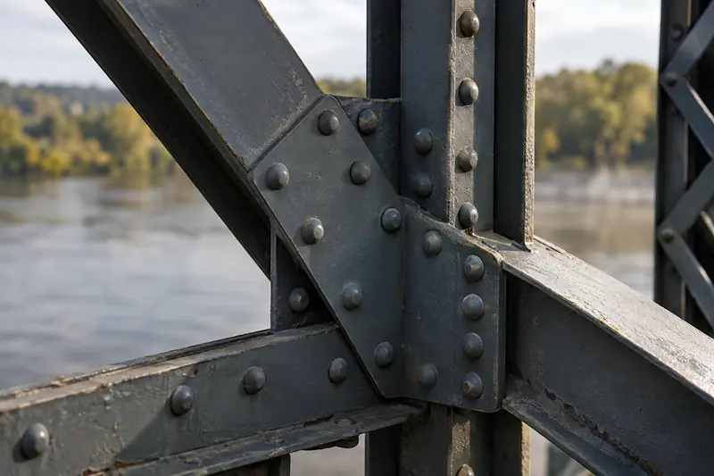
Its conversion to a pedestrian crossing lets visitors read the repeating steel framework at close range while looking along the river. The neighbouring railway infrastructure provides a contrast between an early crossing and the working transport corridor that followed it. This is most useful as an extension of a riverfront walk, with the bridge itself providing both the historical subject and the viewpoint.
What to look for
- The repeating iron trusses and the former railway deck used by pedestrians.
- Views along the Songhua River and toward the neighbouring railway crossing.
The surrounding area
Provincial capital base for Central Street, architectural history, music and seasonal ice displays.
Location & getting there
Getting to Songhua River Bridge
Approach the old railway bridge from the southern-bank riverside path east of the Flood Control Monument.
- Follow the signed pedestrian approach and any current limits on access to the span.
Combine your visit
Suggested order within this visit:
-
Southern bridge approach
Take in the river crossing and its structural outline.
-
Permitted pedestrian span
Study the trusses and river views from within the bridge.
-
Southern-bank promenade
Return to the riverfront path for a wider view of the crossings.
This sequence is an editorial suggestion based on the features described in the sources. Access to individual buildings or areas should be checked locally; no travel time or shared admission is implied.
Find Songhua River Bridge
滨洲铁路桥步行段 · 哈尔滨市
The pin marks the area, not the entrance.
More places nearby
Approximate straight-line distances between map pins, not travel distances.
Flood Control Monument 防洪胜利纪念塔
Less than 1 km awayHarbin's Flood Control Monument marks the city's defence against the 1957 flood. Built the following year, it combines a sculpted tower with a semicircular colonnade that opens toward the Songhua riverfront. Figures and reliefs…
View guide →Zhaolin Park 兆麟公园
Less than 1 km awayZhaolin Park layers a historic city garden with the memorial and burial place of resistance leader Li Zhaolin. Its bridges, small hills and pavilions reward a slow circuit: Kuahong Bridge is one of the named garden structures…
View guide →Zhongyang Street 中央大街
2 km awayZhongyang Street is an architectural walk as well as a shopping street. Its rounded stone paving runs toward the Songhua River through façades associated with Harbin's early international trading community. At No. 89, the Modern…
View guide →Sources & visit information
The sources below support the place-specific description and arrival information. Suggested combinations are editorial planning ideas; confirm current opening, entry arrangements and transport services for your date.
Visitor information adapted and edited from Wikivoyage contributors · CC BY-SA 4.0.