


Get to know Mengzhou
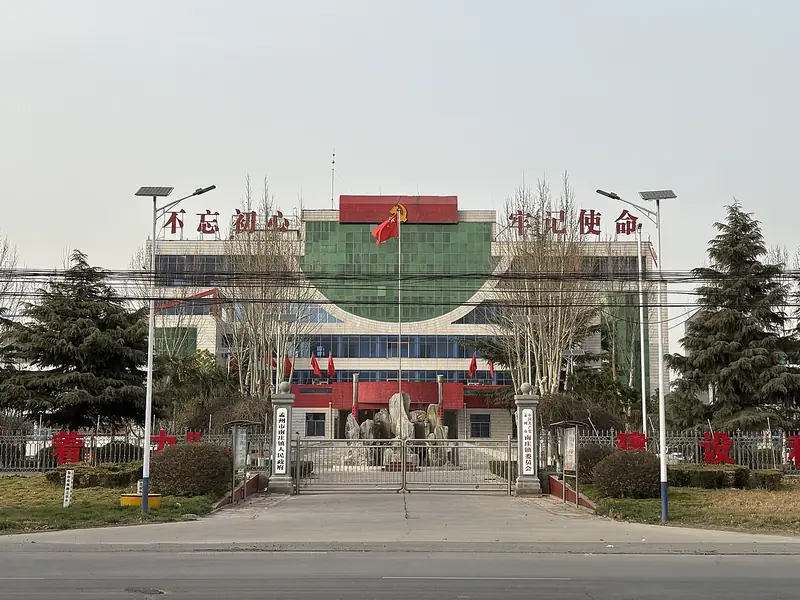
Photo adjustments
Full frame retained; EXIF orientation normalized, proportionally resized to at most 800 pixels and converted to WebP. No generated pixels or subject changes. Cards may crop the display.
- Administrative area
- County-level city · 县级市
- Part of
- Jiaozuo
- Chinese name
- 孟州市
- Local areas
- County-level city guide
Area & population
- Area in the source
- 542.00 km²
- Population · 2019
- 375,800
Source: cited geographic source, as of the dates shown.
Setting and landscape
The city sits where the Taihang foothills give way to the North China Plain: the ground falls from 305.9 metres in the north-west to 108.5 metres in the south-east, moving from low mountains through hills to plain, and hills, plain and river flats each take about a third of the area. Qinyang (沁阳) and Jiyuan (济源) lie to the north, and the Zhulong River (猪龙河) roughly marks the border with Wen County (温县) to the east.
The Yellow River runs 26 kilometres along the southern edge. The Mengzhou government notes that here, where the middle and lower reaches meet, the river widens, drops its silt and begins to become a raised "suspended river"; the left-bank levee starts at the Dawang Temple (大王庙) in Zhongcao (中曹), and an old saying holds that the thousand-li Yellow River levee begins at Meng County.
History
Peiligang, Yangshao and Longshan culture finds occur widely across the area. Tradition holds that King Wu of Zhou gathered 800 lords at a Yellow River ford on the north bank, called Mengjin (盟津); that ground, now Luoyang's Jili District (吉利区), belonged to Meng until 1979. In 106 BC the area became Heyang County (河阳县). In 843 the Tang raised Heyang to Mengzhou (孟州), in charge of five counties, and in 1377 the Ming reduced it to Meng County (孟县). It became the city of Mengzhou on 20 May 1996.
What to see
The Tomb of Han Yu (韩愈墓) lies on a hillside north of Hanzhuang village. Han Yu (768–824) is ranked first among the Eight Great Prose Masters of the Tang and Song. The tomb dates from 825; its mound rises more than 10 metres, and 13 steles in the shrine in front record his life. It became a national key protected site in 2006. The Xiansheng Wang Temple (显圣王庙), with Yuan and Qing buildings, joined the national list in its seventh batch, and the provincial list includes the Heyang ancient city site (河阳故城), Shengfo Temple (圣佛寺) and the Yuan–Ming main hall of Yueyun Palace (岳云宫).
Food and local products
Mengzhou is one of the main growing areas for the four "Huai medicines" (四大怀药): rehmannia, Chinese yam, chrysanthemum and achyranthes.
Highlights
- Tomb of Han Yu 韩愈墓: Tomb of the Tang writer Han Yu, built in 825; national key protected site since 2006.
- Xiansheng Wang Temple 显圣王庙: Yuan and Qing temple buildings on the seventh national list of protected sites.
- Heyang ancient city site 河阳故城: Provincially protected site of the old Heyang city.
- Four Huai medicines 四大怀药: Rehmannia, Chinese yam, chrysanthemum and achyranthes, grown in Mengzhou.
Sources for this guide
历史沿革 - 孟州市人民政府 · Mengzhou Municipal People's Government
人文地理 - 孟州市人民政府 · Mengzhou Municipal People's Government
孟州市 - 维基百科,自由的百科全书 · Wikipedia (Chinese) · CC BY-SA 4.0
韩愈墓 - 维基百科,自由的百科全书 · Wikipedia (Chinese) · CC BY-SA 4.0
孟州市各级文物保护单位列表 - 维基百科,自由的百科全书 · Wikipedia (Chinese) · CC BY-SA 4.0
Original English written from the listed sources and checked sentence by sentence against quoted extracts by a separate reviewer. Updated 2026-09-30.
Explore Mengzhou
Core places to explore, with English and Chinese names.
Plan your visit
Getting there
Mengzhou is about 55 km in a straight line from central Jiaozuo. Search for 孟州市 in a map app to find stations and your accommodation.
Where to stay →More in Jiaozuo
Sources & geographic information
Administrative names and parent areas: Official geographic directory · Reference date 2026-09-06.
Some facts checked against 孟州市 — Wikipedia contributors, CC BY-SA 4.0.
Some facts checked against 韩愈墓 — Wikipedia contributors, CC BY-SA 4.0.
Some facts checked against 孟州市各级文物保护单位列表 — Wikipedia contributors, CC BY-SA 4.0.
Map data © OpenStreetMap contributors. Pins mark approximate centres, not entrances or boundaries.