


Get to know Liangyuan District
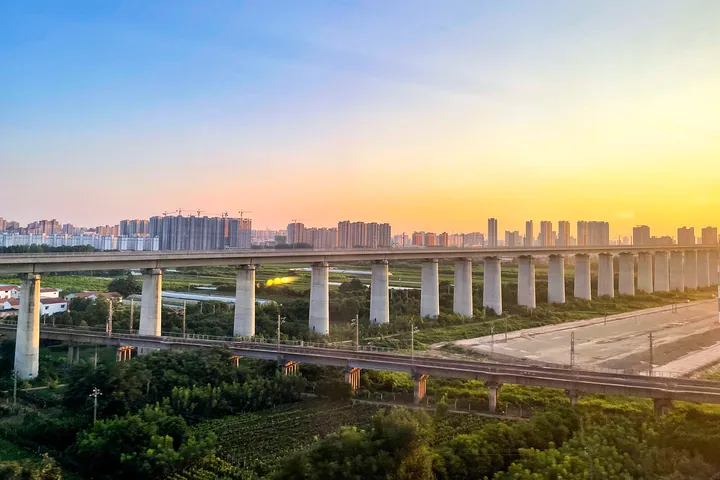
Photo adjustments
Full frame retained; proportionally resized and converted to WebP. No retouching or changes to the photographed subject. Card displays may crop the view.
- Administrative area
- District · 市辖区
- Part of
- Shangqiu
- Chinese name
- 梁园区
- Local areas
- District guide
Area & population
- Area in the source
- 673.00 km²
- Population · 2019
- 967,400
Source: cited geographic source, as of the dates shown.
Setting and landscape
The district lies on the alluvial plain of the Yellow, Huai and Hai rivers, with a warm-temperate, semi-humid monsoon climate and four distinct seasons. Its rivers all drain to the Huai basin through the Hui River (浍河) system; the larger ones include the old Yellow River bed, the Dongsha River (东沙河) and the Bao River (包河). Along the old river course, the district government describes an ecological corridor of water, forest and wetland, with the Yellow River Old Course National Wetland Park (黄河故道国家湿地公园) as Shangqiu's "back garden".
History
The old city of Shangqiu, from which Liangyuan was partly formed, was called Qiaojiaji in the Ming Yongle era, Zhusunji under the Kangxi emperor and Zhujiaji under Xianfeng, later shortened to Zhuji (朱集). Zhuji became a town in 1945, and in August 1951 the cities of Zhuji and Shangqiu merged under the name Shangqiu, with the seat at Zhuji. In October 1997, when Shangqiu became a prefecture-level city, the old city and Shangqiu county were abolished and reorganised into Liangyuan and Suiyang (睢阳) districts.
What to see
The Sanlingtai (三陵台) mausoleum mounds, traditionally the tombs of rulers of the ancient state of Song, are the ancestral burial ground of nine clans including the Song, Dai and Niu families. They belong to the Xugudui tomb group (徐堌堆墓群) in Shuichipu (水池铺) and Wanglou (王楼), where four other mounds are thought to be tombs of Eastern Han princes of Liang; the group became a national key cultural relic in 2013. The district government also lists the site of Mengqiang Temple (蒙墙寺) in the home area of Zhuangzi (庄子), and the Qingliang (清凉寺) and Guanyin (观音寺) temples.
Two local stage traditions, Siping opera (四平调) and the "Red-faced King of eastern Henan" (豫东红脸王), are national intangible heritage.
Food and local products
Farms in the district grow chilli peppers, strawberries, Chinese yam, wheat and small fruit, and Liangyuan carries the titles "home of Chinese chilli" and "home of Chinese strawberries". Liangyuan lotus root and tomatoes are on the national list of notable farm products.
Getting oriented
Liangyuan is Shangqiu's rail hub: the Zhengzhou–Xuzhou, Shangqiu–Hefei–Hangzhou and Beijing–Hong Kong high-speed lines share one station, and the Longhai and Beijing–Kowloon railways cross here. The Lianyungang–Khorgas and Jinan–Guangzhou expressways pass through. In town, Xiangyang Road (向阳路) is a provincially listed pedestrian shopping street.
Highlights
- Sanlingtai 三陵台: Mounds traditionally held to be tombs of Song-state rulers; ancestral tombs of nine clans.
- Xugudui tomb group 徐堌堆墓群: Mounds thought to hold Eastern Han princes of Liang; national key cultural relic since 2013.
- Yellow River Old Course National Wetland Park 黄河故道国家湿地公园: Wetland on the old Yellow River course, called Shangqiu's back garden.
- Siping opera 四平调: Local opera listed as national intangible heritage.
Sources for this guide
梁园概况 · Liangyuan District People's Government, Shangqiu
历史沿革 · Liangyuan District People's Government, Shangqiu
自然地理 · Liangyuan District People's Government, Shangqiu
徐堌堆墓群 · Wikipedia (Chinese) · CC BY-SA 4.0
Original English written from the listed sources and checked sentence by sentence against quoted extracts by a separate reviewer. Updated 2026-09-24.
Explore Liangyuan District
Core places to explore, with English and Chinese names.
Liangyuan District 梁园区
Plan your visit
Getting there
Liangyuan District is about 5 km in a straight line from central Shangqiu. Search for 梁园区 in a map app to find stations and your accommodation.
Where to stay →More in Shangqiu
Sources & geographic information
Administrative names and parent areas: Official geographic directory · Reference date 2026-09-06.
Some facts checked against 徐堌堆墓群 — Wikipedia contributors, CC BY-SA 4.0.
Map data © OpenStreetMap contributors. Pins mark approximate centres, not entrances or boundaries.