


Get to know Sui County
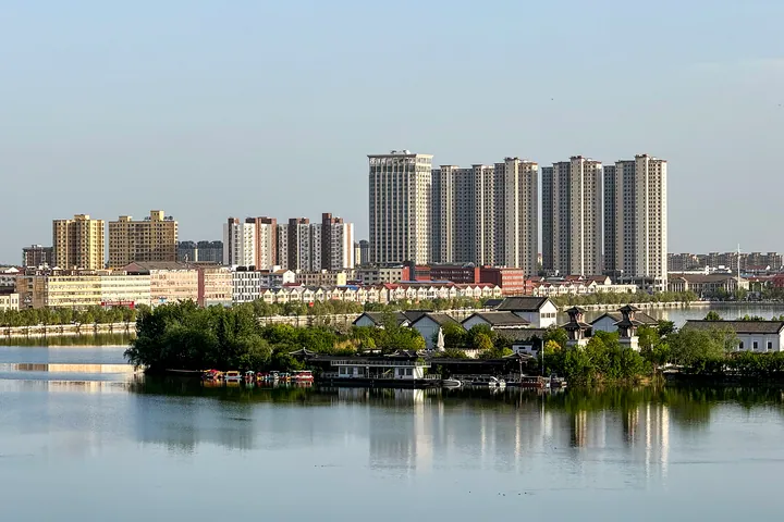
Photo adjustments
Full frame retained; proportionally resized and converted to WebP. No retouching or changes to the photographed subject. Card displays may crop the view.
- Administrative area
- County · 县
- Part of
- Shangqiu
- Chinese name
- 睢县
- Local areas
- County guide
Area & population
- Population · 2019
- 668,500
Source: cited geographic source, as of the dates shown.
Setting and landscape
The county lies on the eastern Henan plain, part of the lower Yellow River alluvial fan; the ground falls only about nine metres from north-west to south-east. North Lake and five smaller satellite lakes lie inside the town, and the county is known as the "water city of the Central Plains" (中原水城). The county government describes North Lake as about ten thousand mu of water and an AAAA-rated scenic area, and the county has hosted national and international triathlons.
History
Neolithic remains have been found at Zhoulonggang (周龙岗). The Qin set up Xiangyi county (襄邑县) here; under Emperor Huizong of the Northern Song it was raised to Gongzhou (拱州), and the Jin renamed it Suizhou after the old Sui River (睢水). The county government sums this up as "a 2,000-year-old town and an 800-year prefectural seat". The old Suizhou city, used from the Spring and Autumn period to the Ming, was abandoned after Yellow River floods and now lies under North Lake, a type of "city beneath a lake" found in eastern Henan. In 1913 Suizhou became Sui County.
What to see
The Shengshou Temple Pagoda (圣寿寺塔) at Yanzhuang (阎庄) in Houtai (后台) is a national key cultural relic, listed in 2006: a six-sided, nine-tier multi-eaved brick pagoda of the Northern Song, about 22 metres tall. In town, the Lüzu Temple (吕祖庙), also called Yuanjiashan (袁家山), is a Ming garden complex laid out like a boat. The Tang Bin Shrine (汤斌祠), built by the Qing official Tang Bin (汤斌) for his mother, keeps its gatehouse and main hall. The Ming-founded Dongguan Mosque (东关清真寺) served as a command post for Su Yu (粟裕) during the Suiqi Campaign. At Zhouta village (周塔村) in Pinggang (平岗), the Wuyou Temple Pagoda (无忧寺塔), rebuilt in the Song, survives as three of its original five storeys.
Getting oriented
Sui County is 62 kilometres west of Shangqiu and 166 kilometres east of Zhengzhou (郑州). The Shangqiu–Dengfeng Expressway crosses the county from east to west. No railway runs through the county; the nearest stations are Minquan on the Longhai Railway and Minquan North on the Xuzhou–Lanzhou high-speed line.
Highlights
- North Lake 北湖: AAAA scenic lake on the north side of the county town, over the drowned old Suizhou city.
- Shengshou Temple Pagoda 圣寿寺塔: Northern Song six-sided brick pagoda; national key cultural relic since 2006.
- Lüzu Temple 吕祖庙: Boat-shaped Ming garden complex in the town, also called Yuanjiashan.
- Dongguan Mosque 东关清真寺: Ming-founded mosque used by Su Yu as a command post in the Suiqi Campaign.
Explore Sui County
Core places to explore, with English and Chinese names.
Sui County 睢县
Plan your visit
Getting there
Sui County is about 55 km in a straight line from central Shangqiu. Search for 睢县 in a map app to find stations and your accommodation.
Where to stay →More in Shangqiu
Sources & geographic information
Administrative names and parent areas: Official geographic directory · Reference date 2026-09-06.
Some facts checked against 睢县 — Wikipedia contributors, CC BY-SA 4.0.
Some facts checked against 阎庄圣寿寺塔 — Wikipedia contributors, CC BY-SA 4.0.
Map data © OpenStreetMap contributors. Pins mark approximate centres, not entrances or boundaries.