


Get to know Jianli
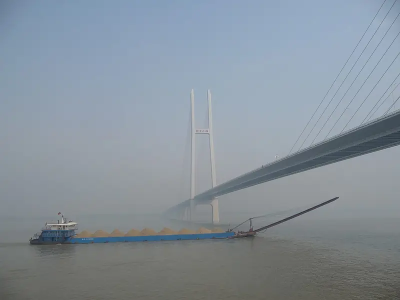
Photo adjustments
Full frame retained; EXIF orientation normalized, proportionally resized to at most 800 pixels and converted to WebP. No generated pixels or subject changes. Cards may crop the display.
- Administrative area
- County-level city · 县级市
- Part of
- Jingzhou
- Chinese name
- 监利市
- Local areas
- County-level city guide
Area & population
- Area in the source
- 3,508.00 km²
- Population · 2020
- 1,120,822
Source: cited geographic source, as of the dates shown.
Setting and landscape
The land is a flat plain dense with rivers and lakes, lying between 23.5 and 30.5 metres above sea level. The only hills are Yanglin Mountain (杨林山, 78.8 metres) and Lion Mountain (狮子山, 58 metres) on the Yangtze shore in Bailuo town (白螺镇), outliers of the hills south of the river left on the north bank as the channel moved south. The Dongjing River (东荆河), a branch of the Han, flows out to the east, and the man-made Sihu River (四湖河) enters from the north-west.
History
The name records a tax post. After the Battle of Red Cliffs in 208 the old county of Huarong passed to Eastern Wu (东吴). Because the land was low, fertile and rich in fish and rice, Wu had officials "supervise the profits" (监利) of fish and rice there, and in 222 Sun Quan (孙权) carved Jianli County out of Huarong. The Song made it part of Jiangling Prefecture (江陵府), and the Ming and Qing placed it under Jingzhou Prefecture.
In December 1931 the Hunan-West Hubei provincial Soviet government (湘鄂西省苏维埃政府) was set up at Zhoulaozui (周老嘴), and after Communist forces took the county in April 1949, the new county government sat there until moving to Rongcheng (容城) that July. Jianli became a city in 2020.
Food and local products
The Jingjiang duck (荆江麻鸭), an egg-laying breed named for the Jingjiang reach of the Yangtze, is mainly raised here; hens lay about 200 eggs a year, in white and blue-green shells. Jianli has farmed rice-field eel since the 1980s and is one of the places where rearing eels in net cages began; "Jianli eel" (监利黄鳝) became a registered geographical indication trademark in 2013.
Getting oriented
Jiangling County (江陵县) and Shishou (石首市) border it to the west, Qianjiang (潜江) and Xiantao (仙桃) to the north and Honghu (洪湖市) to the east. The Suizhou-Yueyang Expressway runs north to south, and the Jingyue Yangtze Bridge (荆岳长江大桥), opened in December 2010 with an 816-metre main span, starts in Bailuo and links Hubei with Hunan.
Sources for this guide
自然地理 - 监利市人民政府 · Jianli Municipal People's Government
历史沿革 - 监利市人民政府 · Jianli Municipal People's Government
荆江麻鸭 - 监利市人民政府 · Jianli Municipal People's Government
监利黄鳝 - 监利市人民政府 · Jianli Municipal People's Government
监利市 - 维基百科,自由的百科全书 · Chinese Wikipedia · CC BY-SA 4.0
Original English written from the listed sources and checked sentence by sentence against quoted extracts by a separate reviewer. Updated 2026-09-24.
Explore Jianli
Core places to explore, with English and Chinese names.
Places to explore around Jianli
 Zhoulaozui Ancient Town ·
 Plan your visit
Getting there
Jianli is about 85 km in a straight line from central Jingzhou. Search for 监利市 in a map app to find stations and your accommodation.
Where to stay →Build your route
Start with Zhoulaozui Ancient Town. The linked place guides have entrance and visit details.
Continue with Jingzhou →More in Jingzhou
Sources & geographic information
Administrative names and parent areas: Official geographic directory · Reference date 2026-09-06.
Some facts checked against 监利市 — Wikipedia contributors, CC BY-SA 4.0.
Photo: Zhoulaozui Ancient Town · Source photographer · License not provided. EXIF orientation normalized; resized without changing aspect ratio; converted to WebP. No subject edits.
Map data © OpenStreetMap contributors. Pins mark approximate centres, not entrances or boundaries.