

Explore the region
Tap any red Chinese text to hear it in Mandarin.
A mountain day outside Changsha
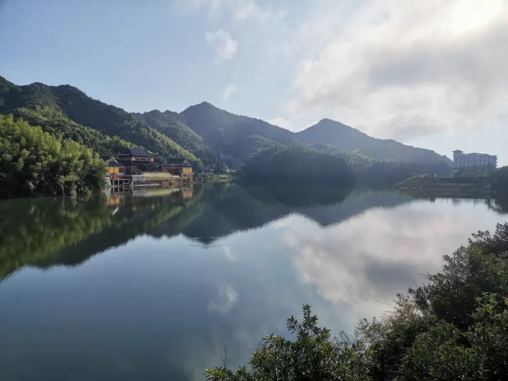
Daowu Mountain belongs to Liuyang rather than the urban core of Changsha. The provincial scenic-area plan treats Wulaofeng and Jinzhuwan as named zones, while the mountain is also associated with a Daowu monastery counted in local material among Liuyang’s four Chan ancestral monasteries. The mountain’s religious names are not a promise that every temple building is open: older visitor material also refers to Xinghua Monastery, so ask locally which halls and paths are accessible on the day.
The landscape is best understood on foot. From Jiaoxi Village’s Shangyunxi, a 5.4-kilometre stone-stepped trail runs towards the Tianhu part of the mountain. A 2024 report describes dense forest, clear springs, a deep valley and several waterfalls; at about 600 metres on the climb, it records falls with the largest drop roughly 30–40 metres. The same report says that the trail reaches the top of the Daowu Mountain urban-park area and gives wide views towards Liuyang’s built-up area and Jinyang New Town. Treat those views and water levels as weather-dependent rather than guaranteed scenery.
The mountain’s older identity is more layered than a simple viewpoint. Tianhu, ancient pines, ravines and temple remains appear together in the earlier place record, while the official planning material makes clear that the scenic area is still being refined through plans, environmental controls and service projects. The two detailed planning zones are Wulaofeng and Jinzhuwan; a 2026 planning notice concerns a proposed change to construction land in the Wulaofeng zone, which is evidence of continuing planning rather than proof that a new facility is already open.
Plan the walk carefully
Use 浏阳市蕉溪镇蕉溪村上云溪 Liúyáng Shì Jiāoxī Zhèn Jiāoxī Cūn Shàngyúnxī as the Chinese trailhead wording if the 5.4-kilometre walk is your purpose. It is not safe to treat “Daowu Mountain” as one entrance: the older place page says the mountain was once approached from the north-western ring road, while the newer Jiaoxi route begins on the far side of the mountain. Confirm the exact drop-off point, trail condition and a return vehicle before leaving Liuyang town. A one-way climb should not be treated as a loop unless a driver or an open onward route has been confirmed.
The operating picture needs a same-day check. The tourism listing viewed on 24 October 2026 marks Daowu Mountain as temporarily closed with reopening pending, and Tripadvisor’s page also shows it as currently closed. Public reports describe the 5.4-kilometre trail and continuing urban-park and scenic-area work, but those reports do not establish current admission, opening hours, passport entry, reservations, shuttle services or the condition of every path. Do not rely on old online ticket figures or a crowd-sourced “09:00–18:00” listing. Before setting out, confirm whether the scenic-area entrance and the Jiaoxi trail are open, whether foreign visitors may enter with a passport, and how you will return after the hike.
Getting there and back
By car, a local transport report describes the Changsha approach via the Changliu Expressway, then G319 at Yong’an and Jinyang Avenue towards Jiaoxi. The route is useful as a road relationship, not as a guarantee of a particular parking area or drop-off point. Set the destination in Chinese and match the driver’s route to 浏阳市蕉溪镇蕉溪村上云溪 Liúyáng Shì Jiāoxī Zhèn Jiāoxī Cūn Shàngyúnxī for the trail, or to the currently confirmed scenic-area entrance if the town-side route is open.
For public transport, check a same-day Changsha–Liuyang service rather than assuming that an old timetable still runs. A station directory lists Changsha East Bus Station(长沙汽车东站), at 1021 Yuanda First Road, and Liuyang Long-Distance Bus Station(浏阳长途汽车站), at 402 Jinsha Middle Road; that directory was updated in 2018 and does not confirm today’s departures. A September 2026 report says a Didi point-to-point bus service now links Liuyang and Changsha, with live stops and times shown in the Didi app. It is an intercity option, not a mountain shuttle, so arrange the Liuyang-to-trailhead transfer and the return before starting the climb.
Carry the Chinese names 道吾山 Dàowú Shān, 道吾山风景区 Dàowú Shān Fēngjǐngqū, and 浏阳市蕉溪镇蕉溪村上云溪 Liúyáng Shì Jiāoxī Zhèn Jiāoxī Cūn Shàngyúnxī. Bring water and shoes suitable for wet stone steps. In rain, fog or late afternoon, turn back rather than entering an unconfirmed section of trail or relying on the last town-bound service.
Find Daowu Mountain
道吾山 · 浏阳市
No reliable map pin yet: search by the Chinese name.
Sources & visit information
Sources checked on 24 October 2026. Hours, tickets, reservations and transport can change; confirm with the operator before you go.
Image credits & notes (1)
- The reservoir on the hilltop of Daowu Mountain, Liuyang, Hunan. Photo: Allervous (Wikimedia Commons user)Photo: CC BY-SA 4.0