


Get to know Haibowan District
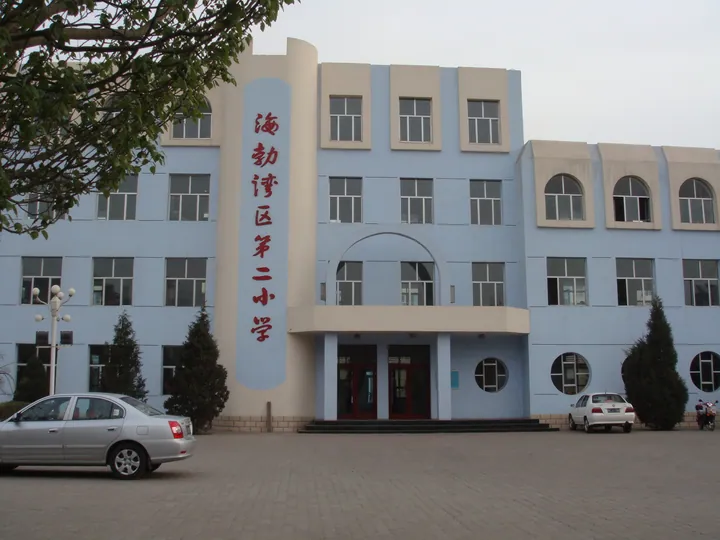
Photo adjustments
Full frame retained; proportionally resized and converted to WebP. No retouching or changes to the photographed subject. Card displays may crop the view.
- Administrative area
- District · 市辖区
- Part of
- Wuhai
- Chinese name
- 海勃湾区
- Local areas
- District guide
Area & population
- Area in the source
- 470.90 km²
- Population · 2020
- 339,155
- Administrative seat
- Fenghuangling Subdistrict
Source: cited geographic source, as of the dates shown.
Setting and landscape
Three parallel north–south ranges run through Wuhai, all northern outliers of the Helan Mountains (贺兰山): the Zhuozi Mountains in the east, Gander Mountain (甘德尔山) in the middle and Wuhu Mountain (五虎山) in the west. The dam of the Haibowan water-control project on the Yellow River filled Wuhai Lake (乌海湖) in December 2013, a reservoir of 118 square kilometres lying between Haibowan and Wuda (乌达区).
Jinshawan (金沙湾), 14 kilometres north of the district seat, is a belt of golden dunes with the Yellow River to the west and the Zhuozi range to the east, across the road from Wuhai airport.
History
The name comes from a Mongolian–Tibetan phrase, Hairobu Tohoi (海若布刀亥), which the district government translates as "lion's bay". Local legend links it to Hairobu, son of a smith who made bows and armour on the Zhuozi Mountains for Genghis Khan's western campaign and received the land as a reward. Under the Han, the walled town of Woye county (沃野县) was built here in 120 BC; its remains are the Xindi old town site (新地古城) in the north of the district.
From the mid-Ming until the Republic the area was pasture of the Ordos Mongols. It was split from Otog Banner (鄂托克旗) in 1955 as the Zhuozishan mining area, later Haibowan city, and became the central district of Wuhai when that city was formed in January 1976.
What to see
Five rock-art sites have been found along the foot of the Zhuozi Mountains in the district. The best known, Zhaoshaogou (召烧沟岩画), 15 kilometres from the city, has 118 identifiable figures, mostly human faces, ground into a limestone slope; it is attributed to Bronze Age northern nomads and has been an Inner Mongolia key protected site since September 1986.
Jinshawan is a national 4A scenic area with sand surfing, camel rides and sand sliding, a vineyard and a garden of rare plants including Tetraena mongolica (四合木). Wuhai as a whole was named a "city of Chinese calligraphy" by the China Calligraphers Association in 2008.
Highlights
- Zhaoshaogou rock art 召烧沟岩画: Bronze Age rock art with 118 identifiable figures; Inner Mongolia protected site since 1986.
- Wuhai Lake 乌海湖: 118 square kilometre reservoir on the Yellow River, filled in 2013.
- Jinshawan 金沙湾: National 4A desert scenic area north of the city with a rare-plant garden.
Sources for this guide
海勃湾区 - 维基百科 · Wikipedia (Chinese) · CC BY-SA 4.0
历史沿革 - 走进海勃湾 - 海勃湾区人民政府 · Haibowan District People's Government, Wuhai
自然资源 - 走进海勃湾 - 海勃湾区人民政府 · Haibowan District People's Government, Wuhai
金沙湾 - 魅力海勃湾 - 海勃湾区人民政府 · Haibowan District People's Government, Wuhai
乌海市 - 维基百科 · Wikipedia (Chinese) · CC BY-SA 4.0
Original English written from the listed sources and checked sentence by sentence against quoted extracts by a separate reviewer. Updated 2026-09-26.
Explore Haibowan District
Core places to explore, with English and Chinese names.
Haibowan District 海勃湾区
Plan your visit
Getting there
Haibowan District is about 5 km in a straight line from central Wuhai. Search for 海勃湾区 in a map app to find stations and your accommodation.
Where to stay →More in Wuhai
Sources & geographic information
Administrative names and parent areas: Official geographic directory · Reference date 2026-09-06.
Some facts checked against 海勃湾区 — Wikipedia contributors, CC BY-SA 4.0.
Some facts checked against 乌海市 — Wikipedia contributors, CC BY-SA 4.0.
Map data © OpenStreetMap contributors. Pins mark approximate centres, not entrances or boundaries.