


Get to know Hongze District
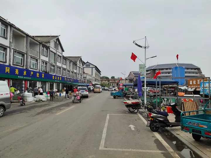
Photo adjustments
Full frame retained; proportionally resized and converted to WebP. No retouching or changes to the photographed subject. Card displays may crop the view.
- Administrative area
- District · 市辖区
- Part of
- Huai'an
- Chinese name
- 洪泽区
- Local areas
- District guide
Area & population
- Area in the source
- 1,394.00 km²
- Population · 2020 census
- 285,097
Source: cited geographic source, as of the dates shown.
Setting and landscape
The district sits on the Huai River alluvial plain on the lower Huai and is framed by water: Baima Lake to the east, the Huai River's channel to the Yangtze (淮河入江水道) to the south, Hongze Lake to the west and the North Jiangsu Main Irrigation Canal (苏北灌溉总渠) to the north. Land rises from east to west; the highest point, 51.5 metres, is on Danshan (丹山) in Laozishan town (老子山镇), where low hills lie southwest of the lake, and the lowest, 5.1 metres, is in the Baima Lake area. The Hongze Lake Dike (洪泽湖大堤) stands 18.5 metres above datum, and the lake bed lies 3 to 5 metres above the plain east of the dike, which is why the lake is called a 'hanging lake'. The district lies just south of the Qinling–Huai River line that divides northern and southern China's climates.
What to see
The Hongze Lake Dike has a history of more than 1,800 years and is recognised as World Heritage; the Hongze Lake Ancient Weir (洪泽湖古堰) scenic area is rated national 4A. Along the dike are the Hongze Lake Stele (洪泽湖碑), a stele of the Qianlong Emperor (乾隆御碑) and the Zhouqiao Datang stele (周桥大塘碑), and around the lake are the water-taming iron ox (镇水铁牛) and Xianren Cave (仙人洞). Sanhe Sluice (三河闸) is a national water-conservancy scenic area. Laozishan, which the district government calls a place of origin of Taoist culture, is a provincial hot-spring resort area, and its Guishan village (龟山村) is listed as a traditional Chinese village. Hongze Lake fishing-drum singing (洪泽湖渔鼓) is on the national intangible heritage list.
Food and local products
Hongze Lake hairy crabs carry an 'H' shape on the back, which local legend explains as a plough-spade given to the crab by Yu the Great. Hongze Lake whitefish (洪泽湖白鱼), a tribute fish since the Sui dynasty, is served steamed in the traditional dish of qingzheng baiyu (清蒸白鱼), made into fish-ball soup, or salted and sun-dried for steaming. Fox nut (芡实) growing took off after 2002, when Zhangzhuang village (张庄村) in Dongshuanggou town (东双沟镇) brought in the Su variety and it spread quickly across Hongze. Lotus-leaf rice (荷包饭) was long popular among Laozishan fishermen: soaked rice wrapped in fresh lotus leaves and steamed, sometimes with salted fish or pork, melon seeds or red dates.
Highlights
- Hongze Lake Dike 洪泽湖大堤: More than 1,800 years old; recognised as World Heritage.
- Hongze Lake Ancient Weir 洪泽湖古堰: National 4A scenic area and provincial forest park.
- Sanhe Sluice 三河闸: National water-conservancy scenic area.
- Laozishan 老子山: Lakeside town with hot springs and the traditional village of Guishan.
- Hongze Lake whitefish 洪泽湖白鱼: Tribute fish since the Sui dynasty, served steamed.
- Lotus-leaf rice 荷包饭: Fishermen's rice steamed in fresh lotus leaves, long popular in Laozishan.
Sources for this guide
洪泽概况 — 淮安市洪泽区基本情况简介 · Hongze District People's Government, Huai'an
名优特产 · Hongze District People's Government, Huai'an
Original English written from the listed sources and checked sentence by sentence against quoted extracts by a separate reviewer. Updated 2026-09-25.
Explore Hongze District
Core places to explore, with English and Chinese names.
Places to explore around Hongze District
 AI illustration · AI
 Plan your visit
Getting there
Hongze District is about 45 km in a straight line from central Huai'an. Search for 洪泽区 in a map app to find stations and your accommodation.
Where to stay →Build your route
Start with Hongze Lake Ancient Weir. The linked place guides have entrance and visit details.
Continue with Huai'an →More in Huai'an
Sources & geographic information
Administrative names and parent areas: Official geographic directory · Reference date 2026-09-06.
Map data © OpenStreetMap contributors. Pins mark approximate centres, not entrances or boundaries.