

Photo adjustments
Full frame retained; proportionally resized and converted to WebP. No retouching or changes to the photographed subject. Card displays may crop the view.
Explore the region
About Jinggang Mountains
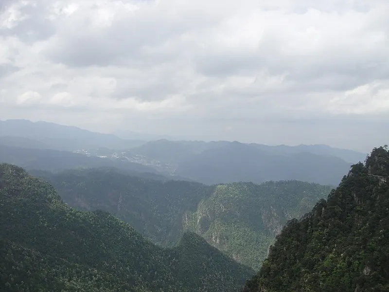
Around Ciping, revolutionary memorials share the landscape with steep passes and wooded valleys. Huangyangjie is especially revealing: its narrow approach helps explain the defensive importance of the early Communist base and the fighting in 1928. Begin with the Revolution Museum for context, then choose a mountain sector; the scattered sites are connected by roads and scenic transport, rather than one continuous urban walk.
In October 1927, Mao Zedong, Zhu De, Chen Yi, Peng Dehuai and Teng Daiyuan (滕代远) led Red Army units into the Jinggang Mountains and established the first revolutionary base area, opening a path of surrounding the cities from the countryside; the range is accordingly known as the 'cradle of the revolution' (革命摇篮).
Viewed from below, the range resembles a fortress, with five major outposts (哨口) forming the passes that must be crossed to enter it. The designated scenic area covers 213.5 square kilometres and is divided into eight sectors. Azalea (杜鹃), which blooms extensively across the range in spring, is the city's flower.
More than 100 sites and relics associated with the Jinggang Mountains revolutionary struggle survive, of which 21 are listed as national-level Key Cultural Heritage Sites (中国重点文物保护单位), six at provincial level and 35 at municipal level. The area was listed as a National Key Scenic Area (国家重点风景名胜区) in 1982 and, in 1994, was designated a national patriotic education base and a National Garden City (国家园林城).
What to look for
- Huangyangjie, the mountain pass associated with the defence of the revolutionary base.
- The Revolution Museum in Ciping, which introduces the history behind the surrounding memorial sites.
Background & history
The Jinggang Mountains, historically rendered as Chingkang Mountains are a mountain range of the Luoxiao Mountains System, in the border region of Jiangxi and Hunan Provinces. The range lies at the junction of four counties – Ninggang, Yongxing, Suichuan and Lingxiang. The mountains cover some 670 km2 (260 sq mi), with an average elevation of 381.5 metres (1,252 ft) above sea level. The highest point is 2,120 m (6,960 ft) above sea level. The range's massif consists of a number of thickly forested parallel ridges. On the heights there is not much farmland with most settlements at the base of the mountains. The main settlement is at Ciping, which is surrounded by five villages whose literal meanings are Big Well, Little Well, Middle Well, Lower Well, and Upper Well. Henceforth came the name of the mountain, literally means "Well Ridge Mountains". Jinggang Mountains have rich reserves of porcelain clay and rare earth ore, which are two major dominant minerals.
Excerpt from Wikipedia: Jinggang Mountains · Wikipedia contributors · CC BY-SA 4.0. Selected introductory sentences; formatting simplified. Background information, not current visitor-service advice.
Location & getting there
Getting to Jinggang Mountains
Jinggangshan Railway Station is below the mountain resort; continue by road to Ciping. The scenic operator identifies the 1928 Visitor Centre as the main sightseeing-bus terminal, with routes toward Huangyangjie and other mountain sectors. Confirm the route operating on your visit date.
Combine your visit
A suggested sequence linking the specific features of this visit.
-
Jinggangshan Revolution Museum
Establish the historical context before travelling into the mountain sectors.
-
Huangyangjie
See the narrow pass and terrain that shaped the base’s defence.
This order is editorial. Confirm access and any transfers between stops; it does not establish a walking route, same-day connection or common admission ticket.

Find Jinggang Mountains
井冈山 · 吉安市
The pin marks the area, not the entrance.
More places nearby
Approximate straight-line distances between map pins, not travel distances.
Wugong Mountains 武功山
98 km awayWugongshan’s best-known landscape is a long grassy ridge above the forest. Around Golden Summit, the open meadow views are complemented by small stone-built ritual structures whose vaulted construction uses no timber beams. The…
View guide →Bailuzhou Academy 白鹭洲书院
98 km awayBailuzhou Academy stands on a sandy island in the Gan River at Ji’an. Repeated floods and rebuilding shaped its history, making the raised grounds and river edge especially meaningful. Fengyue Tower and Yunzhang Pavilion…
View guide →Tongtian Rock 通天岩
104 km awayTongtian Rock is a Danxia landscape in Shuixi town, Ganzhou’s Zhanggong district. Grottoes and niches cut into the red rock hold Buddhist carvings, mostly from the Song period with some earlier Tang figures.
View guide →Sources & visit information
The sources below support the place-specific description and arrival information. Suggested combinations are editorial planning ideas; confirm current opening, entry arrangements and transport services for your date.
Visitor information adapted and edited from Wikipedia contributors, “Jinggang Mountains” · CC BY-SA 4.0. Source revision 1369302365.
Background paragraphs translated and condensed from Wikipedia contributors, "井冈山", Chinese Wikipedia · CC BY-SA 4.0. Source revision 93941117.