


Get to know Luxi County
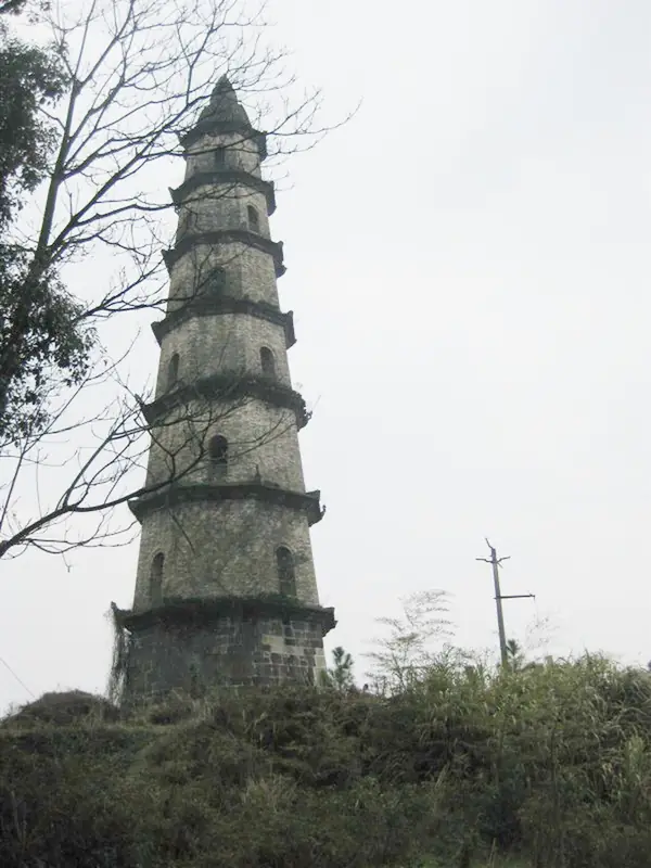
Photo adjustments
EXIF orientation normalized; resized without changing aspect ratio; converted to WebP. No subject edits.
- Administrative area
- County · 县
- Part of
- Pingxiang
- Chinese name
- 芦溪县
- Local areas
- County guide
Area & population
- Area in the source
- 968.00 km²
- Population · 2019
- 313,300
Source: cited geographic source, as of the dates shown.
Setting and landscape
The land is mountainous and high in the southeast and lower and flatter in the northwest, with hills across much of the county. Yichun (宜春) lies to the east, Shangli (上栗) to the north, and Lianhua (莲花) and Anfu (安福) to the south. Forest covers 62.7 percent of the county, which is one of Pingxiang's main areas for timber, tea and medicinal herbs.
History
Luxi was Pingxiang's first county seat. In 267 Sun Hao (孙皓), ruler of Eastern Wu, carved Pingxiang County out of western Yichun and placed its seat at Gugang (古岗), now Gucheng village (古城村) in Luxi town. In 619 the seat moved to Fenghuangchi (凤凰池) in today's Pingxiang city, after 353 years and eight dynasties at Luxi. A Luxi District of Pingxiang was created in 1980 and became Luxi County in November 1997.
The Northern Song thinker Zhou Dunyi (周敦颐), who served here as a tax supervisor, founded Lianxi Academy (濂溪书院). Lu Deming (卢德铭), commander-in-chief of the Autumn Harvest Uprising, was killed at Shankouyan (山口岩) aged 22 while covering the withdrawal of Mao Zedong's troops; a martyrs' cemetery in his name is a national 3A scenic area. Folk traditions on Jiangxi's provincial intangible heritage list include the one-horned dragon dance of Gucheng (古城独角缩龙) and the nuo masked dance of Chexiang in Nankeng (南坑车湘傩舞).
What to see
The Wugong Mountains belong to the northern branch of the Luoxiao range (罗霄山脉) and run northeast to southwest for more than 120 kilometres across Anfu, Yuanzhou (袁州), Luxi and Lianhua. The highest point, Baihe Peak (白鹤峰), also called the Golden Summit (金顶), rises to 1,918.3 metres but stands inside Anfu. The range was made a national key scenic area in 2005 and is a national 5A tourist attraction; a sacrificial site beside the summit is a Jiangxi provincial protected relic. By legend the name "Wugong" was granted by Chen Baxian (陈霸先), Emperor Wu of the Chen dynasty.
Luxi's part of the range, on the county's southeastern edge, is run by the Pingxiang Wugong Mountain scenic area committee. Its Matian (麻田) area, 55 kilometres east of Pingxiang city, has a road to the foot of the mountain and a cable car. Fayunjie (发云界), at 1,628 metres, is known for its alpine meadows. The range's alpine meadows and stands of Huangshan pine are uncommon south of the Yangtze.
Highlights
- Wugong Mountains 武功山: Northern branch of the Luoxiao range, over 120 km long; national key scenic area since 2005 and national 5A attraction.
- Fayunjie 发云界: 1,628-metre area of alpine meadow in the Wugong Mountains.
- Matian scenic area 麻田: Wugong Mountain area 55 km east of Pingxiang city, with a road to the foot of the mountain and a cable car.
- Lu Deming Martyrs Cemetery 卢德铭烈士陵园: National 3A scenic area honouring the Autumn Harvest Uprising commander killed at Shankouyan aged 22.
Sources for this guide
芦溪县 - 维基百科,自由的百科全书 · Wikipedia (Chinese) · CC BY-SA 4.0
武功山 - 维基百科,自由的百科全书 · Wikipedia (Chinese) · CC BY-SA 4.0
全国电影频道联盟《美丽家乡我代言 芦溪篇》在江西芦溪开机-国际在线 · China Radio International (CRI Online)
Original English written from the listed sources and checked sentence by sentence against quoted extracts by a separate reviewer. Updated 2026-09-25.
Explore Luxi County
Core places to explore, with English and Chinese names.
Places to explore around Luxi County
 Historic altar remains on a misty ridge in the Wugong Mountains. Photograph date recorded by the source: 2011-05-11.
Plan your visit
Getting there
Luxi County is about 15 km in a straight line from central Pingxiang. Search for 芦溪县 in a map app to find stations and your accommodation.
Where to stay →Build your route
Start with Wugong Mountains. The linked place guides have entrance and visit details.
Continue with Pingxiang →More in Pingxiang
Sources & geographic information
Administrative names and parent areas: Official geographic directory · Reference date 2026-09-06.
Some facts checked against 芦溪县 — Wikipedia contributors, CC BY-SA 4.0.
Some facts checked against 武功山 — Wikipedia contributors, CC BY-SA 4.0.
Photo: Wugong Mountains · Doctoroftcm · CC BY-SA 3.0. Full frame retained; proportionally resized and converted to WebP. No retouching or changes to the photographed subject. Card displays may crop the view.

Map data © OpenStreetMap contributors. Pins mark approximate centres, not entrances or boundaries.