


Get to know Yujiang District
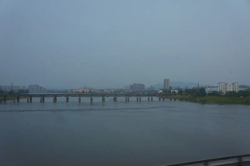
Photo adjustments
Full frame retained; EXIF orientation normalized, proportionally resized to at most 800 pixels and converted to WebP. No generated pixels or subject changes. Cards may crop the display.
- Administrative area
- District · 市辖区
- Part of
- Yingtan
- Chinese name
- 余江区
- Local areas
- District guide
Area & population
- Area in the source
- 936.00 km²
- Population · 2018
- 399,800
Source: cited geographic source, as of the dates shown.
History
A county called Jinxing (晋兴县) was set up here in 291 under the Western Jin, later renamed Xing'an and then folded into Yugan. Anren County (安仁县) was created under the Chen dynasty, merged into Yugan again under the Sui, and re-established in 988 under the Northern Song. It took the name Yujiang County in 1914, came under Yingtan in 1983, and was converted from a county into Yujiang District in 2018.
Yujiang holds a place in the history of China's campaign against schistosomiasis, a parasitic disease that People's Daily says was once widespread in the Yangtze basin and south of it. The same People's Daily article records that in 1958 Mao Zedong read a report that Yujiang had been the first to wipe out the disease and wrote his pair of poems "Farewell to the God of Plague" (《送瘟神》). The Yujiang schistosomiasis memorial hall (余江血防纪念馆) is now a Jiangxi provincial protected site.
What to see
The Yingtan city government describes the Jinjiang old town (锦江古镇) as long known for its scholarly tradition. The town (锦江镇) holds two provincial protected sites: the Jinjiang Catholic Church (锦江天主堂), a Republican-era building, and the old Yujiang county yamen (余江县衙) on Zhongxin Street. The Longxi Academy (龙溪书院) and the cliff tombs at Luosiling and Baojiafeng (螺丝岭、保驾峰崖墓群) are also on the provincial list. So are several Red Army sites, among them a divisional headquarters of the Tenth Red Army at Gaogongzhai (高公寨), the north-eastern Jiangxi Red Army command post at Wangjiayuan (汪家源) and the assembly hall of the Yujiang county soviet government.
Chinese Wikipedia also lists Mazu Rock (马祖岩), Xianglu Peak (香炉峰), Swan Lake (天鹅湖), the Jinjiang old town, a Confucian temple, the old city wall of Anren and the former home of Zou Taofen (邹韬奋故居) among the district's sights.
Getting oriented
The district government sits in Dengbu (邓埠). The district is a long, thin strip, about 75 kilometres from north to south and 28.65 kilometres across, narrowing to 17.5 kilometres at its waist. Yujiang railway station in Dengbu opened in 1935 with the Zhejiang–Jiangxi railway (浙赣铁路) and is now on the Shanghai–Kunming line; National Highway 320 also crosses the district.
Highlights
- Yujiang schistosomiasis memorial hall 余江血防纪念馆: Jiangxi provincial protected site on Yujiang's fight against schistosomiasis, whose elimination Mao Zedong marked in 1958 with the poems "Farewell to the God of Plague".
- Jinjiang Catholic Church 锦江天主堂: Republican-era church in Jinjiang town, a Jiangxi provincial protected site.
- Yujiang county yamen 余江县衙: Old county government building on Zhongxin Street in Jinjiang town, a provincial protected site.
- Longxi Academy 龙溪书院: Old academy on the Jiangxi provincial list of protected sites.
Sources for this guide
余江区 - 维基百科,自由的百科全书 · Chinese Wikipedia · CC BY-SA 4.0
“五万万人民支持的运动”--党史-中国共产党新闻网 · People's Daily Online (CPC News)
余江区各级文物保护单位列表 - 维基百科,自由的百科全书 · Chinese Wikipedia · CC BY-SA 4.0
余江站 - 维基百科,自由的百科全书 · Chinese Wikipedia · CC BY-SA 4.0
鹰潭市人民政府 名景名胜 古镇风采 · Yingtan Municipal People's Government
Original English written from the listed sources and checked sentence by sentence against quoted extracts by a separate reviewer. Updated 2026-09-25.
Explore Yujiang District
Core places to explore, with English and Chinese names.
Yujiang District 余江区
Plan your visit
Getting there
Yujiang District is about 15 km in a straight line from central Yingtan. Search for 余江区 in a map app to find stations and your accommodation.
Where to stay →More in Yingtan
Sources & geographic information
Administrative names and parent areas: Official geographic directory · Reference date 2026-09-06.
Some facts checked against 余江区 — Wikipedia contributors, CC BY-SA 4.0.
Some facts checked against 余江区各级文物保护单位列表 — Wikipedia contributors, CC BY-SA 4.0.
Some facts checked against 余江站 — Wikipedia contributors, CC BY-SA 4.0.
Map data © OpenStreetMap contributors. Pins mark approximate centres, not entrances or boundaries.