


Get to know Lishu County
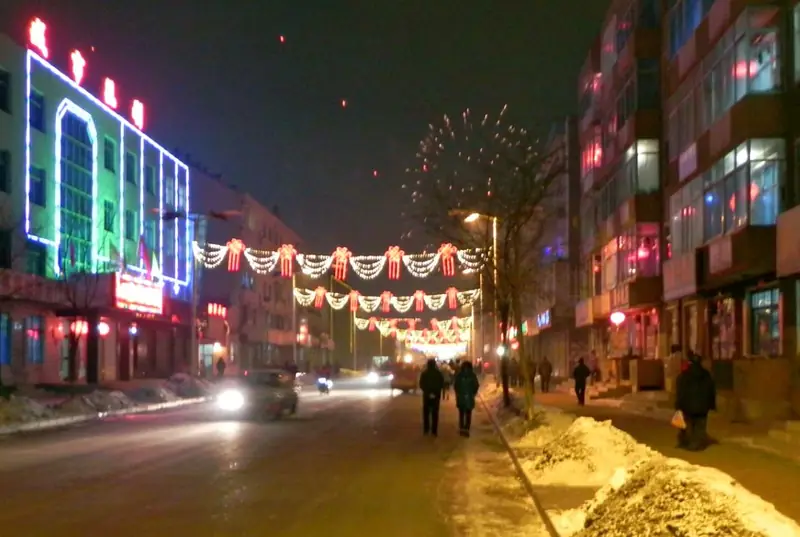
Photo adjustments
EXIF orientation normalized; resized without changing aspect ratio; converted to WebP. No subject edits.
- Administrative area
- County · 县
- Part of
- Siping
- Chinese name
- 梨树县
- Local areas
- County guide
Area & population
- Area in the source
- 3,900.00 km²
- Administrative seat
- Lishu Town (梨树镇)
Source: cited geographic source, as of the dates shown.
Setting and landscape
The Dongliao River (东辽河) forms two of the county's edges: across it lie Gongzhuling (公主岭) to the east and Shuangliao (双辽) to the north. Siping city adjoins it to the south, and Changtu County (昌图县) in Liaoning to the west. The county seat is 10 kilometres from Siping and 100 kilometres from Changchun (长春). The Beijing–Harbin, Harbin–Dalian and Siping–Meihekou railways and the Changchun–Dalian and Ji'an–Shuangliao expressways cross the county.
History
Finds at the Changshan site (长山遗址) show people living here in the Neolithic. Under the Liao and Jin the area belonged to Hanzhou (韩州), whose seat moved in 1150 to what is now Pianlian city (偏脸城) at Xiuyan village (岫岩村) in Baishan township (白山乡). Han Chinese settlers from Shandong and Hebei began arriving after 1803, when the Mongol prince opened land for farming. A county was set up in 1878 under the name Fenghua (奉化县); it became Lishu in 1914 because the name clashed with Fenghua County in Zhejiang, and was transferred to Jilin province on 21 July 1954.
The county government notes that Lishu was the birthplace of Empress Xiaocigao (孝慈高皇后), mother of Hong Taiji (皇太极), and the ancestral home of the Empress Dowager Cixi (慈禧太后), and that the "four jinshi of the Qi family" (齐家四进士), four holders of the highest imperial examination degree, came from Lishu under the Guangxu emperor. It counts more than 100 heritage sites, among them the old city at Pianlian and a headquarters of the Northeast Allied Army (东北联军指挥部).
What to see
The Guandong Farming Museum (关东农耕博物馆) in Caijia town (蔡家镇), founded in 2016, keeps more than a thousand old farm tools, household items and folk objects in four halls. Coming into Caijia village from the north, visitors meet a thousand-metre gallery of 160 sets of millstones and stone rollers, and a stretch of the Qing-dynasty Willow Palisade (柳条边) with its gate has been rebuilt in the village.
Food and local products
The county sits in what the county government calls the golden corn belt and hosts the annual Lishu Black Soil Forum (梨树黑土地论坛). Its named products include Lishu corn, Lishu white pigs, Lishu rice and the Jiuyueqing green bean (九月青豆角). The county is also listed as a home of the song-and-dance duet form errenzhuan (二人转).
Highlights
- Pianlian city 偏脸城: Seat of Hanzhou under the Jin from 1150, in Baishan township.
- Guandong Farming Museum 关东农耕博物馆: Founded 2016 in Caijia town; over a thousand old farm and household objects, a millstone gallery and a rebuilt stretch of the Willow Palisade.
- Jiuyueqing green bean 九月青豆角: One of the Lishu farm brands named by the county government.
Sources for this guide
梨树概况_梨树县人民政府 · Lishu County People's Government
历史沿革_梨树县人民政府 · Lishu County People's Government
梨树关东农耕博物馆_梨树县人民政府 · Lishu County People's Government
地理地貌_梨树县人民政府 · Lishu County People's Government
Original English written from the listed sources and checked sentence by sentence against quoted extracts by a separate reviewer. Updated 2026-09-25.
Explore Lishu County
Core places to explore, with English and Chinese names.
Lishu County 梨树县
Plan your visit
Getting there
Lishu County is about 30 km in a straight line from central Siping. Search for 梨树县 in a map app to find stations and your accommodation.
Where to stay →More in Siping
Sources & geographic information
Administrative names and parent areas: Official geographic directory · Reference date 2026-09-06.
Map data © OpenStreetMap contributors. Pins mark approximate centres, not entrances or boundaries.