


Get to know Fuyu
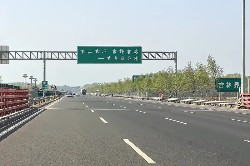
Photo adjustments
EXIF orientation normalized; resized without changing aspect ratio; converted to WebP. No subject edits.
- Administrative area
- County-level city · 县级市
- Part of
- Songyuan
- Chinese name
- 扶余市
- Local areas
- County-level city guide
Area & population
- Area in the source
- 4,464.00 km²
- Population · 2017
- 800,000
- Administrative seat
- Sanchahe (三岔河镇)
Source: cited geographic source, as of the dates shown.
Setting and landscape
Most of Fuyu is terrace land standing 20 to 80 metres above the riverbeds, cut down by the surrounding rivers. The ground is higher in the east and south and slopes towards the northwest. The highest point, Nanying Mountain (南鹰山) at 261.8 metres, takes its name from its eagle-head shape; the lowest, at 116.3 metres, is the corner in the northeast where the Lalin River runs into the Songhua. Below the terrace edge the Lalin valley is flat and dotted with ponds and marshes, sand ridges run along its banks, and its channel through Fuyu winds and often shifts.
History
The Fuyu city government traces the area to the kingdom of Buyeo (夫余国), set up by the Yemaek (濊貊) people in the early Western Han and described as the first local regime of northeast China; Fuyu was part of its lands. Under the Qing the Bodune (伯都讷) deputy military governor was posted here from 1692. In 1906 the area became Xincheng prefecture (新城府), which was made a county in 1913 and, because other provinces had counties of the same name, was renamed Fuyu in April 1914 after ancient Buyeo. It became a district of the new city of Songyuan in 1992, was made a county again in 1995 with its seat moved to Sanchahe, and became a county-level city in 2013.
What to see
The Dajin Deshengtuo Stele (大金得胜陀颂碑) was set up by the fifth Jin emperor, Shizong (金世宗), to record how his grandfather Wanyan Aguda (完颜阿骨打) gathered his people here and swore to rise against the Liao. The 3.2-metre stone has four coiled dragons on its head and a tortoise base, with 815 Chinese characters on the front and more than 1,500 characters in the Jurchen large script on the back.
The Dajin Victory Pavilion (大金得胜亭) is a three-storey octagon 25.92 metres high; its 12-metre marble base stands for the 120 years of the Jin and its nine steps for the nine Jin emperors. A Liao-Jin history hall next to it shows tools, pots and armour of the period, wetland wildlife specimens and old local ploughs and costumes.
Food and local products
Fuyu grows Silihong peanuts (四粒红花生, "four red kernels"), a national geographical-indication product; the city government says 80 percent of all Silihong peanuts come from Fuyu. The kernels are bright red, even in size and glossy.
Highlights
- Dajin Deshengtuo Stele 大金得胜陀颂碑: Jin dynasty stele recording Wanyan Aguda's oath against the Liao, with Chinese and Jurchen inscriptions.
- Dajin Victory Pavilion 大金得胜亭: Three-storey octagonal pavilion, 25.92 m high, beside a Liao-Jin history hall.
- Nanying Mountain 南鹰山: Highest point in Fuyu, 261.8 m, named for its eagle-head shape.
- Silihong peanuts 四粒红花生: National geographical-indication peanut with bright red kernels.
Sources for this guide
扶余市 - 维基百科,自由的百科全书 · Chinese Wikipedia · CC BY-SA 4.0
扶余市人民政府 - 历史沿革 · Fuyu Municipal People's Government
扶余市人民政府 - 自然地理 · Fuyu Municipal People's Government
扶余市人民政府 - 大金得胜陀颂碑 · Fuyu Municipal People's Government
扶余市人民政府 - 扶余四粒红花生 · Fuyu Municipal People's Government
扶余市人民政府 - 大金得胜亭 · Fuyu Municipal People's Government
Original English written from the listed sources and checked sentence by sentence against quoted extracts by a separate reviewer. Updated 2026-09-25.
Explore Fuyu
Core places to explore, with English and Chinese names.
Plan your visit
Getting there
Fuyu is about 95 km in a straight line from central Songyuan. Search for 扶余市 in a map app to find stations and your accommodation.
Where to stay →More in Songyuan
Sources & geographic information
Administrative names and parent areas: Official geographic directory · Reference date 2026-09-06.
Some facts checked against 扶余市 — Wikipedia contributors, CC BY-SA 4.0.
Map data © OpenStreetMap contributors. Pins mark approximate centres, not entrances or boundaries.